Download
1 / 17
170 likes | 306 Views
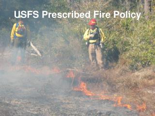
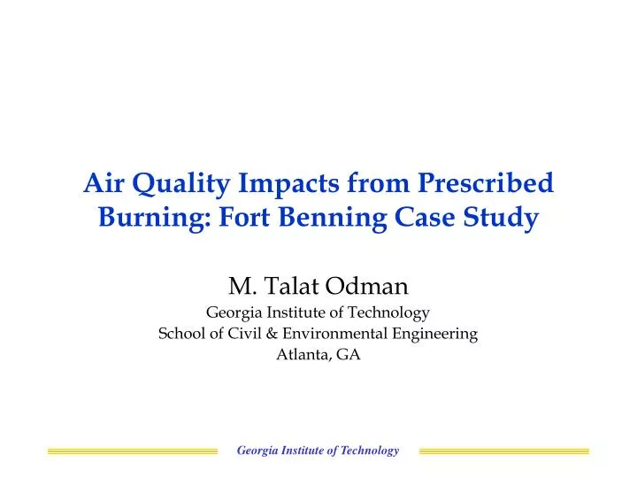
Air Quality Impacts from Prescribed Burning: Fort Benning Case Study. M. Talat Odman Georgia Institute of Technology School of Civil & Environmental Engineering Atlanta, GA. SERDP Project. Sponsor: Strategic Environmental Research and Development Program

E N D
Air Quality Impacts from Prescribed Burning: Fort Benning Case Study M. Talat Odman Georgia Institute of Technology School of Civil & Environmental Engineering Atlanta, GA Georgia Institute of Technology
SERDP Project • Sponsor:Strategic Environmental Research and Development Program • Performers:Georgia Tech, UGA and Forest Service • Title:Characterization of Emissions and Air Quality Modeling for Predicting the Impacts of Prescribed Burns at DoD Lands • Technical Objective • To develop, evaluate and apply a simulation system that can accurately predict the impacts of prescribed burns on regional PM2.5 and ozone levels by • (1) Improving emission estimates, • (2) Further developing and coupling advanced models, • (3) Evaluating the models with existing and newly collected data, and • To assess alternative burning strategies including no burning and eventual wild fires. Georgia Institute of Technology
Uncertainty Chemistry Air Quality Model Emissions Emission Rate Meteorology Uncertainty Max. Impact Air Quality Models Air quality models (AQMs) are scientifically the best available tools to estimate the regional PM2.5 and O3 impacts of forest fires. Simulated Concentrations Simulated Impacts Georgia Institute of Technology
Reducing Uncertainty • Accurate emission estimates are needed: • Fuel load and consumption uncertainties limit our ability to accurately simulate impacts. • Emission factors have been developed under either laboratory or field conditions. EPA’s AP-42 Tables are mostly based on studies conducted in Western US. • Recent in situ observations from prescribed burns provide better emissions assessments. • Resolution of fire plumes must be improved: • Given their large domains AQMs have limited (horizontal) resolution (~4 km). • In the absence of sub-grid treatments, plumes are immediately mixed into the grid cell. • Sub-grid scale plume models exist but they are designed mostly for industrial stacks. • Also, these plume models have not been coupled successfully with AQMs. Georgia Institute of Technology
History In 2003, with SERDP exploratory funding (CP-1249), we incorporated the Dynamic Adaptive Grid technique (as well as sensitivity analysis) in an ozone AQM (no PM capability). Sensitivity Analysis Adaptive Grid Simulation with Air Quality Model Simulated Fort Benning Fire Plume Burning Options Prescribed Burns at DoD Facilities Impact to Regional Air Quality Georgia Institute of Technology
Model Evaluation • Indicator of success: improved agreement of model predictions with observations and measurements. • Observation network is sparse with typical range > 25 km. • Remote sensing, aircrafts, or ground-based (stationary or mobile) techniques can be used to chase plumes. • The range of most ground-based measurements is < 2 km. • There is a gap in data at ~10 km range. Georgia Institute of Technology
Technical Approach Emission Estimation Field Measurements Model Development & Simulations Feedback (multiple cycles) Model Evaluation Burning Strategy Simulations Georgia Institute of Technology
Fuel Loading, Consumption • Assess fuel loads using Fuel Characteristic Classification System (FCCS): • Determine the most representative FCCS fuel bed through the use of digital photo series and customization methodology for modifying existing fuel descriptions • Compare with National Fire Danger Rating System fuel maps and remote sensing data • Calculate fuel consumption using CONSUME 3.0 and Fire Emissions Prediction System (FEPS): • Input fuel characteristics and conditions, lighting patterns, and meteorology to get fuel consumption rates by combustion phase Georgia Institute of Technology
Emission Factors • Exploit existing data sets to determine emission factors: • Find PM, CO and VOC emission factors for each fuel type in Forest Service data set for the Southeast • Enrich with VOC emission factors in Georgia Tech data set for Fort Benning • PNNL project will also provide additional emissions data • Estimate emissions both for flaming and smoldering phases: • Weight emission factors over fuel types, combine with fuel load and consumption, and estimate hourly emissions Georgia Institute of Technology
Model Development • The models to be used in this research are CMAQ regional air quality model and Daysmoke local plume model. • Incorporate Dynamic Adaptive Grid methodology in CMAQ to improve its grid resolution and facilitate its coupling with sub-grid scale models. • Explore the adaptive grid version of MM5 (model that provides meteorological inputs to CMAQ) recently developed at NCSU as an alternative to interpolation. Georgia Institute of Technology
Coupling the Models • Daysmoke can be coupled with CMAQ by injecting the particles crossing a “wall” as emissions into the grid cells on the opposite side of the wall. • Determine where to place this “wall” using Fourier analysis • Revise Daysmoke and the Adaptive Grid algorithm as necessary • Explore the “Particle-in-Grid” method for modeling the chemistry of Daysmoke particles (currently a non-reactive model) before mixing into CMAQ grid cells. • Treat smoldering and nighttime emissions as ground-level sources. Here adaptive grid resolution will be the major improvement. Wall Georgia Institute of Technology
Field Measurements • Position 3 mobile teams at predetermined locations at or near Fort Benning (~ 10 km) the morning of the burns according to the burning plan and the forecasts (our forecasts with the models as well as other local forecasts) • Each team will be equipped with real-time PM2.5 and CO monitors. • Conduct plume sighting (survey) and digital photogrammetry from three fire towers at Fort Benning. The height and direction of the plumes will be determined by triangulation, feature tracking and GPS. • Collect data for 5-8 burns per year over 3 years under ideal burn and dispersion conditions. Georgia Institute of Technology
Model Evaluation • Model evaluation will continue throughout this project: • Start with data previously collected at Savannah River Site and Fort Benning • Data used in calibrating the model will be withheld from evaluation. • Compare model predictions to historic (range < 2 km) and newly collected (range ~ 10 km) data as well as to “base” model predictions • UCR project at southwestern US will provide additional data for evaluation. • Consider the quality of the data as well as spatial and temporal scales of predictions • Reiterate data collection and model refinement steps as necessary More Desirable Georgia Institute of Technology
Model Evaluation • Whenever there is an opportunity (e.g., February 28, 2007 smoke event in Atlanta), compare new model with base model in terms of agreement with regional observations. • Compute the sensitivity of the model to various emission inputs, meteorological inputs (e.g., wind direction), and model parameters (e.g., plume turbulence coefficient). To appear in May 15 issue of ES&T: “Simulation of Air Quality Impacts from Prescribed Fires on an Urban Area” byY. Hu, M. T. Odman, M. E. Chang, W. Jackson, S. Lee, E. S. Edgerton, K. Baumann and A. G. Russell Georgia Institute of Technology
Sponsor:Joint Fire Science Program Performers:Georgia Tech and Forest Service Title:Evaluation of Smoke Models and Sensitivity Analysis for Determining their Emission Related Uncertainties Technical Objective “Propagate” uncertainties in various emission parameters to determine the uncertainty in model outputs. Sensitivity Analysis Uncertainty JFSP Project Georgia Institute of Technology
Burning Strategy Goals AQM Simulation Emission Estimates Impacts Burning Strategy Simulations • Determine burning options in consultation with land managers, GA Forestry Commission, GA Department of Natural Resources and the Forest Service. • Burning Season: Simulate equivalent burns during each season • Frequency of burning: Using growth models, estimate fuel loadings as a function of frequency, simulate resulting air quality impact • Firing Techniques: Consider emissions temporal profile, plume rise, number of uplift cores • Leave it to nature (wildfire) option: Estimate frequency distribution of wildfires. Evaluate using recent wildfires in GA/FL. • Determine impacts using the “burn” minus “no burn” simulation results. Georgia Institute of Technology
Smoke Forecasts • Continuous air quality forecasting in GA: • http://forecast.ce.gatech.edu • Coming soon: Forecast of the impact of fires from 9 counties around Ft. Benning: • GA: Muscogee, Chattahoochee, Harris, Talbot, Marion, Stewart, Webster • AL: Lee, Russell • Per ton of emissions from “non-urban” forests. Georgia Institute of Technology