Download
1 / 30
300 likes | 412 Views
In and Beneath the Hudson’s Waters with Dr. Frank Nitsche and Margie Turrin 24 Apr 2010. The Hudson at the base of the Palisades on which LDEO is located is one of America’s most interesting waterways. Few rivers match its beauty and history. Autumn foliage, Alpine. Cornwallis House, Alpine.

E N D
In and Beneath the Hudson’s Waterswith Dr. Frank Nitsche and Margie Turrin 24 Apr 2010
The Hudson at the base of the Palisades on which LDEO is located is one of America’s most interesting waterways
Few rivers match its beauty and history Autumn foliage, Alpine Cornwallis House, Alpine
In the 19th Century, the “Hudson River School” was among America’s earliest art movements. “Hastings-on-Hudson” by Jasper Cropsey (1897.) http://www.byu.edu/moa/exhibits/Current%20Exhibits/150years/830025900.html
“View from the Artist’s Home, Sunset” by Jasper Cropsey (1887). http://www.newingtoncropsey.com/index1.htm
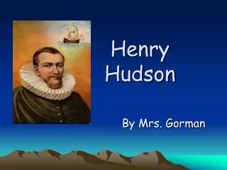
The river is named for Henry Hudson http://www.ulster.net/~hrmm/halfmoon/1609moon.htm • Hudson, an English explorer working for the Dutch East India Company, sailed up the river in the “Half Moon” in 1609 • He was seeking the “Northwest Passage” around North America
Up until development of modern highways in the 20th century, the Hudson was a major north-south transportation corridor. • Dutch fur traders and settlers used the river between Ft. Orange (Albany) and New Amsterdam (NYC) • Hundreds of thousands of people and tons of freight floated on the river to and from the Erie Canal’s eastern end. http://www.ulster.net/~hrmm/sail/age.html
Replica Half Moon • In honor of the 400th anniversary of Hudson’s voyage, a full size replica of the “Half Moon” has returned to the river • http://www.halfmoon.mus.ny.us/
Even today, there is much barge traffic for cement, petroleum, and other goods. The river is also important for pleasure boating during the warmer months. • Images of the former bustle on the river can still be found in many books. • A selected bibliography is provided in the Resources section accompanying this Workshop. http://www.hudsonriver.com/
The Great Hudson River Paddle For the past few years, kayak enthusiasts have paddled from Albany to NYC, stopping at various riverside locales for water-related festivals. Thousands of casual boaters enjoy the river. http://www.hrwa.org/index.html
The Hudson provide a true opportunity for “re-creation” after the bustle of everyday life. Looking south near Croton across the Tappan Zee
Croton River near Peekskill Tributaries large and small contribute to the Hudson’s beauty over its more than 300 miles (500 km)
Geologically, the Hudson is also among the most fascinating river systems because of the many regions through which it passes • The Hudson begins in the Adirondacks as a small stream coming out of a small pond on the southeast side of Mt. Marcy. • As it flows through the Hudson-Mohawk Lowlands, it grows in size as tributaries join. • Ancient rocks of the Hudson Highlands have been sliced through, forming West Point, Bear Mountain, and Anthony’s Nose.
The Hudson Begins at Lake Tear of the Clouds near Mount Marcy in the Adirondacks http://commons.wikimedia.org/wiki/File:Adirondack_Mountains,_N.Y.-_Lake_Tear_of_the_Clouds_by_Stoddard,_Seneca_Ray.png
Much of the Upper Hudson (above Troy) has been dammed. Log runs, hydro-power, and other uses have significantly altered the original water quality. PCB and other contaminants pose serious health threats. http://www.dec.state.ny.us/website/dfwmr/fish/uphudcar.html
The Hudson is an estuary with tidal flows all the way north to Albany • You can find more about these cyclical changes in the water level through the National Ocean Service web pages: www.nos.noaa.gov You can find both tide predictions http://www.co-ops.nos.noaa.gov/tp4days.html and, for some locations, the actual water levels http://tidesonline.nos.noaa.gov/.
The Lower Hudson has a tongue of saltier water extending upriver from the Atlantic beneath fresher water at the surface. • “Salt Front” data is monitored by the US Geological Survey http://ny.usgs.gov/htdocs/dialer_plots/saltfront.html
Here is the link to New York State Watersheds http://cfpub1.epa.gov/surf/state.cfm?statepostal=NY From here, you can use your mouse to find which watersheds are part of the Hudson system and learn much about the various parts of this amazing river system. Similar studies can be done with watersheds all over the United States.
The Tappan Zee is the widest part of the river, nearly three miles in places. This area is a boundary between the Manhattan Prong of the New England on the east and the Palisades and Triassic Lowlands on the west. This means that drivers crossing the TZB make a “bedrock age” jump between 200 and 500 million years! (Of course, when we are stuck in traffic, this amazing fact seems somewhat trivial.) http://www.nycroads.com/crossings/tappan-zee/
Not far north of LDEO is the Sparkill Gap, where the river once turned sharply westward through the Palisades to wander in a generally southward directions, eventually eroding what is now the Hackensack Meadowlands and reaching the Atlantic south of Staten Island. Today, Sparkill Creek flows into the Hudson in the gap
The creek is a popular paddling location, wending its sinuous route through the Tallman Salt Marsh.
What happens when the Hudson meets the Atlantic? • During the Pleistocene when continental ice sheets covered much of this region, the Hudson Valley was beneath glacier more than a thousand feet thick. • Sea level was much lower, and the river carved out the largest of several submarine canyons along the Northeast coast, the Hudson Canyon
Many of the earliest Lamont Geological Observatory research cruises aboard the “Vema” investigated this fascinating drop-off valley. Recently, Diane Duane used this area as the setting for her science fantasy book “Deep Wizardry.” http://www.ldeo.columbia.edu/CORE_REPOSITORY/RHP1.html
As the last Pleistocene glaciers melted, sea level rose to cover the continental shelf and flood the Hudson Valley, making this the “southernmost fjord in the Northern Hemisphere.” Salt marshes, oyster beds, and other interesting features reveal continuous changes over the past 10,000 years. Robin Bell, Martin Visbeck, Tim Kenna, Margie Turrin, Andrew Juhl, and other LDEO scientists have shared research results in previous E2C programs.
Hudson River Research at LDEO • Bottom Mapping http://www.ldeo.columbia.edu/Hudson/articles/article5.html • Water Quality http://www.ldeo.columbia.edu/Hudson/articles/article1.html • River Marsh http://www.ldeo.columbia.edu/Hudson/articles/article4.html • River Plume http://www.ldeo.columbia.edu/Hudson/articles/article2.html • Estuary Ecosystem http://www.ldeo.columbia.edu/Hudson/articles/article3.html • LDEO’s Commitment to the Hudson River http://www.ldeo.columbia.edu/Hudson/about/index.htm
Hudson River Snapshot Day Coming: October 14, 2010
For “armchair” explorers of the Hudson, there are several excellent videos: • “The Hudson River: An American Paradise” • “Henry Hudson’s River:A Biography” (narrated by Orson Welles) • “World’s End: A Brief History of the Hudson River Highlands” (narrated by Richard Kiley) • Hudson River Film & Video Indian Brook Road, Garrison NY 10524 914-265-3405
Other Useful Links • NYS DEC Hudson River Homepage http://www.dec.state.ny.us/website/hudson/ • USGS Hudson River Basin National Water Quality Assessment http://ny.water.usgs.gov/htmls/pub/nawqaweb/ • New York Geology Resource Page http://www.albany.net/~go/newyorker/ • Hudson River Sloop “Clearwater” http://www.clearwater.org/