Download
1 / 49
500 likes | 679 Views
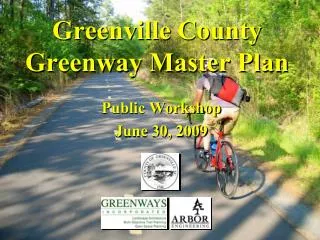
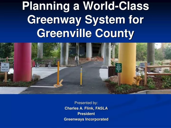
Planning a World-Class Greenway System for Greenville County. Presented by: Charles A. Flink, FASLA President Greenways Incorporated. Greenways 101. What is a Greenway? Where are Greenways Found? Why are Greenways Important?. What is a Greenway?. Multi-Objective Greenways. Growth

E N D
Planning a World-Class Greenway System for Greenville County Presented by: Charles A. Flink, FASLA President Greenways Incorporated
Greenways 101 • What is a Greenway? • Where are Greenways Found? • Why are Greenways Important?
Multi-Objective Greenways Growth Management Floodplain Management Stewardship Greenways Alternative Transportation Water Quality Protection Economic Development
Greenway Corridor Types Vocabulary of Types • Type 1: No development • Type 2: Limited development • Type 3: Multi-use unpaved trails • Type 4: Multi-use paved trails • Type 5: On-road trails • Type 6: Paddleway trail
Where are Greenways Found? Rural Urban Suburban
Why are Greenways Important? Greenways connect us to natural places we treasure -- and enable us to preserve these places for future generations
Why are Greenways Important? Greenways connect us to our communities and allow citizens to freely and safely navigate a variety of urban and suburban environments.
Why are Greenways Important? Greenways connect us with each other -- serving to break down social barriers and serving as America’s new “Main Street” for community events.
The Benefits of Greenways Health/Wellness Transportation Economics Education Environment
Resources on Greenway Planning Both books are available from Island Press
Spoke: River/Stream Corridor Hub: City Park Hub: Federal Land Sensitive Habitat Workplace or Center City Residential Neighborhood Farmland Shopping Center Spoke: Landscaped Roadway Spoke: Rail-Trail School Hub: County Or State Park A Framework for Greenway Systems • Effective Greenway programs are based on the “Hubs and Spokes” model. • Connections is the key - create opportunities for community residents to be linked to outdoor resources.
Key Elements of Planning GIS Mapping Public Involvement Hubs and Spokes Framework Plan of Action Source of Funding Acquisition/Development
Key Steps in Planning • Step 1: Consensus Building • Step 2: Data Collection/Synthesis • Step 3: Needs Identification • Step 4: Prepare Draft Greenways Plan • Step 5: Draft Plan Review • Step 6: Prepare Final Greenway Plan • Step 7: Present Final Plan • Step 8: Develop Implementation Strategies
Step 1: Consensus Building • Form Advisory Committee • Hold Public Open House Meetings • Publish a Newsletter
Step 1A: Public Workshops • Conduct public workshops: • Initial workshop with citizens would define goals and solicit ideas for updates to system. • Follow up workshop would be to present preliminary Greenway Plan and discuss implementation program.
Step 2: Data Collection Use GIS technology to complete a thorough data collection effort that will include: • Assessment of existing greenspace in Greenville County • Plot all information on separate layers into GIS data set using ESRI Arc View (NAD 83) • Conduct field investigations • Review prior greenspace planning efforts
Step 1 Step 2 Step 3 Existing Greenspace. Wildlife Habitat Wetlands Community Resources Phasing Floodplains/ Stream Corridors Short Term 0 to 2 years Medium Term 2 to 5 years Long Term 5 years & up Water Resources Select and prioritize greenbelt segments GreenwaySystem Map GIS Data Set Analysis Watersheds Land Cover Slopes and Soils Roads & Utilities GIS Analysis GIS Analysis Historic Sites T. I. P. Base Data GIS Screening Process
Data Available from Greenville County GIS: • Zoning • Street Centerlines • Railroads • Traffic Counts • Streams and Rivers • Lakes • Parks, Libraries, & other Landmarks • Contour Lines (4, 8, & 12 Feet) • Aerial Photography
Step 3: Needs Assessment • Determining a “Level of Service” – LOS • Why? Provide adequate supply of greenspace resources to serve the public health, safety and welfare needs of Greenville County residents. • Proper balance of greenspace and developed land. • Proximity and accessibility are key elements of satisfying needs of residents. • Barriers to access and use must be considered
NRPA Standards Adopted Policies Demographic Trends Leisure Activity Trends Prior Planning Efforts Statistical Surveys Opinion Surveys Public Input Market Reckoning Benefits of Greenspace Community Comparison Determining a Level of Service
Current Greenspace in Charleston County Local Government greenspace 6,683 acres State and Federal greenspace 128,916 acres Private greenspace 25,785 acres Totals 161,384 acres Data Source: Greenways Incorporated 2005
Step 4: Draft Master Plan Prepare draft Master Plan that will: • Define level of service of the system • Define uses for each corridor • Define financial constraints associated with facility development (O&M) • Define sources of funding
Conceptual Framework • Progressive framework that forecasts immediate and long term needs • How are these needs met • Illustrated on GIS mapping • Described in report
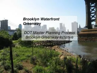
MetroGreen System Map • A “Greenprint” for future growth and development of the Kansas City Region. “Just as you would not consider building a home without a blueprint, we should not continue to grow our communities without a Greenprint.”
Regional Trail Conceptual Map • Connecting Communities • 500 miles of trail • 2.3 million people • 40 destinations • 7,300 sq. miles • 15 counties 29
Future of the 15-County Region Hubs of the Future Bikeable Community Walkable Community Thriving Downtowns A Region of Communities Transit Friendly
Step 5: Review Draft Plan • Meet with citizens to review draft plans • Coordinate plan review with a public workshop - solicit input on draft recommendations • Articulate for community residents how greenway program will be implemented
Step 6: Final Master Plan • Final Master Plan should include: • Description of Greenway Corridors • Estimate of Greenway Facility and Land Acquisition Costs • Implementation Strategy • Design Development Guidelines • Land Acquisition strategy • Define roles and responsibilities of County • Final GIS Mapping • Digital files for uploading to web site
Greenway Stewardship • Who manages the increasing amount of greenway facilities • Public sector stewardship • Private sector stewardship
Step 7: Present Final Plan Present Final Plan to: • Advisory Committee • Parks and Recreation Commission • County Planning Commission • County Council
Step 8: Ensuring Implementation of the Master Plan Create mechanisms within existing rules & regulations that will lead to the implementation of the greenways master plan: • Cluster Ordinances • Connectivity Requirements • Development (and consistent enforcement) of a countywide growth framework • Public Funding for Greenway Development
Fundamentally, Greenways are aboutconnectionsbetween people and the land.
Leaving a Legacy for Future Generations “To build a Greenway is to build a Community” Charles Little