Download
1 / 26
270 likes | 421 Views
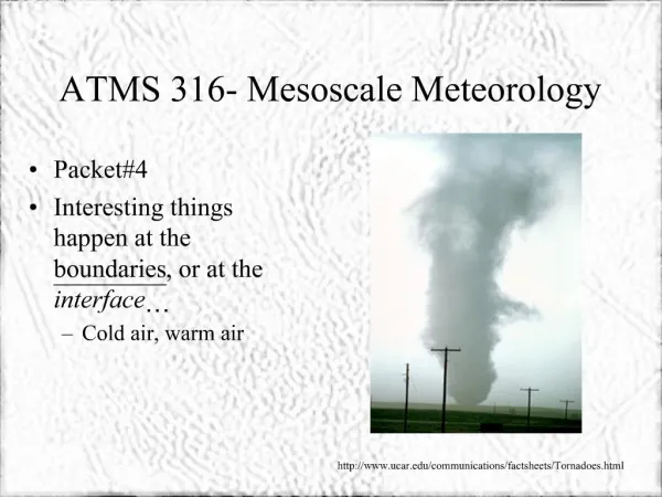
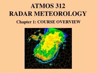
Introduction of Mesoscale and Radar meteorology. Beautiful pictures vs. Disasters. Large planetary waves. Hemi-spherical plot of 500mb height (color) and MSL pressure (contours) showing planetary scale waves and surface cyclones (lows). . Diurnal cycle of precipitation Systems .

E N D
Large planetary waves Hemi-spherical plot of 500mb height (color) and MSL pressure (contours) showing planetary scale waves and surface cyclones (lows).
Diurnal cycle of precipitation Systems
There is a local peak around 1 day – associated with diurnal cycle of solar heating, and a large peak near 1 year – associated with the annual cycle due to the change in the earth's rotation axis relative to the sun. These time scales are mainly determined by forcing external to the atmosphere. There is also a peak in the a few days up to about 1 month range. These scales are associated with synoptic scale cyclones up to planetary-scale waves. There isn’t really any external forcing that is dominant at a period of a few days – this peak must be related to the something internal to the atmosphere – it is actually scale of most unstable atmospheric motion, such as those associated with baroclinic and barotropic instability. There is also a peak around 1 min. This appears to be associated with small-scale turbulent motion, including those found in convective thunderstorms and planetary boundary layer. The figure also shows that energy spectrum of the atmospheric motion is actually continuous! There appears to be a 'gap' between several hour to half an hour – there remain disputes about the interpretation of this 'gap'. This 'gap' actually corresponding to the 'mesoscale' that is the subject of our study here. We know that many weather phenomena occur on the 'mesoscale', although they tend to be intermittent in both time and space. The intermittency (unlike the ever present large-scale waves and cyclones) may be the reason for the 'gap'. Mesoscale is believed to play an important role in transferring energy from the large scale down to the small scales.
Different scales Time scales: • diurnal cycle • annual cycle • inertial oscillation period – due to earth rotation – the Coriolis parameter f. • advective time scale – time taken to advect over certain distance Spatial scales: • global – related to earth's radius • scale height of the atmosphere – related to the total mass of the atmosphere and gravity • scale of fixed geographical features – mountain height, width, width of continents, oceans, lakes
What are mesoscale phenomena? • thunderstorms • squall lines • supercells • tornadoes • mesoscale convective complexes • inertia-gravity waves • mountain waves • low-level jets • density currents • land/sea breezes • heat island circulations • clear air turbulence • jet streaks • fronts • hurricanes …
Summary of scales There are more than one way to define the scales of weather systems. The definition can be based on the time or space scale or both of the system. It can also be based on certain physically meaningful non-dimensional parameter. The most important is to know the key characteristics associated with weather systems/disturbances at each of these scales, as revealed by the scale analysis.
Weather phenomena to be covered • Single cell • Multiple cell • Squall lines • Super cell • Tornados • Tropical cyclones • Lightning • Seasonal and diurnal variations
Depending on the time, these weather phenomena may not be covered • Mountain forced flows, waves • Mesoscale gravity waves • Planetary boundary layer structure
Before we start A correct tool may save you tons of time!!!