Download
1 / 15
150 likes | 256 Views
2013 Geographic Review Project: 2010-003-00 May 2, 2013. Lower South Fork Clearwater River. Nez Perce Tribe DFRM Watershed Division Mark Johnson-Project Leader markj@nezperce.org. Project Map. Lower South Fork Clearwater River Project:. 301, 000 Acres 1,047 stream miles

E N D
2013 Geographic Review Project: 2010-003-00 May 2, 2013 Lower South ForkClearwater River Nez Perce Tribe DFRM Watershed Division Mark Johnson-Project Leader markj@nezperce.org
Project Map Lower South Fork Clearwater River Project: • 301, 000 Acres • 1,047 stream miles • Focal species- • Snake River ESU listed steelhead, spring chinook, bull trout • Merger of two former BPA funded projects • Original project began in 1997 3
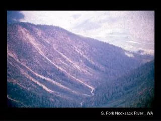
Vicinity Map Newsome Creek American River Red River Crooked River 4
Limiting Factors The project focus is on the key limiting factors: • high water temperatures • migration barriers • excess sediment • degraded riparian conditions
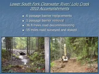
Activities/ Accomplishments We are addressing limiting factors by: • riparian planting and protection • barrier removal/replacement • 71,000 plants • 388 Acres invasive weed treatment • 15 miles fence installed & maintained • protecting 5.9 miles of streambank in sensitive meadows • 15 barriers removed/replaced • access to 23.9 miles of potential habitat
Activities/ Accomplishments We are addressing limiting factors by: • removing unneeded roads • restoring natural stream conditions • 126 miles of roads decommissioned • 0.7 miles of roads improved • 600 feet of stream restored
Response to Previous ISRP Comments This project has not previously undergone ISRP review, however there has been previous comments on the parent projects which were used in the adaptive management process: Comment- ISRP questioned the use of hard-engineered methods for increasing instream habitat complexity. NPT response- use of hard-engineered methods was reduced in future actions. Define Design ADAPTIVE MANAGEMENT STRATEGY Adjust Evaluate Comment- ISRP commented on the deficiency of a synthesized monitoring approach. NPT response- development of the “NPT DFRM Watershed Division, Tributary Habitat Programmatic Monitoring and Evaluation Plan” 8
Research, Monitoring, & Evaluation Implementation and Compliance- • All projects monitored post construction • Assess project function over time and provide adaptive management feedback loops Focused Status and Trend- • Selected parameters based on the limiting factors including temperature, cobble embeddedness, and fish presence/absence • 18 paired sites in 9 key sub-watersheds
McComas Meadows Riparian Vegetation • Exclosure fence installed in 1997 • Planting began in 2000 • Over 50,000 trees and shrubs planted 2008 1992
Past Projects 2000-2013 ProposedProjects2014-2018 Lower South Fork Clearwater River Project Area Barrier Replacements Fencing Projects Monitoring Sites Planting Sites Road Decommissioning Road Improvements Stream Restoration Project Boundary Sub-Watersheds Critical Sub-Watersheds
Proposed Projects 2014-2018 • 7 barrier replacements, accessing 11.4 miles • 4 road decommissioning projects, totaling 50 miles • 5 road improvement projects, totaling 11.3 miles • 2 stream restoration projects, totaling 1800 feet • planting 10,000 native riparian plants • ongoing fence maintenance, ongoing monitoring