Download
1 / 34
480 likes | 1.24k Views
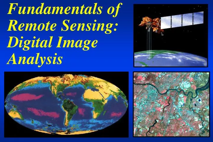
Fundamentals of Remote Sensing: Digital Image Analysis. Advanced Remote Sensing: Introduction to Digital Image Analysis. Lecture 1 Prepared by R. Lathrop 10/99 updated 9/03 Readings: ERDAS Field Guide 5th ed ERDAS CH. 1: 1-15; 3: 52-77. Lecture Notes 1: Overview of Remote Sensing .

E N D
Advanced Remote Sensing: Introduction to Digital Image Analysis Lecture 1 Prepared by R. Lathrop 10/99 updated 9/03 Readings: ERDAS Field Guide 5th ed ERDAS CH. 1: 1-15; 3: 52-77
Lecture Notes 1: Overview of Remote Sensing A number of these slides were originally produced by Scott Madry and Chuck Colvard with some subsequent modification by Rick Lathrop. Additional slides were produced by Rick Lathrop.
“Remote sensing is the science and art of obtaining information about an object, area, or phenomenon through the analysis of data acquired by a device that is not in contact with the object, area, or phenomenon under investigation”.-Lillesand & Kiefer (1987) Remote Sensing
Radiation source/target/sensor Electromagnetic energy interacts with physical matter in different ways in different parts of the spectrum. Some energy is scattered, absorbed, etc.
Digitization of analog aerial photography, can be very useful for historical studies and/or for high spatial resolution needs Direct acquisition using some form of digital imaging sensor Computerized image analysis can help to enhance and extract information content of imagery in a time-efficient, cost-effective manner Computers still can not replace the human image analyst Digital Image Acquisition & Analysis
Aerial Cameras Keystone’s Wild RC-10 mapping camera A large format oblique camera
Black & White - single panchromatic layer Color: 3 layers B-G-R Color IR: 3 layers G-R-NIR Aerial photos
The traditional form of remote sensing Pro: Can be easily customized to meet specific requirements Con: Can be expensive Need access to plane Time consuming interpretation Repeat coverage often infrequent Different sun angles Aerial photos
Space-borne Remote Sensing • Emerging Technology • Pro: • GIS ready • faster turn around • acquisition time of 5 minutes gives equal solar illumination, shadows, no clouds • easy to repeat for change detection • Con: • Significant investment in computer hardware/software • Less flexibility in acquisition
Electronic sensors can acquire data outside the visible spectrum Elements sensitive to electro magnetic energy (EME) of certain wavelengths focus energy onto a sensor plane. A prism is used to divide the energy into specific wavelengths. The CCD’s are stimulated and produce an electrical signal equal to the energy focused upon it. These data are recorded. Data are processed and displayed on computers-images are composed of “pixels”, whose brightness relates to the strength of the radiation received from an area on the surface. Digital processing of the data produces useful information Passive electro-optical systems
Clear definition of the problem Evaluation of the potential of remote sensing techniques Identification of appropriate remote sensing data acquisition procedures Determination of the data interpretation procedures Identification of the criteria by which the quality of information can be evaluated Design of A Remote Sensing Effort
Four kinds of resolution determined by user needs: Spatial Resolution: How small an object do you need to see (pixel size) and how large an area do you need to cover (swath width) Spectral Resolution: What part of the spectrum do you want to measure Radiometric Resolution: How finely do you need to quantify the data Temporal Resolution: How often do you need to look Resolution
Spatial resolution Instantaneous Field of View (IFOV) determines the dimension, D, of the Ground Resolution Cell (GRC) imaged on the ground IFOV
24 inch (60 cm) ultra-high spatial resolution • 6 inches (15 cm)
Landsat-185km (100 mi) 80 m = 40 Mb-4 bands (MSS) 30 m = 320 Mb-6 bands (TM) 10 m = 342.25 Mb-1band 5 m = 1.369 Gb -1 band 1 m = 34.225 Tb - 1 band How small do we need? How much data can we store and process? Swath width 185 by 185 km
Spectral Resolution: slicing up the electromagnetic spectrum
The electromagnetic spectrum Comparative Sizes: from subatomic to human scales Atom Nucleus Molecule Human & larger Pinhead Atom Bacteria Honeybee From NY Times graphic 4/8/2003
Landsat TM-7 bands-8 bit data Spectral (where we look) Radiometric (how finely can we measure the return) 0-63, 0-255, 0-1023 Landsat TM BAND 1 2 3 4 5 7 6
Landsat TM: each waveband provides different information about earth surface features
Radiometric resolution • Sensitivity of the detector to differences in EMR signal strength determines the smallest difference in brightness value that can be distinguished Bright Dark Determined by the A-to-D quantization 6 bit = 0-63, 8 bit = 0-255, 10 bit = 0-1023
Radiometric resolution • Higher radiometric resolution is especially important for quantitative applications such as sea-surface temperature mapping where the user wants to distinguish small differences in temperature
Geostationary Polar Sun-synchronous Constant view of hemisphere Covers entire Earth Satellite remote sensing orbits give repeat coverage 700-900 km 35,800 km
The ability to monitor change is one of the benefits of remote sensing We can monitor human and natural changes in the landscape Change Detection
Spatial and temporal resolution Ground Surveys 50 years As spatial resolution increases, the revisit time is also increased, as are the applications that are appropriate and the cost Aerial Photography 5 years Repeat time Space photography 3 years SPOT 28 days Landsat-TM 17 days NOAA AVHRR 12 hours Meteosats 30 min. .1 m 1 m 5 m 10-20m 30m 1 km 5 km Ground resolution
Different sensors and resolutions sensor spatial spectral radiometric temporal ---------------------------------------------------------------------------------------------------------------- AVHRR 1.1 and 4 KM 4 or 5 bands 10 bit 12 hours 2400 Km .58-.68, .725-1.1, 3.55-3.93 (0-1023) (1 day, 1 night) 10.3-11.3, 11.5-12.5 (micrometers) Landsat MSS80 meters 4 bands 6 bit 16 days 185 Km .5-.6, .6-.7, .7-.8, .8-1.1 (0-63) Landsat TM30 meters 7 bands 8 bit 14 days 185 Km .45-.52, .52-.6, .63-.69, (0-255) .76-.9, 1.55-1.75, 10.4-12.5, 2.08-2.3 um SPOT 10m P / 20m X P -1 band X- 3 bands 8 bit 26 days 60 Km P - .51-.73 um (0-255) (2 out of 5) X - .5-.59, .61-.68, .79-.89 um IRS1 5.8 meters 1 band 6 bit 22 days 70 km .5-.75 (0-63) IKONOS 1 meter 1 band 8 bit 3 days 11 km .45-.9 (0-255) (1.5 out of 3)
Remote sensing : acquiring and analyzing data using distant devices recording electromagnetic energy • Digital scanning devices or analog photography • Airborne, terrestrial, marine, or orbiting platforms • Can be passive, sensing existing radiation, or active, sensing radiation bounced off the surface, as with radar. Remote sensing usually involves digital data, but also photography Usually means both the capture and computerized image analysis of data. Quantitative, easily incorporated into GIS • Design of a remote sensing effort must clearly define information needs and consider the 4 types of remote sensing resolution: radiometric, spatial, spectral, temporal when considering the types of imagery to use Remote Sensing - Summary