Download
1 / 58
580 likes | 712 Views
Hurricane Forecast Improvement Project (HFIP ): Where do we stand after 4 years ? Research and Innovation Transition Team (RITT). Fred Toepfer —HFIP Project Manager May 15, 2013. HFIP OVERVIEW. 10-year program with ambitious forecast improvement goals Designed and run by NOAA

E N D
Hurricane Forecast Improvement Project (HFIP): Where do we stand after 4 years?Research and Innovation Transition Team (RITT) Fred Toepfer—HFIP Project Manager May 15, 2013
HFIP OVERVIEW 10-year program with ambitious forecast improvement goals Designed and run by NOAA with non-NOAA collaborators Began in fiscal year 2009 Focus on improving numerical weather prediction model forecast guidance provided to the National Hurricane Center
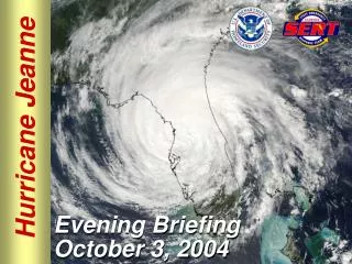
Drivers for a HFIP Program • Lives: More than 50% of U.S. population lives within 50 miles of coast; Number of people at risk increasing along coast and inland; 180 million people visit the coast annually • Property: Value of coastal infrastructure and economy rising… now > $3 trillion; annual U.S. tropical-cyclone-related damage losses averaged about $10 billion circa 2008; averaged losses double about every ten years • Forecasts: Hurricane track forecasts have improved greatly; intensity forecasts have not • Research: Tropical cyclone research has been under-resourced and not well-coordinated within the meteorological community Courtesy: Ed Rappaport There is a great need and potential for substantial improvementsabove and beyond current research efforts in hurricane forecasting. Bolivar peninsula after Ike (2008)
Operational Forecast Performance Good – track forecast improvements Not so Good – Modest intensity gains Some intensity gains since 2008, especially at >48 h • Errors cut in half over past 15 years • 10-year improvement - As accurate at 48 hours as we were at 24 hours in 2000 • 24-48h intensity forecast off by1category • Off by2categories perhaps 5-10% of time http://www.nhc.noaa.gov/verification/verify5.shtml Courtesy of Frank Marks
HFIP Scope • Improve hurricane forecast system/global forecast system to reduce error in intensity and track • Make better use of existing observing systems; define requirements for future systems to enhance research and operations capabilities and impacts • Does not include acquisition or operation of operational observing systems • Expand and improve forecaster tools and applications to add value to model guidance
The HFIP Project – Vision/Goals • Vision • Organize the hurricane community to dramatically improve numerical forecast guidance to NHC in 5-10 years • Goals • Reduce numerical forecast errors in track and intensity by 20% in 5 years, 50% in 10 years • Extend forecasts to 7 days • Increase probability of detecting rapid intensification at day 1 to 90% and 60% at day 5
HFIP Charter and Leadership • HFIP Charter signed August 1, 2007 • Hurricane Executive Oversight Board • Jointly chaired by AA for National Weather Services and AA for Oceanic and Atmospheric Research • Cross-NOAA Membership • HFIP Management • Project Manager: Fred Toepfer, NWS/OST • Development Manager: Robert Gall, UCAR • Research Lead: Frank Marks, OAR/AOML/HRD • Operations Lead: Ed Rappaport, NWS/NHC
Technical Team Leadership2013 FY 2013 Strategic Planning Teams FY 2013 Tiger Teams
HFIP Scientific Review Committee • The SRC provides feedback and guidance contributing to the cohesion of near-term (next year or two) and longer range strategies for improving hurricane forecasts • Being outside of the daily project functioning, the SRC provides a broader assessment of HFIP progress and future approaches • Review and suggest possible changes to annual HFIP plans • Review proceeding year accomplishments • Review the long term HFIP model system development and observing strategy plans • Review the objectives and makeup of the demonstration system each season • Organizational meeting 4th Quarter 2012 • 2 day review held 26 and 27 February, 2013.
HFIP Scientific Review Committee Membership Name Organization Area of Expertise Term of Service Mike Montgomery NPS TC dynamics 3 years Dave Nolan Miami TC regional models 3 years Gary Barnes UH/Manoa TC structure 3 years Jim Price Woods Hole Coupled models 2 years Bob Hart FSU TC environment interaction 2 years Jim Goerss NRL Monterey Global models/ensembles 2 years
HFIP Overall Strategy Use global models at as high a resolution as possible to forecast track out to 7 days Use regional models at 1-3 km resolution to predict inner core structure to meet intensity goals out to 5 days including rapid intensification Hybrid DA for both regional and global using as much satellite and aircraft data as possible Both regional and global models run as ensembles Statistical post processing of model output to further increase forecast skill
Real-time Experimental Guidance Stream 1.5 • Real-time experimental guidance made available to NHC in real-time • Called Stream 1.5 “experimental operations” • Verification evaluation of candidates completed by NCAR • NHC evaluate results and selects which models will be included as Stream 1.5 • Includes both experimental new and projected future capabilities of current system • Typically runs August 1 through October 15 • www.hfip.org to access results
HFIP dedicated HPC for development/demonstrationNOAA Jet system • “Jet” system performance in 2012 peaks at 272 Tflops • Current Operations Computing peaks at 74 Tflops • Components of the operational system that contribute to hurricane forecasts 26% • HFIP computer provided 10 times more compute 16
Progress and Accomplishments • 5-year Performance Goals Exceeded or Within Reach • New Hybrid DA Systems went operational in the GFS in May 2012: track forecasts exceeded the 5-yr and approached the 10-yr goal. Among the best dynamical models for hurricane track prediction, beating ECMWF most lead times. • A third nest was added to operational HWRF allowing an inner core resolution of 3 km. This and other changes led to a 20% improvement in both track and intensity forecasts over previous year. • Real-time confirmation of the impact of radar data on intensity forecasts from the operational HWRF: Improvement Additional 10%-20% out to 72 hours; independently verified with similar results from AOML using experimental HWRF.
Operational GFS Track Forecasts in CY12 Exceed the 5-year Goal Track Skill for NCEP Operational models
Global Model Track Error 2012(% Improvement over HFIP baseline) GFS ECMWF FIM
Comparison of 2012 NCEP Operational Models to the 5 Year HFIP Goal: Intensity HFIP 5 year Goal Baseline skill GFS GFDL HWRF
HWRF Intensity ATL Basin Cumulative Forecast Improvements
Progress and Accomplishments(cont.) • Other Development Areas: • A real-time product for potential genesis using the HFIP global ensembles was demonstrated • Experimental 7-day model guidance • Next generation hurricane storm surge model demonstrated. A forecast for hurricane Sandy made 36 hours before landfall showed surprising skill in forecasting the surge in New York City and along the New Jersey coast. • Statistical Post processing and products development • Operational HWRF Development Process initiated
NHC Operational Genesis Forecasts greatly under predicts around 50% probability slightly over predicts above 70% probability Refinement distribution indicates the percentage of times the forecast falls in a particular category. So for example forecasts of 50% probability of formation occur about 10% of the time good for Lower probabilities
Verification of model genesis for operational global models • All models have a bias towards over-prediction, caused by both false alarms as well as genesis occurring in the forecast long (>>48h) before observed genesis. • 4-ensemble consensus close to reliable up through 50-60%.
HFIP Working With Hurricane Surge Models Maximum storm surge forecast for Hurricane Sandy from the ADCIRC storm surge model made 36 hours before landfall. Sandy’s track is shown in black
Statistical Post Processing • Statistical Post Processing can add skill to dynamical forecasts. • There are a number of techniques based on ensembles or individual models. • One method is shown in the following figure • From the FSU Multi-Model Ensemble (MMEN) which forms a weighted mean of the many global and regional models run both operationally and by HFIP in real time.
NHC • Diagnostics • Ops Evaluation • Recommendation Implementation • EMC • Testing/ Eval/ • Implementation • Physics • Initialization • Diagnostics • Op Support • NCO • Operational Code • Operational Runs Ops Code Outcome Reach HFIP Goals on Intensity Operational HWRF Development Process • GFDL • Development • Physics • Initialization • Ocean Coupling • AOML • Development • Init/DA • Physics • Dynamics GFDL HWRF • MMM • Development • Init/DA • Physics • Dynamics • HWRF CR • Dynamic cores • Physics Packages • Initialization Schemes • Data Assimilation • Single & Multi- Model Ensembles • Post Processing Versions of Ops Code EMC AHW COAMPS-TC • NRL • Development • Init/DA • Physics • Dynamics Ops Code Research / Development HWRF • EMC • HWRF Model Development • Init/DA • Physics • Dynamics • Ocean Coupling DTC Code Maintenance TCMT Testing and Evaluation Enabling Infrastructure • Academic Research Community • Research • Development • JCSDA • Satellite DA
Advanced Next Generation High-Resolution Physics for Operational HWRF Planned Real-time High-Resolution Physics experiments for 2013 Hurricane Season • Develop the next generation physics appropriate for 1-3 km resolutions • Comprehensive use of aircraft and buoy observations to improve model physics, special flight modules to obtain targeted observations in data void regions • Advanced air-sea-wave coupled system with sea-spray parameterization • Meso-SAS convection scheme for high-resolution grids, Higher moment microphysics and advanced Radiation • TKE based PBL schemes for more accurate representation of horizontal and vertical mixing • NOAH LSM for improved representation of land surface processes • Holistic approach in the design of high-resolution physics appropriate for hurricane conditions
Future advancements for Operational HWRF Improved Scale Interactions and Improved Track and Size Forecasts Basin-Scale HWRF: Real-time Multi-nested 3km predictions Comprehensive large-scale/vortex-scale interactions in a unified framework, with high-resolution hurricane forecast guidance
High-Resolution HWRF Ensembles for Real-Time HFIP Stream 1.5 Demo during 2013 Hurricane Season • Hurricane Ensemble Prediction System based on Stochastic Convective Trigger (vortex scale) and GEFS ETR initial conditions (large-scale) perturbations • Based on latest FY2013 HWRF configuration (fully coupled system) • Further improvements to track and intensity forecast skill • High-Resolution Probabilistic Prediction Capability using NMME System (HWRF and COAMPS-TC)
Transitioning HWRF to NMM-B/NEMS Framework Why NEMS/NMM-B? • Concept of Unified NOAA Modeling Framework • Seamless expansion of current “storm-centric” approach to “global-to-local-scale” approach for hurricane prediction • Take advantage of “in-house” expertise Three-Tier Developmental Path: (a) put HWRF in NEMS Framework (b) Adopt NMM-B nests for hurricanes (c) Global-to-local scale modeling system for hurricanes Resource requirements: • Apart from computing resources, estimated human resources are of the order of 8 FTE for three years (includes transition and T&E) and sustained efforts then after. • Dual development strategy: • Continue annual upgrades for HWRF until we have a stable, reliable and skillful hurricane model in NMM-B/NEMS framework • Requires extensive independent T&E setup specific to NMM-B/NEMS workflow 3-year strategy for transitioning HWRF to NMM-B/NEMS framework: Transition existing operational HWRF capabilities Transition basin-scale system with multiple moveable nests Global-to-local scale modeling system for hurricanes in NMM-B global framework
Hurricane Isaac with and without Tail Doppler Radar Data
Impact of TDR Data In Operational HWRF Track Error Intensity Error Without TDR Without TDR With TDR With TDR
Impact of Aircraft Data(% improvement over Baseline (Skill)) All cases with radar data from 2008-2010 for ATL basin
Satellite DataThe hurricane initialization problem HFIP has shown that high resolution data taken near the hurricane core and its near environment can significantly improve Intensity Forecasts. This is particularly true for high resolution wind data (Tail Doppler Radar, TDR) Flight level, dropsonde and SFMR surface wind data also important Currently available only when aircraft are within the Hurricane Roughly only 10% of hurricane NWP initialization times This is about 30% when storms are near the US coast Only other option for inner core data is Satellite data Lower horizontal and vertical resolution than TDR Hurricane core is a highly challenging environment for satellite measurements Heavy precipitation Often completely overcast Sharp gradients of cloudy and clear areas (e.g. eye wall) enhance probability of correlated errors and are often of the same horizontal scale as satellite footprints
Satellite DataData Sources and Challenges • Goes Atmospheric Motion Vectors (AMV) • Height assignment is crude and significantly impacts data quality • Hourly time resolution may be useful with emerging 4-D hybrid assimilation • Probably the easiest to implement • Available all the time • Scatterometer Surface Winds • From polar orbiters, not always available • Relatively easy to implement • Microwave (MW) Sounders • From polar orbiters, not always available • Problems in heavy rain areas (absorption and scattering) • Some development required • IR Sounders • Higher horizontal and vertical resolution than MW sounders • Works well in cloud free areas and above highest clouds • Much of hurricane region has significant clouds • HFIP has been working on use of this data in cloudy regions • This is a very difficult problem and will require considerable development
Atmospheric Motion Vectors from GOES-R Low-Level (700-950 hPa) Vectors from VIS Proxy: AMVs from special GOES-14 super-rapid-scan ops during Hurricane Sandy AMVs from 15-min images (routine GOES sampling) AMVs from 1-min images (mesoGOES-R sampling) 1800 UTC 26 Oct, 2012 C. Velden (CIMSS)
HFIP Priorities2013 - 2016 Operational Impact • Continued development and demonstration of the Experimental Numerical Forecast System (real-time) during hurricane season on HFIP Boulder Jet System • Determine the benefit from standard reconnaissance data (flight level, dropsondes, SFMR) and the addition of Doppler Radar • Demonstrate Impact of Multi-model ensembles for Track and Intensity Research and Development • Best use of limited TDR flights operationally • Improve use of Satellite data in hurricane DA • HWRF Physics • HWRF GSI hybrid DA • Basin scale HWRF • High resolution inner domain/vortex scale Technical Advancements • Convert HWRF to NMM and optimize code for application of accelerator technologies
Further advancements to FY13 HWRF for improved track, intensity and structure forecasts Advanced High resolution (3km)Triple Nested HWRF for 2013 Hurricane Season to be implemented on WCOSS • Implementation of One-Way Hybrid Global EnKF-Regional 3DVAR GSI DA • Improved vortex initialization, nest motion algorithm and nesting techniques • Improved physics and air-sea interactions • Improved product quality and enhanced synthetic satellite imagery • Track Skill comparable to GFS, Intensity Skill superior to Official forecasts and statistical models One-way hybrid GSI for HWRF using GFS EnKFensembles Accurate representation of vortex tilt Intensity Errors OPER HWRF HWRG TDR FY13 HWRF
Advanced Real-Time Products from Operational HWRF • High-Resolution synthetic satellite imagery (IR and Microwave) • High temporal resolution track, intensity and structure forecasts • Advanced inner core and large-scale diagnostics • Swaths for maximum wind and rainfall, SHIPS predictors, 24-hr QPF, TPW, OHC, SST cooling • Advanced verification tools to make use of all available observations (aircraft recon, TDR, AXBTs, buoy data and remote sensing satellite data) GFS HWRF GFDL Research quality forecasts for real-time operations