Download
1 / 25
250 likes | 324 Views
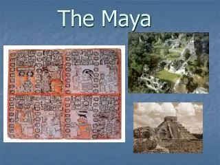
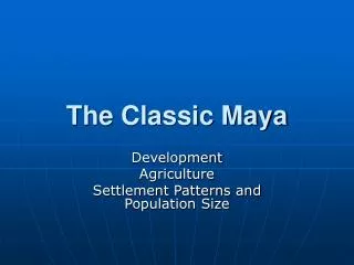
The Classic Maya. Development Agriculture Settlement Patterns and Population Size. Development. Slow, gradual change. Did not develop overnight. Due to several factors Resource concentration population growth beginnings of cultural variability development of ideologies

E N D
TheClassic Maya Development Agriculture Settlement Patterns and Population Size
Development • Slow, gradual change. • Did not develop overnight. • Due to several factors • Resource concentration • population growth • beginnings of cultural variability • development of ideologies • Migration of ideas from other cultures
Socio-Political Organization • Small Kingdoms, No centralized state. • Succession of regional centers • Not really dominant over neighbors • Although some exceptions at different times.
Pacific Coastal Plain • Izapa, Mexico • elaborate stone carvings • Abaj Takalik, Guatemala • ”pot-belly” boulders that have been incised with fat human figures (carved after 500 B.C.) • Monte Alto • collosal heads (contact with Olmec?), also pot belly boulders.
Izapa • Izapa Stela 5, the largest and most complex stela at the site, depicts an enormous World Tree that bisects the composition. • The tree stretches from a watery basal layer at the bottom to a celestial band at the top. A series of mythic and quasi-historical scenes appear on either side of the tree, while the bodies of two zoomorphic beasts frame the scene on either side. http://www.utexas.edu/cofa/a_ah/dir/precol/izapa.htm
Southeast Periphery • Copan, Honduras • evidence of interaction with western areas of MesoAm during the PreClassic (700-500 B.C.).
Copan http://www.misericordia.edu/users/davies/maya/copan.htm
Court of the Stelae http://www.misericordia.edu/users/davies/maya/gcourt.htm
Copan Ballcourt http://www.misericordia.edu/users/davies/maya/bcourt.htm
The hieroglyphic staircase is the longest known Mayan hieroglyphic inscription, tracing the lineage of Copan's kings back to the founder, Yax Kuk Mo. Its inscriptions are more worn-down than those on most of the stelae and, in order to prevent further erosion, it is now protected by an enormous tarp. Hieroglyphic Staircase http://www.misericordia.edu/users/davies/maya/hcourt.htm
Stela M and its associated altar stand at the foot of the staircase,it is a portrait of the fifteenth ruler of Copan, "Smoke Shell" whoalso finished and dedicated the hieroglphic staircase. Stela M was dedicated in 756 A.D. (9.16.5.0.0), three years after the dedication of the staircase. Stela M http://www.misericordia.edu/users/davies/maya/hcourt.htm
Southeastern Highlands • Chalcuapa • one of the important highland centers,important for trade in pottery. • Kaminaljuyu, Guatemala • expansive religious architecture from 400 B.C. to A.D. 100.
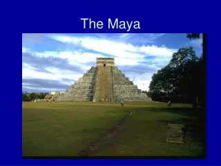
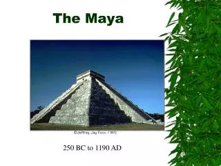
Southern Maya Lowlands • Tikal, Guatemala • Tikal investigations in the 1950s, national park around the site. • 300 B.C. to 300 A.D. developed into a huge city. • Uaxactun, Guatemala • basic chronological sequence of pottery for area.
Tikal http://www.destination360.com/tikal/guide.htm
Yucatan Peninsula and Belize • Cerros • exploited marine resources, adopted kingship by 50B.C. Cerros Main Temple http://www.northernbelize.com/pg2/imagepages/pg2_03.html
Cerros, Belize Structure 5C-2nd was built on the edge of the water and decorated with monumental masks that flank the elongated central staircase. http://www.northernbelize.com/pg2/imagepages/pg2_02.html
Agriculture • Patterns • Previously thought that Maya practiced cultivation similar to 16th c descendants (i.e. Slash/Burn). • Thus, it was believed that that was why no major centers developed. • Additional research discovered that increased population caused them to shift from small scale cultivation to more intensive cultivation.
Localized intensive agriculture • Proposed by Warwick Bray • gardening took place in zones of good water sources.
Expansive Cultivation (900 B.C.) • Shifting cultivation-Slash/Burn • corn farming with swidden or slash/burn, family of five needs 3,000 pounds of corn per year. • lie fallow for 4-8 years, so use up a lot of land if population expands. • but, 150-200 people per square mile can be supported with shifting cultivation. • Doesn’t explain how supported Classic Mayan population.
Wetland cultivation (Extensive-Intensive) • Maya increasingly pressed by population. • Swamps were being drained and drainage canals built., located with radar imagery. • The largest cities are located on the edges of these swamps.
Settlement Patterns and Population Sizes • No direct evidence for census material, so use indirect means. • Counting house mounds • Volumetric assessments of the masses of formal architecture in the civic centers.
House Structures • Small platforms of clay, earth and stone. • Thatched roofs, wattle and daub. • Lowlands areas seem that peak population was Late Classic (A.D. 1000) • Volumetric Assessments • The larger and more numerous the more people needed to build them. • Peaks during Late Classic as well.
Oneonta in Belize!!! • http://employees.oneonta.edu/walkerr/homepage/Belize%20pics/Trippics.htm