Download
1 / 33
350 likes | 470 Views
ICT Tools For The Enhancement of Irrigation Efficiency in West Africa (IRRIWEST). Emmanuel Obeng Bekoe SRS-Surface Water Division. SURFACE Water Division Presentation. ICT Tools For The Enhancement of Irrigation Efficiency in West Africa (IRRIWEST)

E N D
ICT Tools For The Enhancement of Irrigation Efficiency in West Africa (IRRIWEST) Emmanuel ObengBekoe SRS-Surface Water Division
SURFACE Water Division Presentation ICT Tools For The Enhancement of Irrigation Efficiency in West Africa (IRRIWEST) Dr. Emmanuel ObengBekoe - Project Team Leader Dr. Joseph A. Ampofo - Coordinator Dr. Emmanuel Obuobi - Member Dr. K. Kankam-Yeboah - Member Mr. Fredrick Y. Logah - Member Ms. DebieOfori - Member Mr. Paul Fabalona - Member WRI SWD Technicians ()
Duration: 3 years (2013-2015) Funding : by African Union Grant with EU backing Collaborative Institutions Senegal- CORAF/WECARD) Spain - Neiker (Applicant) and INKOA (Subcontractor)
Introduction of ICT-IRRIWEST Irrigation: Application of water to plants for growth development Is it been done judiciously? Are the water needs adequate? • IRRIWEST Project is aimed at enhancing irrigation practices in West Africa in order to optimize water resources management and increase agricultural productivity, and enhance irrigation efficiency and increase cereal and vegetable crops productivity through the testing and transfer of ICT and innovative irrigation advisory services.
Objectives Overall objective: Foster the contribution of agricultural research for the achievement of optimized water resources management and increased agricultural productivity in West Africa, contributing to increased food security and poverty reduction strategies Specific objective: Irrigation efficiency enhanced and cereal and vegetable crops productivity increased in West Africa through the testing and transfer of ICT and innovative irrigation advisory services Target groups: Ghanaian and Senegalese smallholder farms (smaller than 3 ha) cultivating cereal and vegetables, farmers’ associations, agricultural extension services and research institutes
Methodologies to be employed: (4-packages) • WP1- DEVELOP A SOIL WATER BALANCE ESTIMATION MODEL • WP2-DESIGN AND DEVELOP A SENSOR NETWORK FOR THE MONITORING OF KEY ENVIRONMENTAL PARAMETERS WP1 and WP2 Concluded • WP3-DESIGN AND DEVELOPMENT OF AN ICT-BASED IRRIGATION ADVISORY SERVICE • WP4- TECHNOLOGY TRANSFER AND REPLICABILITY IN OTHER AFRICAN REGIONS
Activities: WP1- DEVELOP A SOIL WATER BALANCE ESTIMATION MODEL The main aim of this WP is to select and adapt a soil water balance model to determine the evapotranspiration rates and adjust it to the conditions of the pilot fields selected in Senegal and Ghana • T1.1- Identify and collecte required secondary information for the model • T1.2 – Select pilot fields with the assistance of GIDA for the validation of the soil water balance model • T1.3 -Select and adapt the mathematical model for calculating reference evapotranspiration (Et0) • T1.4 - Adjustment of soil water balance model in the pilot fields. ------On going now
WP2-DESIGN AND DEVELOP A SENSOR NETWORK FOR THE MONITORING OF KEY ENVIRONMENTAL PARAMETERS The main aim of this WP is to design, develop and implement a sensor network capable of monitoring key environmental parameters at the pilot fields of Ghana and Senegal in an accurate and reliable way, in order to use the obtained environmental data for determining crops’ water needs. Activities • T2.1-Design an environmental sensor network with assistance of Neiker and INKOA of Spain • T2.2-Development and implementation of the environmental sensor networks at the pilot sites
WP3-DESIGN AND DEVELOPMENT OF AN ICT-BASED IRRIGATION ADVISORY SERVICE The aim of this WP is to design, develop and test an ICT-based irrigation advisory service for West African farmers and other relevant stakeholders. The major advisory service provided by the ICT platform will be irrigation scheduling, advising farmers when the next irrigation is due and how much water should be applied in order to maximize profit. Besides, it will also provide assessment on the most suitable irrigation technologies depending on the crop, type of soil, water availability, etc. Activities • T3.1 Design of the irrigation advisory service • T3.2 Development of the irrigation advisory service • T3.3 Implementation and in-field testing of the irrigation advisory service
WP4- TECHNOLOGY TRANSFER AND REPLICABILITY IN OTHER AFRICAN REGIONS The main aim of this WP will be to disseminate the project results as much as possible and to build on target stakeholders capacities by giving training sessions and preparing different training materials. Activities • T4.1- Consultation of capacity and training needs of target stakeholders • T4.2- Development of users’ documentation training curricula, modules and materials • T4.3- Conduct specific training sessions for farmers • T4.4- Dissemination plan, target audience identification and development of dissemination materials and tools • T4.5- Conduct dissemination events in Africa
Expected results: • Evapotranspiration from soil reduced through the development and adjustment of a soil water balance estimation tool • Key environmental parameters monitored through the implementation and testing of an online sensor network • Enhanced irrigation efficiency thanks to the implementation and testing of an ICT-based irrigation advisory service tailored to the needs of African farmers • Technology transferred to African stakeholders and reinforced capacities on innovative irrigation technologies and ICT tools for agricultural productivity and sustainability • Action properly managed, monitored and evaluated.
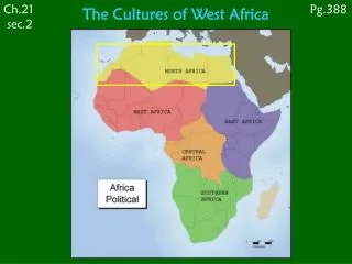
Study Area • Locations: 4 Sites in Ghana (CSIR-WRI) and 2 Sites in Senegal (CORAF/WECARD) • Bontanga, (NR) - Guinea Savanna--Rice • Weija (GAR) - Coastal Savanna-Tomatoes • Akumadan (BAR) - Deciduous Forest-Tomatoes • Kpong (ER) - Coastal Savanna-Rice
TECHNOLOGY TRANSFER Project technical articlesproject newsletters, leaflets and brochure. Specific training sessions for farmers Dissemination events Users’ documentation, training curricula and other training materials.
Activities Undertaken since 2013) 2013 • Kickoff of Workshop in Senegal in March, 2013 • Identified and collected required secondary information for the model Based on FAO 56 Penman Monthieth soil water balance procedures • Undertook in-depth Scientific literature on subject area--- WP1 • Acquired ~ 1Ha experimental pilot sites with the help of GIDA for all 4 sites--WP1 • Gathered literature on project location sites---WP1 2014 (Jan-June) • Pre-analysed, bought and installed Pessl METOS commercial sensors for environmental parameters (such as solar radiation, water soil, soil conductivity, etc.)---WP2
Penman Monthieth parameters • The main aim of the sensor network is to monitor key parameters for the estimation of crop water needs, using as a basis the calculation of the evapotranspiration rates in each plot by means of FAO 56 Penman-Monteith equation. Soil related parameters Meteorological parameters Wind speed Wind direction Solar radiation Air temperature Relative humidity Rainfall Soil moisture Water level This sensor will be required in paddyfieldsdevotedto rice cultivation
Analysis of end-user requirements and assessment of the pilot plots of Ghana Data coveragepatterns in thepilotplots All the plots have 2G or 3G data coverage. The best option for data transmission is a Global Position Radio Satellite (GPRS) modem. Akumadan Kpong The 3G coverage depicted in the maps is based on a tri-band (850/1900/2100MHz) 3G device, while the 2G coverage is based on a quad-band (850/950/1800/1900MHz) 2G device. Bontanga Weija
124 m 12 m Area without irrigation Free distance 12 m 24 m 92 m 12 m 12 m 12 m 6 m 12 m 1 2 18 m Water balance model based irrigation area Conventional irrigation area Schematic diagram for Weija and Bontanga pilot fields
Architectural design of the sensor network Overview of the sensor networkarchitecture
Selection of thesensors and other hardware elements Criteriafortheselection of thecommercialsensors At technical level the following criteria were considered: • Measurement characteristics:measurement range, accuracy, resolution, response time, etc. • Operating conditions: operating and storage temperatures • Average life time: devices with a high life time will be prioritised in order to ensure adequate performance of the network on the long-term. • Power requirements: considering the lack of power supply in the pilot plots, low-power sensors will be prioritised, as the energy required for them will have to be provided by means of solar panels.
Photos of installed PesslMetos stations Weija site Kpong site
Photos of installed meteo stations Akomadan site Bontanga Site
Maintenance Every Week • Rain gauge (1) The funeral has several small holes . These should be cleaned • Solar panel (3) : Carefully clean the surface of the solar panel • Convection cup (6): Carefully clean the convection cup Every Month • Global radiation sensor (2): Carefully clean the global radiation sensor • Wind speed sensor (4) Check the wind speed sensor. The wind sensor should be examined whether the cup wheel is low-friction. If that is not the case the sensor shall be sent to Pessl instruments for service. If the cup iswheel is damaged a new one should be ordered. Other Tasks Convection cup (6): Protect the convection cup with plastic bag before applying the fertilizer
TECHNOLOGY TRANSFER Project technical articlesproject newsletters, leaflets and brochure. Specific training sessions for farmers Dissemination events Users’ documentation, training curricula and other training materials.
Challenges • What happens after the project period 2015 with sensors and monitoring? • Funding?