Download
1 / 24
240 likes | 468 Views
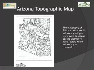
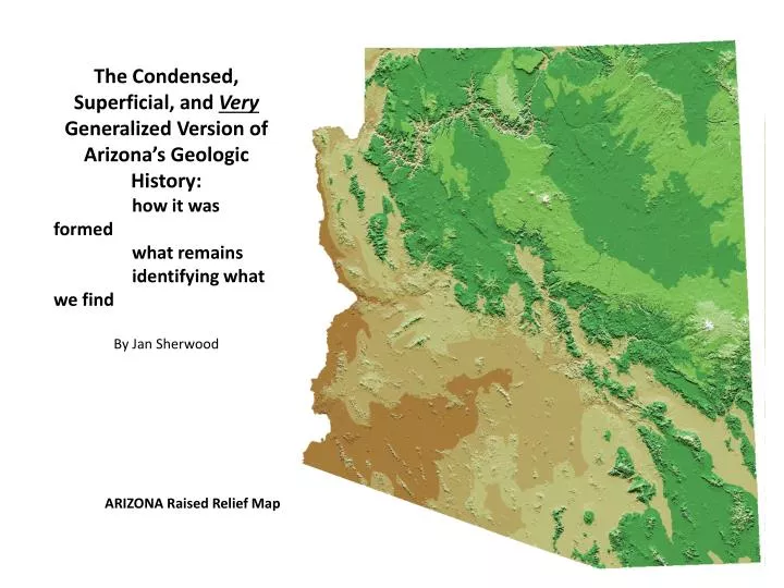
The Condensed, Superficial, and Very Generalized Version of Arizona’s Geologic History: how it was formed what remains identifying what we find By Jan Sherwood. ARIZONA Raised Relief Map. Rocks of Arizona Today.

E N D
The Condensed, Superficial, and Very Generalized Version of Arizona’s Geologic History: how it was formed what remains identifying what we find By Jan Sherwood ARIZONA Raised Relief Map
Rocks of Arizona Today When trying to decide what rock you are holding, walking over, or viewing from a distance, focus on where you are and what the structure of the rock is. In order to understand Arizona rocks, we need to know a bit of basic geology.
Basic principles of geology: Earth is made up of plates that move by convection taking place from within. Plates can move 3 ways: apart, diving under another, and slipping sideways. Plates carry the land and seafloor bed masses with them as they move.
Basic rock types: Igneous rocks form directly from magma (lava). Arizona’s igneous rocks are pegmatite, granite , and diorite formed in batholiths (picture the shape of Half Dome at Yosemite), sills, dykes, and laccoliths under ground (unerupted magma = granite) . Basalt (Hawaii’s lava), andesite, dacite, and rhyolite areextruded on the surface, and welded tuff results from explosive pyroclastic flows. Sedimentary rocks form from layers of broken debris that is left over from other rock, transported by water, wind, or gravity, then compacted and cemented together. Arizona’s sedimentary rocks are sandstone, mudstone, conglomerate (cemented small rocks), and limestone (cemented tiny sea skeletons) Metamorphic rocks get their name from meta (change) and morph (form). Any rock can become a metamorphic rock, usually this involves burial leading to a rise in temperature and pressure. The minerals of the original rock changes. Arizona’s metamorphic rocks are quartzite, gneiss and schist.
Proterozoic • 2.5 billion to 570 million years ago (mya) • Arizona was near the present day South Pole • Plates were moving carrying island arcs which then joined to the continent (evidence of 3 large arcs joining to form Arizona) • Volcanoes were erupting; eroding into shallow seas inland from each arc attachment • Granite formed underground when magma didn’t reach the surface and can be found at: Big Horn, Black Canyon, Deem Hills, Eagletail, Estrella, Goldfield, Lake Pleasant, McDowell, Picacho Peak, Pinnacle Peak, Prescott, San Tan, South Mountain, Spur Cross, Superstition, White Tank, and Wickenburg areas. • Rocks metamorphosed into gneiss, these can be found at: Big Horn, Estrella, Phoenix Mt Preserve, Picacho Peak, South Mountain, White Tank, and Wickenburg areas. Schist can be found in: Big Horn, Estrella, Lake Pleasant, Phoenix Mt Preserve, Picacho Peak, San Tan, and Wickenburg areas.
Quartz Peak, Sierra Estrella Mountains: granite, gneiss, quartzite, and pegmatite gneiss – same composition as granite but metamorphic – stripes and bands pegmatite – similar to granite but comprised entirely of crystals at least 1cm in diameter granite - even crystals of quartz, mica, hornblende (black) & feldspar (pink or white) Have you squeezed through this granite of South Mountain?
Schist of Piestewa Peak Schist (easily splitting into layers, metamorphic rock) Granite of McDowell Mountains weathers into boulders, spires, and weird shapes
Camelback Mountain - body is granite Granite and gneiss (notice the wavy stripes) of the White Tank Mountains Lake Pleasant area, granite and schist
Paleozoic • 570 – 240 million years ago (mya) • Arizona was near the present day Equator (but equator was turned 90 degrees – it ran from Mexico to Canada) • Plates were moving apart and quieting down • Shallow seas came in, seas went out, over and over • Deposits of sediments and volcanic rocks accumulated along the shore and in shallow seas • Sand dunes formed during dry periods • Some deposits were capped with limestone – • Fossils found of: trilobites, coral, snails, clams, and 1st fish • Ice age came and species died out • Land flooded • Another Ice age came • There is a warming trend, coal deposits result in NE corner • Another extinction • Fossils found of: amphibians, reptiles • Another extinction • Sedimentary rocks formed beneath sea, multiple flooding and retreating resulting in alternating rock bands of Monument Valley and Sedona: sandstone, mudstone, conglomerate, and limestone www.somewhereelseland.com sandstone
Sedona alternating bands of sandstone, mudstone, limestone, sand dune sandstone, and conglomerates Limestone forming a greyish-white ring around each formation. Limestone is harder than sandstone and often forms a ridge. Sedona crossbedding in sandstone from sand dunes Conglomerate (notice the imbedded pebbles) formed from eroded earlier rocks carried by rivers from ancestral Rocky Mountains
MESOZOIC • 65 – 251 mya • Arizona is emerging from the sea (which still covered much of CA and NV). Most of the state is a vast low-lying landscape. • Fossils found of dinosaurs, lizards, birds, and mammals • Northern AZ (Colorado Plateau ) deposits of sandstone, shale (mudstone), conglomerate (Canyon de Chelly) • Forests form in NE (fossilized logs of Petrified Forest National Park) • Southern AZ volcanic field – gold, silver, and copper (Bisbee) - hot water circulating near magma forms the minerals • Massive extinction • Northern AZ = desert (like Sahara) with blowing sand • Very little new rock was added: • Granite of White Tank Mountains • Some basalt of Hieroglypic Mountains, gold in Vulture Mine area • Sandstone of Papago Peak • Diorite intruded dikes of Big Horn Mountains Granite of White Tank Basalt of Hieroglyphic Mountains, Lake Pleasant Area
Papago Peak sandstone Diorite – similar to granite but with no quartz Big Horn Mountain basalt, andesite, dacite, and rhyolite layers. As you hike, look for diorite dikes cutting through the layers.
CENOZOIC 66 mya to present The state is divided into 3 sections: Colorado Plateau uplifted transition zone - NW to SE (Mogollon rim) a crumbling plateau Basin & Range - S & W – wide-spread faulting, stretched and rifted, large sections dropped down, valley filled with debris Widespread volcanic activity occurred throughout the state’s south and west. Basalt , rhyolite, dacite, and, andesite flowed from cracks, cinder cones built up, fast moving pyroclastic flows carrying rock and gas exploded with ash and cemented into tuff. Granite formed underground. By 20 mya Arizona was covered with 1000’s of feet of volcanic rock. Basalt can be found at: Big Horn, Black Canyon, Deem Hill, Eagletail, Estrella, Goldfield, Lake Pleasant, Phoenix Mt Preserve, Prescott, San Tan, Sedona, Spur Cross, and Superstitions. Andesite can be found at: Big Horn, Lake Pleasant and Picacho Peak. Dacite can be found at: Big Horn, Goldfield and Wickenburg Rhyolite can be found at: Big Horn, Goldfield, Lake Pleasant, Superstition, and Wickenburg. Tuff can be found at: Black Canyon, Goldfield, Phoenix Mt Preserve, Picacho Peak, Prescott, San Tan, Spur Cross, Superstition, and Wickenburg Granite can be found at: McDowell, Pinnacle Peak, South Mt, and White Tank Goldfield Mountains– layers of rhyolite, basalt lava flow, pyroclastic ash and debris flow tuffs. The Goldfields lie just north of the Superstitions which were formed about 29 mya when a caldera (large magma chamber that collapses) occurred, rhyolite poured out, ash and rocks exploded covering a vast region. Basalt, dacite, andesite, rhyolite, and welded tuff ash samples Sunset crater north of Flagstaff, basalt and cinder cones Eagletail Mountains basalt, notice the layers of various flows
Camelback Mountain’s sandstone head formed about 30 mya (remember it’s body is over 1.5 billlion years old???) A geologic mystery Rhyolite layers and welded tuff of Chiricahua National Monument in SE Arizona. At about 26.9 mya another caldera collapsed, exploding rhyolite, ash and rocks to the depth of over 1000 feet, then dacite welled up. Over time freezing and thawing of water and erosion have carved the cliffs and columns we see today.
All the features eroded, rock debris was blown, washed, or fell down from the mountains, and filled the valleys. Under Pebble Creek the deposits total about 2 miles in depth. You’d have to dig down a mile or two through sand and gravel before you hit bedrock.
GEOLOGYDESSERTS chalcedony - forms when ground water with dissolved quartz fills a cavity near the surface, as the water dissolves away, layers line the cavity mica – super large crystals that form as granite cools. Silvery, thin, flat, flexible flakes that you can see light through (isinglass – used to make windows long ago) quartzite - large crystals form in pegmatite and quartzite chunks litter the ground in many areas geode- a hollow, spherical crystal-filled volcanic bubble
OK, I’ll make it easier by adding roads Generally Pink shades are granites formed underground Orange shades are volcanic rocks extruded above ground Green, Blue, and purple shades are sediments formed under the inland seas Grey are deposits from most recent erosion Can you find Pebble Creek? See I-10, I-8, I-40 and I-17 in yellow? US 60/Grand Ave is the diagonal red. = Phoenix
Let’s Review Multi-colored large grained rock is probably pegmatite. If it has smaller grains it’s probably granite. If it’s only black and white, it’s diorite. All of these were buried deep within the crust, we have a lot of granite around Phoenix. Heavy, fine-grained rocks are probably basalt (black, often rusty-colored), andesite (reddish), dacite (grey), very-fine grained rhyolite (lots of colors, yellowish in the Goldfield Mts.). These flowed or exploded from volcanoes or cracks in the earth. Mt St Helens is dacite, remember seeing the explosion on the news? There are a lot of these fine-grained rocks in the area also. If it looks like cemented BBQ ash, it’s tuff. Yes, it’s just cemented ash blown out of an exploding volcano. Multi-colored rocks (with crystals) that have stripes or wavy lines, are gneiss. If it is flaky and shiny, it’s schist. It it’s mostly pure white, shiny, porcelain looking with no crystals showing, it’s quartzite. These were other older rocks which were buried and heated so they’ve changed their appearance: larger crystals or lined up crystals. If it looks like cemented sand, it’s sandstone. You can rub it and sand comes off. If it looks like cemented gravel, it’s conglomerate. It’s hard to break apart the small cemented rocks, but you can see each older rock in the new rock. If it looks like mud that’s hardened, it’s mudstone. Limestone is trickier, since it’s partially made of sea skeletons, but we often can’t see them. If you are in Sedona, look for the horizontal whitish-grey stripe going around the formations. Also when in Sedona, look for the sandstone made from sand dunes, you will see these parallel swooping lines of cross-bedded sandstone. So remember, when trying to determine what a rock is, think of where you are and how it looks. Maybe you’ll get lucky and find dessert!! Thanks to www.respository.azgs.az.gov for help in finding out about the rocks of Arizona. Maps from www.uwgb.edu/dutchs/StateGeolMaps/ArizGMap Check out the interactive map at www.gemland.com Pretty accurate, but a few disagreements with the AZGS documents. Many of the rock sample images are from www.geology.com
dacite andesite basalt Basic surface igneous rocks As the amount of silica (quartz) increases from basalt to andesite to dacite to rhyolite the color of the rock gets lighter. Welded tuff explodes out as ash and rock fragments, then is cemented together. rhyolite Welded tuff – notice the angular rocks and ash pieces welded together
pegmatite granite Basic igneous rocks formed underground As you go from pegmatite to granite to diorite, the size and amount of the crystals change. Pegmatite cooled slowest resulting in the largest crystals. (Your granite counter probably is more pegmatite than granite.) Granite cools a bit faster growing smaller crystals. Diorite is quartz poor. diorite
gneiss – notice how the crystals are lined up schist – it looks like you could easily split off the crystals quartzite – usually white, can be orange, pink, or purple depending upon the type and amount of iron Basic metamorphic rocks Gneiss, schist, and quartzite were changed deep underground from other, older rocks. The heat and pressure from being buried lined up the minerals, recrystallized them and erased the original structure.
sandstone conglomerate cross-bedded sandstone from sand dunes limestone Basic sedimentary rocks These are the layered, cemented, broken debris from other rock: sandstone from sand, conglomerate from pebbles, limestone from sea creatures and sea floor debris. Buried sand dunes still show the wind direction that created them in cross-bedded sandstone.
Predominant Rock Types Easily Found These are the predominant types, outcroppings of other rocks are also present.