Download
1 / 11
110 likes | 292 Views
Surveys of the Public Lands. “Public Land Survey System (PLSS)”. Lecture 18. Lecture Outline. Introduction System Outline and Units System Components Designations PLSS and LIS Figures: 23-1, 23-2, 23-7, 23-8

E N D
Surveys of the Public Lands “Public Land Survey System (PLSS)” Lecture 18
Lecture Outline • Introduction • System Outline and Units • System Components • Designations • PLSS and LIS • Figures: 23-1, 23-2, 23-7, 23-8 • Sections not covered: 23-5 except for first paragraph, 23-8 except for first two paragraphs, 23-10, 23-11,23-13, 23-14, 23-15, 23-16.
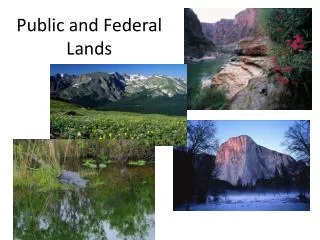
Introduction • Public Lands: areas that have been subject to administration, survey, and transfer of title under the public-lands laws of the US since 1785 • only 72% of the US in 30 states constitute the public land surveys. See fig 23-1 • Why was the system created ? • Low accuracy reasons: inexperienced surveyors, budget, no check up or supervision, instruments, non permanent objects for corners. • Two legal principles: • Boundaries are unchangeable • Corners are the true locations, whether or not in the place shown in the field notes.
System Outline and Units • Boundaries are meridians and parallels. • Area is divided into quadrangles (tracts) 24 mi x 24 mi • Each quadrangle is divided into 16 townships, 6 mi x 6 mi • Each township is divided into 36 sections, 1 mi x 1 mi • division of sections into fractions , 1/2, 1/4, etc. as needed • Surveys proceeded from south to north, and from east to west, errors accumulate in the north and west sections. • Units: • 1 ch = gunter’s chain = 66 ft = 100links (lk) • 1 mile = 80 ch • 10 ch2 = 1 acre • 1 section = 80 ch x 80 ch = 640 acres
System Components • Initial Point: A point of precise location, done with astronomical means.Starting point in a new area. • Principal Meridian (PM): A line in the direction of the true north passing by the Initial point and extended to area limits, marked each 1/2 mile (40 ch) • Base Line: A true parallel of latitude extended east and/or west to area limits. Marked each 1/2 mile (40 ch) • Standard Parallels: True parallels of latitude, 24 mi apart, marked each 40 ch. Numbered north or south of Base line: third standard parallel north. • Guide Meridians (GM): Meridians at 24 mi intervals from principle meridian, numbered east/west of PM, Fourth guide meridian west. They run north from Base line or standard parallels, not south.
Closing Corner(CC): intersection of GM and standard parallel or Base Line Standard Corners (SC): corners at 24 mi from PM or GM. Will not coincide with CC because of meridian convergence. All the above mentioned components are on tract boundaries Range Lines: meridians each 6 mi, run north, marked each 1/2 mi Township Lines: east-west, connect 6 mi marks on PM, GM, and ranges, they are not necessarily parallel to latitude. Range and Township lines are township boundaries Sections are formed by connecting the marks at 1 mi intervals. Quartersections are formed by connecting the 1/2 mi marks. Witness Corners (WC): Markings on adjacent objects. Lost Corners: Restored by equation: x = X (d/D), example 23-3
Designations • Townships: think of the system as X, Y. The X being R (range) either E or W of certain Principle Meridian. The Y being the T (township or tier) either N or S of base line. For Example: T7S, R4E, 6th PM • Sections: There are 36 section in a township, numbered 1 to 36 starting at the NE corner. Designated by numbers. For example: Sec 6, T 2 S, R 3 E, 6th PM • Half, quarter, and quarter-quarter sections: designated by their location in the section: N S, or E W. Examples: • The SE1/4, NE1/4, Sec. 14, T 3 S, R 9 W, SBM. • E1/2 of NE1/4 of sec 20, T 5 N, R10 E, Indian PM.
PLSS and LIS • The Bureau of Land Management is developing a LIS system to facilitate the management of the public lands. The PLSS point locations will serve as the positional components necessary for correlating all other information in the LIS.