Download
1 / 9
90 likes | 161 Views
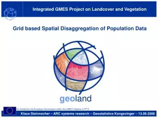
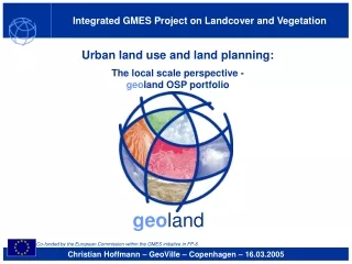
Integrated GMES Project on Landcover and Vegetation. Urban land use and land planning: The local scale perspective - geo land OSP portfolio. geo land. Co-funded by the European Commission within the GMES initiative in FP-6. Christian Hoffmann – GeoVille – Copenhagen – 16.03.2005.

E N D
Integrated GMES Project on Landcover and Vegetation Urban land use and land planning: The local scale perspective - geoland OSP portfolio geoland Co-funded by the European Commission within the GMES initiative in FP-6 Christian Hoffmann – GeoVille – Copenhagen – 16.03.2005
geoland OSP Response Political assessment Which impact of land use on ecosystems? Which quality of life? Environmental impact analysis Methods: Models, GIS analyses, (land accounting?-preliminary results), … Information: Land cover / land use, population distribution, … Data: EO, census, soil, cadastre, … Observatory Spatial Planning geoland • geoland OSP geolandUser community Geospatial explicit information on land consumption geolandService Provider Christian Hoffmann GeoVille 16.03.2005
geoland OSP Comparing CLC2000 and CLC+ Observatory Spatial Planning geoland CLC+ 1 : 25.000 CLC 1 : 100.000 Generalization Artificial surfaces CLC and CLC+ Degree of agreement: 85% for artificial areas Christian Hoffmann GeoVille 16.03.2005
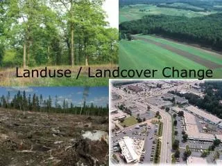
geoland OSP Getting the picture: Potential conflicts in land use Sustainability of land consumption? 2000 Formation 1500 Urban fabric 1000 Artificial vegetated areas Forest Industrial areas Waterbodies 500 Wetlands ha 0 -500 Agricultural areas -1000 -1500 -2000 -2500 Consumption -3000 Observatory Spatial Planning geoland Flows Land consumption for urban expansion Land cover accounts Urban residential sprawl CLC+ map of Vorarlberg (Austria) Sprawl of economic sites Net change of land cover 1990-2000 Land cover changes 1990-2000 Accounting units: 1 x 1 km grid cells Christian Hoffmann GeoVille 16.03.2005
geoland OSP Linking land cover accounts to driving forces Observatory Spatial Planning geoland • Socio–economic change Household formation & single family detached housing • Intensity and type of land use • Land cover accounts / land use statistics Land consumption • Economic change • e.g. technology • Land price patterns Residential function • Industrial / commercial function • Natural assets • High quality soils for agriculture • Infrastructure • Accessibility by transport network Integration of data sources? (e.g. spatial disaggregation) Christian Hoffmann GeoVille 16.03.2005
geoland OSP Accounting for land consumption Observatory Spatial Planning geoland • CLC+ • Land use accounts 1.1 Urban fabric 1.2 Industrial, commercial & transport units • CLC+ Housing statistics • Other information Industrial / commercialareas Residential areas Demographic data Land consumption related to areas with residential function Land consumption related to areas with industrial / commercial function Development of built-up area 1990-2000: + 3,9 % Development of population 1991-2001: + 5,7 % Land consumption per capita(related to total built-up area): - 1,6 % Christian Hoffmann GeoVille 16.03.2005
geoland OSP Accounting for land consumption Sustainability of land consumption? Which impact of land use on ecosystems? Which structural change? Observatory Spatial Planning geoland Increase of land consumption per capitafor residential function Decrease of land consumption per capita for industrial / commercial function - 1,6 % - 10,4 % + 0,7 % in % Christian Hoffmann GeoVille 16.03.2005
geoland OSP Response Political assessment Which impact of land use on ecosystems? Which structural change? Environmental impact analysis • Targeted accounts Method: Land accounting? • Core accounts Information: Land cover / land use, population distribution, … Data: EO, census, soil, cadastre, … Observatory Spatial Planning geoland • geoland OSP geolandUser community Geospatial explicit information on land consumption geolandService Provider Christian Hoffmann GeoVille 16.03.2005
Integrated GMES Project on Landcover and Vegetation Thank you for your attention! www.gmes-geoland.info geoland coordinators: Contact: GeoVille GmbH Christian Hoffmann +43–(0)512–562021-0 hoffmann@geoville.com Infoterra GmbH Medias-France geoland Co-funded by the European Commission within the GMES initiative in FP-6