Download
1 / 27
300 likes | 431 Views
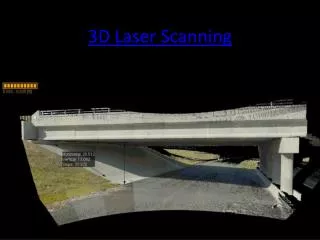
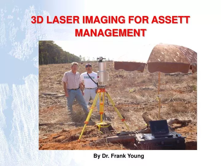
3D LASER IMAGING FOR ASSETT MANAGEMENT. By Dr. Frank Young. Interactive real-time 3D display, analysis, editing and modelling. Scanner Computer Tripod Battery. Features of I-SiTE ……. A three-dimensional Laser Imaging System measures the position or object definition.

E N D
3D LASER IMAGING FOR ASSETT MANAGEMENT By Dr. Frank Young
Interactive real-time 3D display, analysis, editing and modelling. Scanner Computer Tripod Battery Features of I-SiTE …… • A three-dimensional Laser Imaging System measures the position or object definition. • Records true colour and reflective intensity of 6000 points per second. • Uses a pulsed laser rangefinder and scanning system. • Ground based - easily incorporated with conventional survey or GPS.
Specifications • Eye safe, class 1 laser • Range from 2m to 700m (or 350m optimum) • Extents < 340o horizontal < 80o vertical (± 40o) • Accuracy ±2.5cm per point (± 8mm for multiple scans) • Laser wavelength is 0.9 µm (near infrared) • 15kg in weight (including battery)
How does it work? Scanning head Rotating mirror Laser Pulse and reflection Detector Pulsed Laser diode Target
ScannerSoftware • Computer controlled data acquisition and scanner control • Create lines, polygons, points and construction planes. • Can edit scanned data. • Automatic edge detection, filtering, smoothing, shading, transparency and colour manipulation. • Variety of export formats.
Edit example: filter to remove high or low points. High objects Low object
Precise volumetric measurements. • Stockpile monitoring and management. • Geological face mapping. • Virtual scene creation. Applications • Detailed survey of complex surfaces, industrial sites and hazardous areas. • Underground void, stope and geological face mapping. • Local Government/city Mapping, GIS Data collection. • Accident and crime scene Mapping.
Some advantages …….. • Single person operation. • Accurate and rapid data acquisition. • Combined multiple scans coverage of a scene. • Feature mapping, texture draping and mosaicing. • Accurately maps - full 3D. • Safe, remote stand-off and high speed operation. • Portable. • Rapid digital recreation for analysis and real time visualisation.
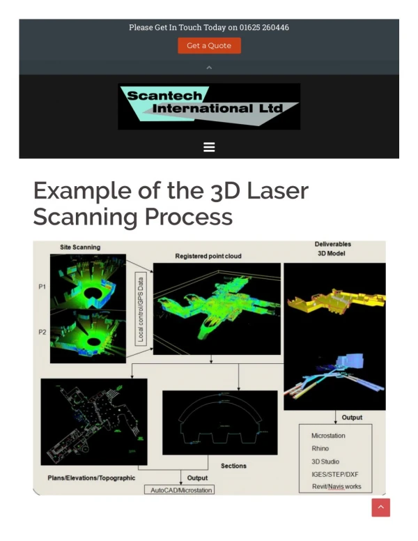
The real World to ScanData image to 3D Model Mapping complex scenes in full 3D from a single remote stand-off vantage point
Raw scan ‘Clean’ 3D model Partially enhanced scan section Industrial Mapping example
Crime scene mapping ….. Equipment Set Up at scene
Real World to Scan Data to 3D Model Scene modelling …..
Terrestrial laser imaging scanners captures intense detail of any scene, in full 3D, for modelling, interrogation and analysis.