Download
1 / 30
300 likes | 462 Views
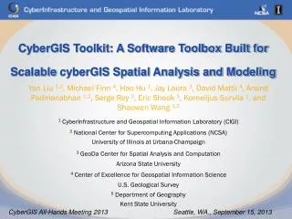
A CyberGIS Environment for Near-Real-Time Spatial Analysis of Social Media Data . Shaowen Wang CyberInfrastructure and Geospatial Information Laboratory (CIGI) Department of Geography and Geographic Information Science Department of Computer Science Department of Urban and Regional Planning

E N D
A CyberGIS Environment for Near-Real-Time Spatial Analysisof Social Media Data Shaowen Wang CyberInfrastructure and Geospatial Information Laboratory (CIGI) Department of Geography and Geographic Information Science Department of Computer Science Department of Urban and Regional Planning National Center for Supercomputing Applications (NCSA) University of Illinois at Urbana-Champaign NSF-CDI Specialist Meeting Knowledge Discovery in Cyberspace and Big Data San Diego, CA August 7, 2013
Cyberinfrastructure – A Simplified View Data / Information People Integration Collaboration Computing Communication
Advanced Cyberinfrastructure Examples http://lakjeewa.blogspot.com/2011/09/what-is-cloud-computing.html www.opensciencegrid.org www.xsede.org
CyberGIS – A Tetrahedron View Data / Information Geo Spatial CyberGIS Computing Communication
What is special about “G” in CyberGIS? • Location • Place • Space • Spatiotemporal • Integration • Synthesis
CyberGIS FluMapper • Purpose: Early and fine- spatiotemporal-scale detection of flu outbreak • Hypothesis: Is such detection feasible based on social media data?
Questions – Scientific Problem Solving • How to detect, represent, and communicate spatiotemporal patterns of flu risk? • How to reveal spatial diffusion trajectories across various spatiotemporal scales?
Wang, S., Cao, G., Zhang, Z., Zhao, Y., and Padmanabhan, A. 2012. “A CyberGIS Environment for Analysis of Location-Based Social Media Data.” In: Location-Based Computing and Services, 2nd Edition, ed. A. K. Hassan and H. Amin, CRC Press, pages: 187-205
FluMapper Components • Data collection and processing • Collects, processes and stores streaming data from Twitter in near real time • Scalable services to query raw and derived data • Spatiotemporal data model • Provides aggregated data and statistics at multiple scales for efficient information retrieval • At the finest scale, the conterminous United States is represented as a field of 30-arc second resolution • Exploratory data analysis • Kernel density estimation (KDE) • Monte-Carlo simulations • Flow mapping • Single-source flow mapping is applied to depict movement patterns
Spatiotemporal Data Cube (May 23 ~ June 5, 2013)
Questions – CyberGIS • How to model and analyze big data that are not collected for the purpose of intended spatiotemporal analysis? • How to integrate hybrid spatiotemporal analyses? • How to replicate and validate such analyses? • What are the key CyberGIS characteristics? • What are the basic building blocks of CyberGIS?
Project Staff • ASU: WenwenLiand Rob Pahle • ORNL: RangaRajuVatsavai • SDSC: ChoonhanYoun • UIUC: Yan Liu and AnandPadmanabhan • Graduate and undergraduate students Principal Investigator • Shaowen Wang • Co-Principal Investigators • Luc Anselin • Budhendra Bhaduri • Timothy Nyerges • Nancy Wilkins-Diehr • Senior Personnel • Michael Goodchild • Sergio Rey • Xuan Shi • Marc Snir • E. Lynn Usery • Industrial Partner: Esri • Steve Kopp NSF CyberGIS Project $4.43 million, Year: 2010-1015
Overarching Goal • Establish CyberGIS as a fundamentally new software framework comprising a seamless integration of advanced cyberinfrastructure, GIS, and spatial analysis and modeling capabilities and, thus, leads to widespread scientific breakthroughs and broad societal impacts
Long Tail – CyberGIS for Whom? CyberGIS Toolkit GISolve CyberGIS Gateway
Wang, S., Anselin, L., Bhaduri, B., Crosby, C., Goodchild, M. F., Liu, Y., and Nyerges, T. L. “CyberGIS Software: A Synthetic Review and Integration Roadmap.” International Journal of Geographical Information Science, DOI:10.1080/13658816.2013.776049.
CyberGIS Gateway – Broad Approach – Lowering Entry Door to CyberGIS Analytics
CyberGIS Toolkit – Deep Approach • Integrated with advanced cyberinfrastructure • Plug and play • Geo/spatial as an integration axis • Open • Access • Community • Source • Service
Science Drivers and Applications • Climate science • Emergency management • Geographic information science • Geography and spatial sciences • Hydrology • Humanities • Political science • Public health • Sustainability science
Cyber + GIS > Cyber | GIS Cyber GIS
Education and Workforce • Curriculum and pedagogy • Open ecosystems • CyberGIS Gateway • CyberGIS Toolkit • Partnerships
Vision Spatial Thinking Computational Thinking Data-Intensive Sciences and Applications Space-Time Integration & Synthesis CyberGIS Toolkit CyberGIS Gateway GISolve Middleware Cyberinfrastructure
www.cybergis.org • A collaborative software framework encompassing many research fields • Geo • Spatial • Empowering numerous applications and sciences • Seamless integration of advanced cyberinfrastructure, GIS, and spatial analysis and modeling • Capable of handling huge volumes of data, complex analysis and visualization required for many challenging applications • Empower high-performance and collaborative geospatial problem solving • Gain fundamental understanding of scalable and sustainable CyberGIS ecosystems
Acknowledgments • Federal Agencies • Department of Energy’s Office of Science • National Science Foundation • BCS-0846655 • EAR-1239603 • OCI-1047916 • PHY-0621704 • PHY-1148698 • TeraGrid/XSEDE SES070004 • Industry • Environmental Systems Research Institute (Esri) • Silicon Graphics, Inc. (SGI)
Thanks! • Comments/Questions? • shaowen@illinois.edu