Download
1 / 14
180 likes | 558 Views
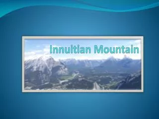
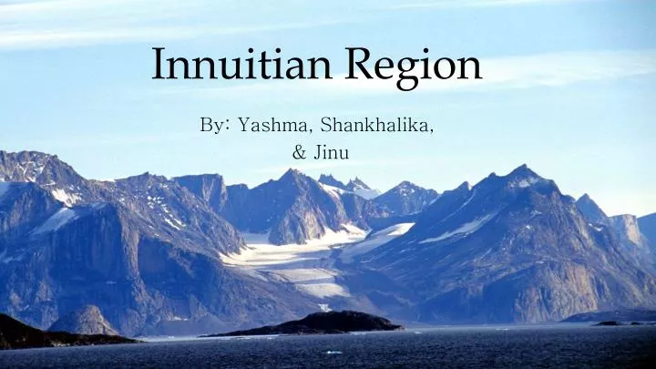
Innuitian Region. By: Yashma , Shankhalika, & Jinu. v Common name ---> Queen Elizabeth Islands v National Park ---> Ellesmere Island National Park Reserve. Innuitian Region. Land Shape . v Triangle-shaped v Younger than Appalachians

E N D
Innuitian Region By: Yashma, Shankhalika, & Jinu
v Common name ---> Queen Elizabeth Islandsv National Park ---> Ellesmere Island National Park Reserve Innuitian Region
Land Shape • v Triangle-shaped • v Younger than Appalachians • v no significant erosion has yet occurred to round mountains • v formed during Mesozoic Era
v area of 540,000 km2 • v Mountains - over 2,500 m in • height and 1,290 km in • length Size v highest peak is called the Barbeau Peak which has an elevation of 2616 m
Minerals/ Rocks Sedimentary v Contains igneous and metamorphic rocks, but mainly sedimentary rock v 12% zinc and 3.5% lead are mined in these regions v Other minerals also there but not economic to mine in such a remote location Metamorphic Igneous
Water v surrounded by the Arctic Ocean
Soil &Vegetation v Buried by ice sheets, permanently covered in snow v mostly barren, no trees because of long winters and short summers
Climates v cold climate, covered in ice and permanent snow; v winters as low as -40 degrees C and summers high 0 degrees C v about same precipitation as Sahara; less than 11cm annually
Industries v fishing v hunting/fur trading v mining Many minerals– Iron, zinc and coal but too remote to exploit and very harsh climates
v Pond Inlet - one of Canada's "Jewel of the North" - population: 1300 Key Cities v Clyde River - located in the Baffin Mountains - population: 850 vBroughton Island - Qikiqtarjuaq “The Big Island” or "Iceberg Capital of Nunavut"- population: 520
Tourism • v 5 national parks • v Human establishments: • Pond Inlet - whale watching, kayaking, and going on fishing trips • Clyde River - hiking, kennel, and snowmobiling tours • Broughton Island - dog sledding and snowmobiling tours
Bibliography • Innuitian Region. (n.d.). The Canadian Encyclopedia. Retrieved April 26, 2014, from http://www.thecanadianencyclopedia.ca/en/article/innuitian-region/ • Pond Inlet. (n.d.). Nunavut Tourism -. Retrieved April 26, 2014, from http://www.nunavuttourism.com/regions-communities/pond-inlet • Clyde River. (n.d.). Nunavut Tourism -. Retrieved April 26, 2014, from http://www.nunavuttourism.com/regions-communities/clyde-river • Qikiqtarjuaq. (n.d.). Nunavut Tourism -. Retrieved April 26, 2014, from http://www.nunavuttourism.com/regions-communities/qikiqtarjuaq