Download
1 / 10
100 likes | 346 Views
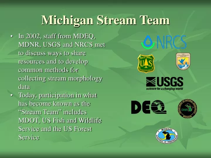
Michigan Stream Team. In 2002, staff from MDEQ, MDNR, USGS and NRCS met to discuss ways to share resources and to develop common methods for collecting stream morphology data

E N D
Michigan Stream Team • In 2002, staff from MDEQ, MDNR, USGS and NRCS met to discuss ways to share resources and to develop common methods for collecting stream morphology data • Today, participation in what has become known as the “Stream Team” includes MDOT, US Fish and Wildlife Service and the US Forest Service
Michigan Stream Team Original intent of the stream team was to develop a common method of taking stream measurements among agencies in Michigan taking such measurements in order to assemble a data base of the information and create regional reference curves for the entire state.
Reference Reach A reference reach is a channel segment that is stable, neither aggrading nor degrading, and of the same morphological type as the channel being assessed. The reference reach should also have a valley slope similar to that of the assessment reach. The reference reach is used as the standard against which the assessment reach is being judged. To account for differences in drainage area and discharge between a reference site and an assessment site, data on channel characteristics (dimension, pattern, and profile) in the form of dimensionless ratios are developed for the reference reach.
States with Reference Reach Curves • North Carolina, South Carolina, Pennsylvania, Maryland, Georgia, Delaware, Arizona, Wisconsin, Minnesota, Colorado, Oregon, Georgia, Kansas, Oklahoma, North Dakota, Wyoming, Idaho, Washington, and Ontario • Currently, have not been developed in Michigan. Only work done to date is by Baker and Richards identifies hydrologically stable reference streams in Michigan
Reasons to develop geomorphic measurement protocols and regional reference curves: • Provide design channel dimensions in stream restoration/naturalization projects • Identify stable streams, to decide where to install stream bank protection measures • Identify channel morphology targets for long-term watershed restoration programs • Regression curves, establishing the relationship between drainage area and: • Bankfull width • Bankfull depth • Bankfull cross-sectional area • Bankfull flow
Bankfull Dimensions Flow that maintains the pattern, dimension and profile of a stream channel. Near the top of bank in stable streams
Protocol for Field Surveys of Stream Morphology at Gaging Stations in Michigan Michigan’s Stream Team
Developing Curves for Michigan The Stream Team has developed a proposal to take the necessary measurements and develop regional reference curves over a 3 year period, beginning with 2006 Field season. Funding is currently being determined.
Future of the Stream Team • Develop and manage a database for the data collected to form reference reach curves. Determine appropriate quality control. • Pursue training on morphology measurements and use for individuals involved with Michigan stream restoration projects. • Produce regional curves for Michigan • Serve as technical resource to Michigan agencies and interest groups on Morphology issues.