Download
1 / 41
410 likes | 535 Views
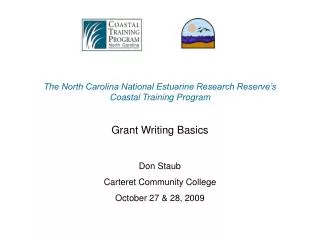
Preservation of Coastal Community Geospatial Content: What's Your Long Term Care Plan For Aging Data? Jeff Essic North Carolina State University Libraries Zsolt Nagy North Carolina Center for Geographic Information and Analysis. Coastal Geotools ‘09. March 4, 2009.

E N D
Preservation of Coastal Community Geospatial Content: What's Your Long Term Care Plan For Aging Data?Jeff EssicNorth Carolina State University LibrariesZsolt NagyNorth Carolina Center for Geographic Information and Analysis Coastal Geotools ‘09 March 4, 2009
NC Geospatial Data Archiving Project (NCGDAP) • Three year partnership between university library (NCSU) and state agency (NCCGIA), with Library of Congress under the National Digital Information Infrastructure and Preservation Program (NDIIPP) • One of 8 initial NDIIPP collection building partnerships • Focus on state and local geospatial content in North Carolina (statedemonstration) • Tied to NC OneMap initiative, which provides for seamless access to data, metadata, and inventories
NCGDAP Specifics • Funding: • $520,000 for 2005-2007 • $500,000 for 18 month extension • Staff: • 1.5 FTE at NCSU • Approx. same at NCCGIA • Website: http://www.lib.ncsu.edu/ncgdap
Project Roots: NCSU Libraries Data Directory Tracking data, map servers, and web services since 2000 Earliest use: Links to local data contacts and downloads Now: Ranked 3rd in traffic among entry points to entire library website Community help in site maintenance
County Map and Data Services in NC 100 Counties in North Carolina
Value in Older Data: Cultural Heritage Future uses of data are difficult to anticipate (as with Sanborn Maps)
Geospatial Data: Compelling Issues • Dynamic content • Constantly updated information • Data versioning • Digital object complexity • Spatially enabled databases • Complicated, multi-component formats • Proprietary formats
Digital Preservation Points of Failure • Data is not saved, or … • can’t be found, or … • media is obsolete, or … • media is corrupt, or … • format is obsolete, or … • file is corrupt, or … • meaning is lost
Risks to Geospatial Data • Producer focus on current data • Data overwrite as common practice • Future support of data formats in question • No open, supported format for vector data • Shift to web services-based access • Data becoming more ephemeral • Inadequate or nonexistent metadata • Impedes discovery and use • Increasing use of spatial databases for data management • The whole is greater than the sum of the parts
Preservation Business Case • Land use change analysis • Site location analysis • Real estate trends analysis • Disaster response • Resolution of legal challenges • Impervious surface change mapping
Business Case: Identifying Land Use Changes 1998 1999 1993 2002 2005 Use case: Land use and impervious surface change analysis
Geospatial Data Preservation Challenges • Data Capture • Backups are common, but not long-term archives • Producer focus is on current data • Shift to web services-based access • Inadequate or Nonexistent Metadata • Consistent NC survey stats: Only 40% of data producers create and maintain metadata
Challenge: Vector Data Formats • No widely-supported, open vector formats for geospatial data • Spatial Data Transfer Standard (SDTS) not widely supported • Geography Markup Language (GML) – diversity of application schemas and profiles a challenge for “permanent access” • Spatial Databases • The whole is more than the sum of the parts, and the whole is very difficult to preserve • Can export individual data layers for curation, but relationships and other context are lost
Challenge: Other Data Types • Cartographic Representation • Software Project Files, PDFs, GeoPDFs, WMS images • Web 2.0 content • Street views, Mashups • Oblique Imagery • 3D Models
Other Challenges • Rights management • Data versioning • Digital Object Complexity • Semantic issues • Content Packaging • Large scale content transfer • Integrating older analog materials • More …
Different Ways to Approach Preservation • Technical solutions: How do we preserve acquired content over the long term? • Cultural/Organizational solutions: How do we make the data more preservable—and more prone to be preserved—from point of production? Current use and data sharing requirements – not archiving needs – are most likely to drive improved preservability of content and improvement of metadata
Repository of Temporal Data Snapshots • Question: Frequency of Capture? • Content Exchange – Getting Data in Motion • Repository Development
Frequency of Capture Issue: How frequently should county and municipal vector data layers be captured in archives? Parcels, centerlines, jurisdictions, zoning, … Parcel Boundary Changes 2001-2004, North Raleigh, NC
Frequency of Capture Surveys • How often should continually changing vector datasets be captured? • Tap into data custodian understanding of production patterns and uses • Tap into local innovation • Learn about local business drivers for data archiving • 2006 and 2008 surveys of NC cities and counties • 2008 survey of archival practice in state agencies in NC • Planned survey of data users in NC
FOC 2006 Survey Results: Overview • 58% response, two-thirds of whom create and retain periodic snapshots • Long-term retention more common in counties with larger populations • Storage environments vary, with servers and CD-ROMs most common • Wide variation in frequencies of capture. • Offsite storage (or both onsite and offsite) is used by nearly half of the respondents • Popularity of historic images has resulted in scanning and geo-referencing of hardcopy aerial photos among one-third of the respondents
Content Exchange Infrastructure • High volume of state/federal requests for local data • Solving the present-day problems of data sharing is a pre-requisite to solving the problem of long-term access • Nov. 2007: NC Geographic Information Coordinating Council (GICC) approved “Ten Recommendations in Support of Geospatial Data Sharing” http://www.ncgicc.org/
Getting the Data in Motion • Important Objectives • Minimize Direct Contact • Provide Metadata • Clarify Rights • Routinize Transfers • Leverage other business uses that put data in motion: • Continuity of operations • Highway Planning • Floodplain Mapping • Census Most costly part of archive development is identifying, negotiating acquisition, and then transferring data
Getting the Data in Motion • NC GIS Inventory • Efficient data identification • Adding preservation elements Orthophoto Data Distribution System – “sneakernet” Transfer of large quantities of imagery • NC OneMap Data Download and Viewer • Public access • Data visualization Street Centerline Data Distribution System Efficient transfer of data from 100 counties, with metadata and clarified rights http://www.ncstreetmap.com
Repository Development • Downloading or acquiring “low hanging fruit” • Tapping into current data flows • Developing our own metadata when necessary • Converting and preserving vector data in shapefile format
Repository Status • Acquired 6+ TB of data with more on the way • Disk space being used initially for “data staging” • Inventorying • In the process of ingesting content into DSpace • Metadata generation
Data Preservation Like Fruit Desiccation? • Complex data representations can be made more preservable (yet less useful) through simplification. • Conversion of various formats to shp • Image outputs (web services, PDF maps, map image files) • Open GeoPDF standard • Analogous to paper maps • Combines data, symbology, annotation • More data intelligence than simple image • PDF content retained in addition to, NOT instead of data
Engaging Spatial Data Infrastructure • Cultural/Organizational solutions: How do we make the data more preservable—and more prone to be archived—from point of production? • Engage and outreach to the data producer community and SDI • Sell the problem to software vendors and standards development • Find overlap with more compelling business problems: disaster preparedness, business continuity, road building, etc. • Discuss roles at the local, state, and federal level
SDI Role in Data Preservation • Data inventories support content identification • Metadata standards support discoverability and use • Content standards support data interoperability over time and help eliminate semantic confusion • Data exchange networks: • Minimize need to make contact • Add technical, administrative, descriptive metadata • Establish rights and provenance
NC Spatial Data Infrastructure: NC OneMap • Next generation mechanism to coordinate and disseminate geographic information in North Carolina and interact with the NSDI. • NC GICC • Inventory for all geospatial data holdings – http://nc.gisinventory.net • Develop content standards for key data themes One of the defined characteristics of NC OneMap is that “Historic and temporal data will be maintained and available”.
Archival and Long Term Access Working Group • Initiated by NC Geographic Information Coordinating Council in 2008 to address growing concerns of state and local agencies about long-term access to data • Federal, state, regional, and local agency representation • Key focus • Best practices for data snapshots and retention • State Archives processes: appraisal, selection, retention schedules, etc. • Valuable outcome of NCGDAP – multiple parties and levels discussing data archiving on their own.
Final Report approved by NC GICC in November, 2008 Best Practices for: Archiving Schedule Inventory Storage Medium Formats Naming http://www.ncgicc.org/ Metadata Distribution Periodic Review Data Integrity Publicity Archival and Long Term Access Working Group
Metadata Distribution Periodic Review Data Integrity Publicity How to Recognize a Retention Schedule: Sample Schedule Item from NC OneMap
NDIIPP Multi-State Geospatial Project • Lead organizations: North Carolina Center for Geographic Information & Analysis (NCCGIA) and State Archives of NC • Partners: • Leading state geospatial organizations of Kentucky and Utah • State Archives of Kentucky and Utah • NCSU Libraries in catalytic/advisory role • State-to-state and geo-to-Archives collaboration • 2 year project: Nov. 2007-Dec. 2009 • Archives as part of Spatial Data Infrastructure
OGC Data Preservation Working Group • Formed Dec. 2006 • Engage archival community • Find points of intersection with other OGC activities: • GML for archiving • Content packaging • Large scale data transfers • Time in decision support
Cultural: Changing Industry Thinking • Is the geospatial industry “temporally-impaired?” • Lack of access to older data • Lack for tool/model support for temporal analysis • Metadata: poor support for changing data • Education: building class projects around available data (i.e., not temporal) • Increased interest now in temporal applications? • Increased demand for temporal data? • Improved tool support: ArcGIS 9.2 animation tools; Geodatabase History, etc. • Emerging commercial market in older data
Conclusions • “Supporting temporal analysis requirements” gets more attention than “archiving and preservation” • Leverage existing infrastructure • Current data sharing needs drive infrastructure improvements that help archiving • Leverage business needs that are more compelling than preservation (e.g., continuity of operations) • Facilitate stakeholder ownership of the solutions • Mine state and local archiving innovations
Slide Presentation:http://www.lib.ncsu.edu/ncgdap/presentations.html Zsolt Nagy Jeff Essic Manager of Coordination Geospatial Data Services Librarian NC CGIA NCSU Libraries ph: (919) 733-2090 ph: (919) 515-5698 Zsolt.Nagy@ncmail.netJeff_Essic@ncsu.edu