Download
1 / 28
280 likes | 422 Views
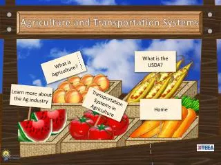
Integrated Systems for Agriculture. Overview of USDA Foreign Agricultural Service. Mission of the Production Estimates and Crop Assessment Division (PECAD) and estimating World Agricultural Production All source methodology and how FAS uses satellite imagery Integrated Systems Solution

E N D
Integrated Systems for Agriculture • Overview of USDA Foreign Agricultural Service. • Mission of the Production Estimates and Crop Assessment Division (PECAD) and estimating World Agricultural Production • All source methodology and how FAS uses satellite imagery • Integrated Systems Solution • Information Delivery • Daily Land Observations • Systematic Vegetation Condition Measurements • Rainfall Monitoring using TRMM-MPA • Improving Global Water Availability Monitoring • Research to Operations • Characterization of Earth Observation Satellites/Sensors • New Research • Benchmarking IGARSS_2006 Integrated Systems for Agriculture
1 of 2 examples of successful technology transfer from NASA to U.S. Federal Agencies LACIE & AgriStars pioneer programs for monitoring agriculture with satellites NRC, http://www.nap.edu/ssb/rapch2.htm IGARSS_2006 Integrated Systems for Agriculture
FAS missionsperformed by Production Estimates and Crop Assessment Division (PECAD) • Global Crop Production Information and Analysiscore mission • World Agriculture Production (WAP) • World Agriculture Supply and Demand Estimates (WASDE) • Market and Food Security Reporting • FSA Early Warning and Crop Conditionsprogram efficiency • Domestic early warning and disaster response • USDA Satellite Imagery Archive (SIA)program efficiency • USDA space program leadership and centralized acquisition management IGARSS_2006 Integrated Systems for Agriculture
Global Agriculture Monitoring and Reporting Role RELIABLE OBJECTIVE TIMELY TRANSPARENT GLOBAL ACCURATE U.S. Crop Production (NASS) SUPPLY Foreign Crop Production (PECAD) Monthly Reports Interagency Commodity Estimates Committees World Agricultural Supply and Demand Estimates (WASDE) Food Security Decisions U.S. Demand (ERS,FSA, AMS) DEMAND Foreign Demand (FAS, ERS) IGARSS_2006 Integrated Systems for Agriculture
Global Crop Production Information and Analysis • PECAD reports estimates of area, yield and production for 80 countries. (384 country X commodity pairs) • Information is updated monthly and can be found at: • http://www.pecad.fas.usda.gov/wap.cfm IGARSS_2006 Integrated Systems for Agriculture
FAS Attaché Ground Truth Atmospheric Remote Sensing Land Remote Sensing External Ground Truth (Country Reports/News Services) PECAD Ground Truth Ag Industry Trade Industry Gov’t Policy Makers Convergence of Evidence,All-Source Methodology PECAD Models and Expert Analysis Global Crop Production IGARSS_2006 Integrated Systems for Agriculture
How does the Foreign Agricultural Service use satellite imagery? • Aids in yield analysis prior to harvest. • Aids in crop identification and determining key growth stages. • Aids in confirming or denying rumors and discovering unreported events. • Why is it useful? • Objective • Reliable • Timely IGARSS_2006 Integrated Systems for Agriculture
Current Season WESTERN AUSTRALIAN SPOT NDVI IGARSS_2006 Integrated Systems for Agriculture Evaluate similar seasons based on vegetation index data.
How does the Foreign Agricultural Service use satellite imagery? • Aids in yield analysis prior to harvest. • Aids in crop identification and determining key growth stages. • Aids in confirming or denying rumors and discovering unreported events. • Why is it useful? • Objective • Reliable • Timely IGARSS_2006 Integrated Systems for Agriculture
August 19 September 4 September 20 October 22 November 23 December 9 Satellite Data Over Important Agricultural Regions Canola Victoria, Australia Field-Level Time-Series Analysis Using Landsat TM Satellite Crop Stage and Field Activity Coverage: Multi-temporal over 112 days of the 170-day growing season. IGARSS_2006 Integrated Systems for Agriculture
How does the Foreign Agricultural Service use satellite imagery? • Aids in yield analysis prior to harvest. • Aids in crop identification and determining key growth stages. • Aids in confirming or denying rumors and discovering unreported events. • Why is it useful? • Objective • Reliable • Timely IGARSS_2006 Integrated Systems for Agriculture
Russian Volga District Russian Central District Belarus Ukraine Russian Southern District • Independent information that supports or conflicts with in-country reports • Supports – continue to monitor • Conflicts – notify country, collect new data and analysis, resolve conflict (if possible) IGARSS_2006 Integrated Systems for Agriculture
Information on Impacts of Disasters is needed quickly Before Hurricane Mitch Oct. 1998, Aguan Valley, Honduras After Tropical Oil Plantations IGARSS_2006 Integrated Systems for Agriculture
NASA/FAS partnership Earth System Models Soil moisture (Modified Palmer, Penman-Monteith) Crop yield/stage (Robertson BMTS, EPIC, Hanway, and others) Hazard models (Winter kill and others) US Air Force weather (AGRMET) Predictions/Forecasts National and sub-national yield forecast (grains, oil seeds, cotton and rice) Condition forecasts Societal Benefit Areas Global Commodity Forecast, Mitigate climate change, Disaster response Decision Support Tools PECAD/CADRE Famine Early Warning Observations, Parameters and Products NDVI Rainfall Land use Reservoir height Soil moisture Weather Crop condition Earth Observation Systems SPOT VEG/HRV TRMM Jason-1 & Topex/Poseidon MODIS VIIRS Landsat ALI/Hyperion GPM IRS-P6 NASA transfers technology to the user community through partnerships and an “integrated systems solution” model. Information Delivery WAP WASDE Crop Explorer Commodity Intelligence Reports IGARSS_2006 Integrated Systems for Agriculture
Information Delivery Crop Explorer: Standard Analysis Product Format for Analysis www.pecad.fas.usda.gov/cropexplorer IGARSS_2006 Integrated Systems for Agriculture
Assimilating NASA Results into FAS/PECAD • NASA-USDA/FAS Cost-Sharing • Project Tasks: • Daily Land Observations • Systematic Vegetation Condition Measurements • Rainfall Monitoring using TRMM-MPA • Improving Global Water Availability Monitoring IGARSS_2006 Integrated Systems for Agriculture
Jan.2004 Daily Land Observations IGARSS_2006 Integrated Systems for Agriculture
Dhaka July 13, 2004 Daily Land Observations NASA-MODIS Rapid Response Products: SE Asia Floods (Bangladesh) IGARSS_2006 Integrated Systems for Agriculture July 7, 2004 July 13, 2004
July 2006 Daily Land Observations from MODIS IGARSS_2006 Integrated Systems for Agriculture
Systematic Vegetation Condition Measurements IGARSS_2006 Integrated Systems for Agriculture
Systematic Global Vegetation Indices IGARSS_2006 Integrated Systems for Agriculture
Cross-Sensor Comparisons GIMMS @ NASA/GSFC Systematic Vegetation Condition Measurements IGARSS_2006 Integrated Systems for Agriculture
Rainfall Monitoring Using TRMM-MPA TRMM Precipitation from NASA GSFC DAAC Coming soon PECAD DSS Integration IGARSS_2006 Integrated Systems for Agriculture
Monitoring Global Water Availability IGARSS_2006 Integrated Systems for Agriculture
Geopositional,Radiometric and Spatial Characterization (Joint Agency Commerical Imagery Evaluation) Specific Target Areas Highlighted Four targets of opportunity near SSC were selected that are 100s of meters across • Two gravel pit sand sites • Large monoculture fields • Cut grass-amateur golf course IGARSS_2006 Integrated Systems for Agriculture
Preparing for Future NASA Results • Transition from Research to Operations: • Daily Land Observations • Systematic Vegetation Condition Measurements • Rainfall Monitoring using TRMM-MPA • Improving Global Water Availability Monitoring • Prepare for • MODIS -> NPP -> NPOESS • Landsat Data Continuity [http://ldcm.nasa.gov] • Future of Land Imaging [http://landimaging.gov] • GEOSS/JACIE [http:usgeo.gov] • New Research (SBIR and other funding) • Benchmarking • Do the new NASA results improve decision making? IGARSS_2006 Integrated Systems for Agriculture
Aqua* Aura CHAMP Cluster (with ESA) FAST GOES-M* Geotail (with Japan) GRACE* ICESat* JASON-1* EO-1* Landsat-7* NOAA-M(POES) Polar QuickSCAT SAGE III (with Russia) SeaWinds* (with Japan) SORCE TERRA* TIMED TRMM* (with Japan) *Land observations AIM Aquarius CALIPSO CloudSat CINDI GOES Series* GPM* LDCM* NPP* NPOESS* OSTM OCO *Land observations NASA Earth Observing Systems Current Planned IGARSS_2006 Integrated Systems for Agriculture
Contact Information Bob Tetrault Robert.tetrault@usda.gov 202 690-0130 IGARSS_2006 Integrated Systems for Agriculture