Download
1 / 18
180 likes | 336 Views
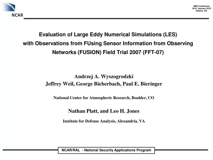
Evaluation of Large Eddy Numerical Simulations (LES) with Observations from FUsing Sensor Information from Observing Networks (FUSION) Field Trial 2007 (FFT-07).

E N D
Evaluation of Large Eddy Numerical Simulations (LES)with Observations from FUsing Sensor Information from ObservingNetworks (FUSION) Field Trial 2007 (FFT-07) Andrzej A. Wyszogrodzki Jeffrey Weil, George Bieberbach, Paul E. Bieringer National Center for Atmospheric Research, Boulder, CO Nathan Platt, and Leo H. JonesInstitute for Defense Analysis, Alexandria, VA
Evaluate system ability to simulate physically realistic atmospheric environment and T&D in extreme conditions CURRENT TASKS Test accuracy of variable in time mean conditions turbulent fluctuations, and contaminant concentrations Evaluation of atmospheric and transport and dispersion (T&D) model performance Virtual THreat Response Emulation and Analysis Testbed (VTHREAT) High fidelity models to create realistic virtual environment and synthetic observations Generation of Synthetic Environment Simulated Sensor Measurements Applications That Utilize Observations Atmospheric Models (EULAG/WRF) Models and Analysis Systems EULAG – multiscale geophysical fluid flow model nonhydrostatic, anelastic approximation, LES, passive scalar T&D Transport and Dispersion Models (EULAG/LPDM /SCIPUFF)
Fusion Field Trials 2007 (FFT07) Continuous propylene release FFT07 at Dugway Prowing Ground (UT) PRESELECTED TRIALS: TRIAL 16 – plume/daytime TRIAL 54 – plume/daytime TRIAL 30 – plume/nighttime TRIAL 36 – puffs/daytime TRIAL 71 – puffs/nighttime Locations of Digipids (blue) and Uvics (yellow)
EULAG initialization and BC for Trail 54 morning transitional effects (8:00 – 8:45 Local Daylight Saving Time) • Potential temperature profile: • - SLC (or LKN) profile at 12 UTC • θ=303.4 K at surface, • θgradient: 20 K/km below 400m, • θgradient: 1.5 K/km above 400m Thermal conditions Surface heat fluxes: - turbulence tower data - SAMS measurements of incoming solar radiation: HF=Cf*Sol, where the coefficient Cf=0.3-0.65 determined from the local PBL height model. • WIND DIR Variable in time wind: Composite wind conditions • 4-32m – averaged 3 towers • 32-150m - 15 minute averaged Sodar data • 14:15 and 14:45 UTC • above 150m – interpolation to SLC/LKN stations • 2m - domain averaged 40 PWIDS • - wind speed 3 m/s, • - wind direction ~135-165 deg • WIND DIRECTION • WIND SPEED
Nudging – key component to capture near surface transitional effects Parameters used to estimate nudging time scale: Domain size 1.6 x 2.4 x 0.5 km Periodic BC Homogeneous surface No information about thermal structure of BL at DPG site w*= 0.7-1 m/s (Hflux=0.07-1.3 Km/s) Zn=50m – max wind variability below Zn 200 Nudging time scale Tn=Zn/w* =50-70 sec 150 Sodar data between 14:15-14:45 UTC 100 Time evolution of model winds 50 Nudging Tn=60 sec WIND SPEED WIND DIR
Fusion Field Trials 2007 (FFT07)Trial 54 FFT07: 40 PWIDS [u, v, w measurements at 10 seconds] FFT07 at Dugway Prowing Ground (UT) Locations of Pwids PWIDS = Portable Weather Information Display System EULAG: ensemble of 20 grids (40 sensor locations per grid, 800 sensors total) in the same configuration as FFT07 PWIDS, but at different physical locations
Evaluation of atmospheric model performancewind mean components and fluctuations mean wind: required for capture plume meandering wind fluctuations: required for plume dispersion EULAG realizations (red) ensemble averaged (blue) FFT07 sensor averaged (black) FFT07 realizations (red) sensor averaged (black) U (m/s) EULAG: 10m resolution DIR (deg) T (C) Time (UTC) Time (UTC) How much the observed variability is influenced by the inhomogeneity of the SL?
Evaluation of atmospheric model performancepossible physical sources of error in observations • Effects not accounted in current idealistic FFT07 simulations Larger scale effects: • Thermal mountain/valley flow structure (e.g. drainage flows) • Mesoscale winds interacting with nearby mountains Mountain range ~2km washes Surface heterogeneity: • Roughness variability due to vegetation • Small scale topographical features (e.g. gentle terrain slopes, dry forks)
Evaluation of atmospheric model performancepossible physical sources of error in observations • Effects not accounted in current idealistic FFT07 simulations REAL SURFACE: inhomogeneous MODEL SURFACE: homogeneous Mountain range ~2km washes To compare fluctuations (turbulence) from model and field sensors we must account for surface inhomogeneity and their effects on the sensor measurements Bias due to inhomogeneity = <obs(x,t)>time - <obs(x,t)>x
Atmospheric conditions evaluationobservational bias at different PWID locations V (m/s) V (m/s) Red = model Blue = biased observations V (m/s) V (m/s) u (m/s) u (m/s)
Atmospheric conditions evaluationremoving bias from the observations V (m/s) V (m/s) Red = model Black = unbiased observations V (m/s) V (m/s) u (m/s) u (m/s)
Atmospheric conditions evaluationobservational bias at all PWID locations and times Red = model Blue = biased observations
Atmospheric conditions evaluationremoving bias from All observations Red = model Black = unbiased observations
T&D model evaluation EULAG realization (red) FFT07 sensor measurement (blue) Trial 54, Continuous Release, 1 Source (Propylene) EULAG start time at 13:35 UTC (∆= 10m, dt=0.25 sec) 13:55 UTC (∆= 5 m, dt=0.2 sec) 14:05 UTC (∆=2.5 m, dt=0.125 sec) - Length of the simulation 30-60 min Ensemble of 20 grids at different spatial locations Shifted in X and Y directions Point to point comparison between model and field sensor locations
T&D model evaluation for Trail 54, near source time series (Digipid 78) ~150m from source shown by arrow 10m 5m Ratio: cc_fft07 / cc_model cc<1s> – peak, concentration 1s averaged <cc>15min – 15 minute time integral 2.5m cc<1s> cc<10s> cc<60s> <cc>15min D10m 5.93 4.02 1.79 5.22 D 5m 2.32 1.57 0.70 1.98 D2.5m 0.65 0.44 0.19 0.63 Tume [UTC]
T&D model evaluation for Trail 54, time series at larger distance (Digipid 26) ~400m from source shown by arrow 10m 5m Ratio: cc_fft07 / cc_model cc<1s> – peak, concentration 1s averaged <cc>15min – 15 minute time integral 2.5m cc<1s> cc<10s> cc<60s> <cc>15min D10m 3.27 3.00 2.46 9.77 D 5m 1.44 1.32 1.08 4.97 D2.5m 0.46 0.42 0.34 1.29 Tume [UTC]
T&D model evaluation SCIPUFF LES – 10m EULAG concentrations [ppm] SCIPUFF concentrations [ppm] LES – 2.5m LES – 5m EULAG concentrations [ppm] EULAG concentrations [ppm] FFT07 concentrations [ppm] FFT07 concentrations [ppm]
Progress summaryongoing & future work • LES simulations with nudging are able to properly simulate mean winds and turbulent fluctuations during morning transition in BL • Model concentrations are strongly dependent on grid resolution • At 5m resolution EULAG concentrations agree perfectly with appropriate SCIPUFF run • At 2.5 m resolution model results are even overpredicting FFT07 concentrations at some locations (possible explanation: single release during Trial54 is compared to ensemble of 20 independent model realizations). • Ongoing work: compare model results with Surface Layer Similarity theory (SLS) • In near future: • Analyze different trials including fully convective and stable BL • Add support to missing data, unknown local valley and mesoscale tendencies with the WRF mesoscale forecast run over the DPG during FFT07 period • Updates to model SL/PBL parameterization (e.g. different roughness for momentum and heat, dynamic SGS models, etc).