Download
1 / 23
240 likes | 472 Views
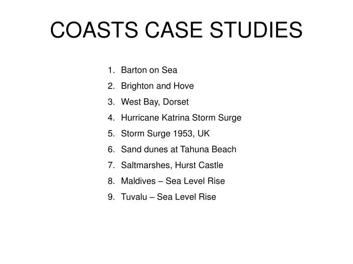
COASTS CASE STUDIES. Barton on Sea Brighton and Hove West Bay, Dorset Hurricane Katrina Storm Surge Storm Surge 1953, UK Sand dunes at Tahuna Beach Saltmarshes, Hurst Castle Maldives – Sea Level Rise Tuvalu – Sea Level Rise. Barton-on-Sea Management. Introduction

E N D
COASTS CASE STUDIES • Barton on Sea • Brighton and Hove • West Bay, Dorset • Hurricane Katrina Storm Surge • Storm Surge 1953, UK • Sand dunes at Tahuna Beach • Saltmarshes, Hurst Castle • Maldives – Sea Level Rise • Tuvalu – Sea Level Rise
Barton-on-Sea Management • Introduction • Barton on Sea is built on a cliff of clay under sand, and this has eroded rapidly[ 1m p.a.]. This was the result of 1. A high energy wave environment with large waves from the SW. The waves create an under tow that removes beach material. The cliff is undercut and slumping occurs.2. Longshore drift from West to East.3. Dredging offfshore starves Barton beach. • 4. Groyne systems to the west starve Barton beach5. Sub aerial processes affect the face of the cliff e.g. wind action and run off. • Management 1 1. 1960’sNew Forest Council built a scheme based on drainage of the groundwater and protection of the cliff foot by rocks and steel piles. 2. Scheme cost about $1 million and protected about 1800m of coast by 1968. 3. But in 1970’s the cliff became unstable and erosion began to occur at the foot of cliff. 4. In 1974 a bad storm breached revetment and saturated the undercliff,damaging 200m of the cliff foot defences. 5. During the spring of 1975, more erosion took place and several houses were lost. 6. To repair the defences would cost £166 000and this might only last a few years 7. Geologists were against the stabalisation of the cliff as erosion exposed fossils of the Tertiary era and it was a site of international importance. • Management 2 1. Beach nourishment is now used to absorb the energy of the waves. 2. The top of the cliff will be allowed to retreat until it is at a sustainable angle. • Later defences 1.Since 1974 the wooden groynes have been replaced with seven rock strong points about 400m apart. These are more able to resist storm waves.2. The old timber revetments were replaced by a 1.8 km long rock revetment in 1991 at the cost of £4.5 million. [ designed to last 30 years]. 3. New fan shaped drains were put in the cliff in 1995 and some of the cliff has been regarded to make it less steep. 4.The free face of the cliff will be allowed to retreat by weathering until it is stable. The cost since 1987 is £ 4.5 mill 5. No defenses have been built at Naish farm to the west as the cost benefit analysis was 6:1. The site is an SSSI and the geology and fossils are of scientific interest, so it must be exposed. 6. The erosion at Naish farm provides sediment for Barton and Hurst Castle spit.7. Since 1954 Hurst Castle spit has been beached several times and it has moved 100m inland since 1898. The spit has been protected at the proximal end with rock armour and the crest ridge has been widened to 6m with a1:3 slope. 8.The increase in breaching may be the result of the protection of Barton on Sea as there is less sediment moved by longshore drift
The coast of West Dorset is an exposed an rapidly eroding coastline and it is a huge challenge for the authorities to protect West Bay from flooding and coastal erosion due to the fetch present. The heart of the village is a conservation area and tourism is a major source of income. West Bay, Dorset • Causes and evidence of sub- aerial erosion: • Weathering from: rain • wind • chemical • and oxidation • Orange cliffs-as fine-grained pyrite is oxidised. • Slumping due to slip zone • Causes and evidence of Marine erosion: • Wave pounding, hydraulic action, abrasion and attrition. • Long fetch causing destructive waves • Mass movement-such as slipping, slumping • Wave cut notches and platforms • Rock falls Can be very erosive and have created gullies in the sandstone of the cliff. • Human factors promoting erosion: • Groynes are blocking the flow of sediment through littoral cell and as a result West Bay is receiving less sediment through long shore drift. • Some offshore sandbanks are being dredged for use as beach nourishment in other locations, removing an important sediment source. • Physical consequences • Cliff line is weakening therefore it is retreating • Mass movement when the cliff is unstable • Cliff is eroding which may increase coastal flooding. • Socio- economic consequences • A lot of money will be lost due to the amount of money spent to treat the coastline • Defending property and keeping tourist coming is a challenge as tourist is a main source of income issues for tourist such as footpath diversion and danger of rock falls onto the beach, where there were incidents of people narrowly escaping from rock falls. • Other information: • The cliff east consist of sedimentary rocks and the West consist of clay • Intermittent slipping due to the flow ground water within fault zone in the Frome clay. • Protection and warning signs have been put to maintain its value as an amenity for holidaymakers.
Replacing existing defences = 3.11 Continue current maintenance and replace defences in year 45 = 4.53 Continue current maintenance and replace defences in year 27 = 3.59 Continue current maintenance and replace defences in year 40 = 3.87 Brighton – Ovingdean: End of lifespan for most defences therefore need to replace or repair. All options include strengthened sea wall. Ovingdean – Rottingdean: Sea wall suffers from abrasion however there is no major problem with defences therefore not much is being done, only monitoring the sea wall. Rottingdean – Saltdean: Relatively new sea defences, problems with sea wall due to abrasion and lack of beach. They are going to monitor the sea wall. Saltdean: Not much damage, simply monitoring the rate of abrasion Brighton and Beachy Head have unprotected chalk cliffs – recede at 0.6m each year (e.g. Seaford Head of Seven Sisters). Along the cliffs, there is farmland. There is rapid growth in Brighton as both a residential and tourist area. Sea wall, promenade and splash wall. Groynes were built at right angles to the sea wall to trap shingle. Major groyne built at Black Rock to trap shingle but it did not disrupt long shore drift. Construction of Brighton Marina severely disrupted long shore drift – many beaches to the east were depleted and an increased exposure to wave attack. Sub-aerial weathering causes the cliffs to erode. – 4000 tonnes of material fell from the cliff Background information Current strategies Problems with the strategies Options in each area Conclusion of strategies Cost benefit analysis Brighton and Hove • Lots of damage would occur if the do nothing approach is taken. • A “Hold the line” approach is being used • Therefore – where beaches exist, maintain whilst is economically viable-where no beach exist, hard defences should be sustained and measures should be taken to reduce reflection and sceptibility to abrasion. Brighton Marina Brighton
Hurricane Katrina Storm Surge Countries surrounding the Gulf of Mexico is one of the most hurricane prone areas. New Orleans situated on the Mississippi Delta demonstrates problems presented by having high population density in low-lying coastal areas. Hurricane Katrina occurred in 2004. which was a Category 4 to 5 on the Saffir-Simpson Huricane Scale. Factors contributing to the occurrence and impact of Coastal Flooding in Hurricane Katrina’s Storm Surge 2004:
UK’s North Sea Storm Surge The height of land above sea level, the tidal range and he incidence of storm surges were factors that contributed to the storm surge of February 1953 down the North Sea towards low lying lands of East Anglia in Britain and the Dutch lowlands. Factors contributing to the occurrence and impact of Coastal Flooding in UK’s North Sea Storm Surge of 1953: Conclusion: In two of these areas, the storms usually happened in low lying countries, and the densely population in these areas caused major impacts such as deaths. But in New Orleans, more of the black originated and poor people lived in that area, and the rescue were delayed, therefore the damage still had a huge impact on people’s lives. Whereas in UK’s North Sea Storm Surge, the government quickly made plans to rescue the city, and this may be the case because the area affected is a tourist attraction.
Dunes – concentrations of mound-like landforms composed of sand that has been blown off the beach by onshore winds. Case Study: Tahuna Beach, New Zealand • Formation and Development: • Sand is initially trapped by debris towards back of beach • Embryo dunes develop first. Certain plants grow here as they grow upwards through accumulating sand. This stabilizes the surface. The plants add organic matter to the dunes, aiding water retention and making it a more hospitable environment for other plants. • Embryo dunes grow and develop into Yellow Dunes • More species of plants allows the dunes inland to become more fixed. The sand is darkened to grey as decaying plants add humus to the soil over time, creating Grey Dunes. The increased nutrient supply and water retention leads to new species growing in the more hospitable area. • Depressions between the ridges may develop into Dune Slacks, which are damper areas where the water table is closest to the surface. • Behind Yellow and Grey dunes little new sand is added, so these wasting dunes exhibit smaller dune features. Over time it may be colonized by trees, which is the first step to the development of woodland. 4. 3. 2. 1.
Introduction -Flood control structure on the river Thames -constructed 1974 and 1982 Location -Downstream of central London Main cause -To prevent London from being flooded by storm surge. Reason for storm surge -low pressure in Atlantic Ocean -It is funneled down North sea towards the English channel and the Thames estuary -Assist by spring tides Advantages -As a reservoir to hold water the floodwatercoming over Teddington weir. Description -Total construction cost was around £534 m (£1.3 billion at 2001 prices) with an additional £100 m for river defenses -The barrier will be able to cope with projected sea level rises until around 2060–2070 and is expected to serve its full term -In 2005, Thames barrier in renovated to form 16 km (10 m) long barrier across the Thames Estuary from Sheerness in Kent to Southend in Essex. -In 9 November 2007 at Thames river storm surge did not completely coincide with high tide. How it works? -It is triggered by high tides forecast in the North Sea and high river flows at the tidal limit at Teddington weir indicate that water levels would exceed 4.87 m in central London -Forecast sea levelsby Met Office computers -About 9 hours before the high tide reaches the barrier a flood defense closure begins. The gates remain closed until the tides downstream of the barrier fall to the same level as the water level upstream THAMES BARRIER
Where: Salt marshes form in coastal areas that already have mud flats. They are usually formed in well sheltered areas, such as creeks, inlets and estuaries. Formation also occurs behind spits and artificial sea defenses as tidal waters can flow gently. These are all areas where fine sediments can be deposited. There needs to be very little wave action on the shore. Case Study: Hurst Castle Spit, UK • Saltmarsh Development: • The area is exposed at each low tide. There are only thin layers of mud which contain only algae at first. • Mud deepens and pioneer plants, glasswort and spartina, are established and trap more mud. Channels are cut by receding water at low tide. • More plants, mannagrass and sea purslane, higher up the marsh trap more sediment. This causes the surface to rise and the channels to deepen. • Mud deepens further. The marsh grows slowly with more plants, sea rush and red fescue, colonizing the higher zones until they are largely covered with vegetation. Only the highest tides cover the marsh. Erosion along the channels can cause banks to collapse and salt pans to form. • The channel deepens due to runoff. The marsh is only covered at high tide. Sea thrift and Sea lavender are now growing. • Factors Affecting Development: • Agricultural pollution can lead to eutrophication, which leads to disruption of the marine and marsh ecosystems • Dredging removes sediment so it means that currents can more easily erode and carry away sediment • The grazing of animals can lead to the trampling of some species and selectivity can lead to diversification in species • Development in these areas for projects such as recreational facilities puts a lot of pressure on the area • Water level changes can increase erosion as well as upset the equilibrium and destroy the marsh • Climate change can greatly affect the rate at which different species grow Natural and Human Threats: An increase in tides will erode away the area more, which can cause the marsh to become unstable. Tourism and grazing of animals can put a large amount of pressure on the land and its species, putting them into threat.
Impacts: • Tuvalu experienced lowland flooding. • Saltwater intrusion affects drinking water and food • production. • Coastal intrusion eats away the 9 islands that make • make up the country. • If sea level increases by greater heights, the whole • population (311, 000) would have to evacuate and • as climate refugees in other countries. Sea Level Rise: Tuvalu – “An Endangered Nation” Causes: Sea levels rose by 8 -12 inches in the 20th century due to melting glaciers and thermal expansion of the ocean due to global warming. High temperatures leads to destructive storms. Higher surface water temperatures in the tropics and subtropics mean more energy radiating into the atmosphere to drive storm systems. Tuvalu is barely 2 meters above sea level. • Responses: • There hasn’t been any real measures taken. However the UN might • be forced to develop a climate-immigrant quota system to allocate • the refugees among countries according to the size to their • population.
Sea Level Rise: Maldives’s Battle With Climate Change • Impacts: • Within only 100 years, the Maldives would • disappear, sunken underneath the Indian ocean. • Sea level rise aggravates the problem of beach • erosion and even 1 meter increase in sea level • would cause maybe half of the Maldives land lost. • Infrastructure damage would include the Male • International Airport on Hulhule Island. Damage to • their only international airport would disrupt tourism • (the largest industry in the country). • Increased sea surface temperature would result in • large-scale coral bleaching and death. The Maldives • are famous for their coral reefs (tourism and • economy earnings). • The quality of main sources of freshwater • (groundwater and rainwater) are deteriorated due to • saltwater intrusion. • Temporal pattern of rainfall due to global warming • poses a threat to the availability of water. Causes: Global warming have caused sea levels to rise, maybe even by 20 inches in 20 – 25 years. Global warming is mainly caused by greenhouse effects, transferring heat to the oceans and expand as they warm. A large percentage of the carbon dioxide emissions are sourced from neighbouring countries owning heavy industries miles away. This will only generate more storms. All the 1, 191 Maldivian islands and islets, not one rises higher than 6 feet above the sea. The Maldives is a poor nation, earning an annual income of $800 per capita. They are unable to afford coastal defences. There are 200 islands that need to be protected by 20-foot-high walls, each foot costing $4,700. • Responses: • The government has banned dropping anchor on the coral • reefs (their only natural barrier) to protect them from damage. • It is outlawed to harvest coral for jewelry and building material. • Japan’s provided aid, building a 20-foot-high wall of concrete that • blocks off Male island’s eastern shore, to protect against tidal • waves.
TAHUNA BEACHNew Zealand WHAT IS HAPPENING The beach dues are eroding away during times of high tide, storms, and swells. The dunes absorb the force of the storm and act as a natural sea defense. The erosion of the dunes is typically self repairing with on shore breezes depositing sands and building up dues from a sand bar of shore. The problem of Tahuna beach occurs when the sand is not trapped at the foot of the dues by vegetation, because of this during high tide there dunes are eaten away. The reason this has developed at Tahuna is that it is an urban beach and the continual foot traffic has notably helped erosion but prevent the growth of see grasses. the area in question is the Tahuna reserve a 93 hectare site of beach and dunes in nelson NZ. The costal area of the Tahuna reserve was formed only since 1909. the Eastern end of the Tahuna reserve is more commercial and in the west the use is more recreational. Tahuna beach Management strategy The management in Tahuna is cared out by coast care a community based program. It is low cost dune management through replanting the right plants to promote growth. This works with the natural processes and is low cost making it soft engineering. Sand trapping barriers were also built in 2001 to trap the sand and to brake to force of the waves. Foot traffic on the dunes were reduced by fencing off the areas of planting and installing foot paths to reduce erosion. Conclusion Sand trapping barriers have stopped high tides eating away at the base of the dues and encouraged growth of the dunes. The sea grasses have helped sand build up and has helped stabilize some dunes. the biggest s sign of successes is that the beach is now advancing at a rate of 10meters in 4 years. Costs and benefits of management Coast care provides grate value for money in the management and is the best an most sustainable method for the beach.
Hurst Castle spit Coastal management includes: • Rock Armor-this dissipates energy on the sub-angular flint pebbles • Shingles • Frequent management and shingle replenishment • Groynes • Revetments • Rock breakwater Coastal management issues includes: • Ensuring future coastal protection works impact less on sediment loss and thus reduce the risk of breaches • Restoration of the natural accretion of shingle and protection of shingle habitats • Protection of the salt marsh Problems: Extensive defence works involving rock armoring and land drainage at Barton-on-sea, and the construction of a seawall at Milford-on-sea. These put a stop to the erosion of the gravel cliffs which had previously supplied the sediment for Hurst castle spit. Why protect it? Hurst castle spit is a very important natural feature It helps to protect keyhaven and lymington from the full force of the sea In the lee of the spit is a much valued saltmarsh and wetland habitat, breaching of the spit would destroy this habitat very rapidly. It’s historic and in attracts tourist. There’s also a small fishing fleet is harboured at keyhaven.
FLOODING CASE STUDIES • Bangladesh Flooding Part 1 • Bangladesh Flooding Part 2 • Brunei Flooding • Mississippi Management • Nile Management • River Thames • Sarno, Italy
Bangladesh-flooding Causes Natural -three main rivers goes through Bangladesh which are The Ganges, Meghna and The Brama-Phutra. -75% of land of Bangladesh is below 10m. -high tides effect the amount of water which flows upstream. -The Monsoon rains which occur between June and November. -The snow in the Himalayas is melting and flowing into the river. Global warming making sea levels rise, causing the land to retain the water Human -In Dhaka, they are channelising the river upstream which is effecting the river downstream. -Places where they use irrigation is causing slit to build up on the river bed which is decreasing the channel capacity. -In Nepal, deforestation is occurring which is increasing soil erosion but decreasing infiltration. The soil which is being eroded is flowing into the rivers by surface run-off which is decreasing the channel capacity.
Flood action plan- 1989 government and aid agencies Bangladesh
Flooding LEDC - Bangladesh Bangladesh, south-east Asia, low-lying river delta of the Ganges, Brahmaputra & Meghna Floods regularly between July and September. Big flood 1998. Causes: Natural causes: • Rapid snow melt in Himalayas into Ganges, Brahmaputra upstream from Bangladesh • Monsoon rains exceptionally heavy. • >50% Bangladesh < 5m above sea level. • Very large drainage basins across Bangladesh Human causes: • Deforestation → Himalayan foothills → ↓ interception → ↑ discharge in Ganges and Brahmaputra • Ganges used for irrigation → removes silt from the water, so when it floods ↓ floodplain = lowering the land • People take water from thousands of wells ↓ the water table → land sinks at 2.5 cm/year. Effects: • 1040 people & 130 million cattle died. 2/3 of country flooded. 23.5 million people homeless. • 11,000 km of roads and 6500 bridges were damaged or destroyed • Contaminated water – disease e.g. cholera, typhoid, spread quickly in crowded shelters • 250,000 people had diarrhoea. • Bangladesh economy → production ↓ 20% and shipping was impossible. Responses Short term • 350,000 tonnes of cereal were bought to feed the people. • > million tonnes of international food aid was given, • WHO received £5.2 million to buy water purification tablets. • Embankments were repaired and contaminated wells were clean Long term flood management: • Flood shelters were built: Flood Action Plan to solve future floods with dykes and levees
Cause: Low-lying and many large rivers. Cyclone Elaine hit bringing more rain and strong winds. Heavy Rain in 3 days triggered the flood. Heavy rain in Zimbabwe causes 8m high waves rushed down the Limpopo river and into Mozambique. Zambia Lake began to overflow causing Dam to be opened and excess water flowed to Mozambique. Lack of vegetation increase flood level. No warning system. Effects: 100 000 Hectares of land floooded. 300 000 lost their homes. Roads destroyed. Electricity and phone lines cut. Thousands of people were forced to leave their home in the capital of Maputo as flood rise. Families were hit by severe outbreaks of dysentery. Many have been killed. Many cling on to tree tops for safety. Mozambique FloodingOccurred in February 2000, 1163mm of rain in 3 days. Key : • Human • Physical • Human/Physical How did they cope? • Helicopters from other countries brought medical and food supplies. • 14 000 airlifted to safety. • Britain donated £5.8 million and cancelled their debts. • Britain sent workers for help. • French relief agencies sent medical equipment. • Italy gave £3.3 million in aid. • Japan provided tent and equipment.
Flooding in Brunei Response • The Public Works Department [JKR] Brunei issued a safety warning advising the people in low-lying areas to guard against flooding and those living hillside areas to beware of landslide. • The department announced that it had already carried out many repairs and much public damage-prevention work, especially at landslide-risk locations. Causes • Continous heavy downpour • Highly impermeable surfaces such as roads in Gadong. • Some rivers channels may be straightened, thus increases surface run-off. Social • With many people displaced/inconvenienced due to the floods or the lack of electricity. • Floodwater raises the risk of spreading infections disease such as cholera, typhoid and diarrhoea. • There also has been a few casualties - from landslides and flood. Unfortunately, a 46-year-old woman who was trapped under the debris of mud and concrete. Economical • Repairs and damage prevention costs. • Cost of clearing of roads. • Cost of electrical back-up system. Eg : generators for water pumps. Environment • Damage public infrastructure eg : drains road • Disrupted water supply • There are a total of 1,654 flood and landslide victims across the country, including 1,591 flood victims, while 63 were affected by landslides.
Management of the Nile • Aswan High Dam • The construction of the Aswan High Dam began in 1960 and was completed 10 years later on 21st July 1970. It cost approximately USD$ 1bn to construct. • Benefits • The dam controls the flow of water through the river. • The dam minimised the effects of dangerous floods in 1964 and 1973 and of threatening droughts in 1972–73 and 1983–84. • A new fishing industry has been created around Lake Nasser. • Nile Basin Initiative • The River Nile runs through 9 countries; Egypt, Sudan, Ethiopia, Uganda, Kenya, Tanzania, Burundi, Rwanda, Congo and Eritrea, making management of the River difficult. • In February 1999, a partnership between these 9 countries, known as the ‘Nile Basin Initiative’ was established aiming to “achieve sustainable socioeconomic development through the equitable utilization of, and benefit from, the common Nile Basin water resources.” • It supported by contributions from the NBI countries themselves and through the support of international financial institutions - such as the World Bank, the Global Environmental Facility and the African Development Bank - and other donors. • NBI Aims • Watershed and environmental management, including reforestation, river bank erosion control, and creation of alternative livelihoods. • Linking river and power systems through an infrastructure backbone including a regional power grid and increase capacity for water storage for flood control, hydropower, irrigation and water conservation. • Enhancing agricultural production through intensified and expanded irrigated agriculture, coupled with targeted investments in agribusiness, marketing, and other agricultural support services. • Complementary investments to leverage growth and promote regional integration, such as in telecommunications, transport, industry, tourism, and credit systems. • Establishing institutions for joint action, including innovative approaches to financing, shared information systems, and improved public communication and transparency. Hazwan Junit
MANAGEMENT OF MISSISSIPPI MANAGEMENT Hard engineering-reservoirs and levees along the river. Flood control reservoirs 1.20 major ones 2.controlled by the US army corporation 3.Flood water is released after flood to prepare any further influx of water Levees 1.Embankment of soils 2.man-made usually consists of impermeable concrete wall 3.To reduce erosion damage BACKGROUND OF THE MISSISSIPPI RIVER Second longest river in the USA with a length of 2320 miles. Its source is the Lake Itasca in Minnesota and its mouth is at the gulf of Mexico. There are over 250 tributaries including Ohio, Kansas, Missouri etc. The drainage area is around 32,561,000 km squared. • EFFECTS • Levees were inefficient. • Levees caused grow higher for the same discharge. • Raising levees could have adverse environmental effects but removal of levees would caused a reduction in river level but increased in width of about 10 miles. • CONCLUSION • Flood control management are not always reliable and people should always be aware during heavy rainfall seasons. As the management result in devastating consequence
Introduction -Largest river basin in Britain -Source is on a steep slope, cotswolds hills. What happened? -More surface runoff during autumn and winter rains which then flows across impermeable rocks e.g. Oxford clay producing waterlogged soils. The cracked/gap in the limestone cause the river to divide. -Glaciation results in the formation of glacial lakes and overflows. Deposition of gravels produce terraces due to formation of ice which block the course of the stream causing it to divert its direction. River profile -The long profile of the river start initially from the source then changes its altitude towards the mouth -On the upper region, the section is short and steep but long and gentler on the lower region. This is due to lots of friction on steep region causing rapid flow of river but decrease its velocity as the sediment has been eroded away and large rocks as it approaches the mouth. The steep slope is not gentle as there is many possible knickpoints because of the presence of permeable and impermeable rocks causing the river to reach its base level. RIVER THAMES
Cross section of the Thames valley at Thames head in the Cotswold Hills -The region is gentler and flat with deep storage presemt (knickpoints) -As there is more potetial energy, vertical erosion occurred producing a wide area Cross section of the river Thames valley at Bisham Abbey -This valley form a v- shaped valley. -When river floods, depositions occurs forming flood plain as larger load are deposited closer to the channel when there is resistance. -As tidal reached its base level, less erosion so more deposition.