Download
1 / 47
480 likes | 576 Views
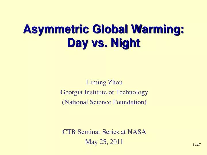
Asymmetric Global Warming: Day vs. Night. Liming Zhou Georgia Institute of Technology (National Science Foundation) CTB Seminar Series at NASA May 25, 2011. /47. Background. /47. Diurnal Cycle of Surface Air Temperature.

E N D
Asymmetric Global Warming: Day vs. Night Liming Zhou Georgia Institute of Technology (National Science Foundation) CTB Seminar Series at NASA May 25, 2011 /47
Background /47
Diurnal Cycle of Surface Air Temperature • Maximum/minimum temperature (Tmax/Tmin), diurnal temperature range (DTR), and mean temperature (Tmean) Tmax DTR=Tmax-Tmin Tmean=(Tmax+Tmin)/2 DTR Temperature Tmin 0 Local Time 24 /47
One Extreme Case: DTR = 0 • DTR represents the day-night temperature difference • A decrease in DTR means hotter nights, i.e., the day-night temperature difference is becoming smaller • DTR=0: the day and nigh temperatures are the same Tmax DTR DTR = 0C DTR = 15C DTR Temperature DTR = 20C Tmin /47 0 Local Time 24
Global Warming • Global mean surface temperature has risen by about 0.74°C from 1906 to 2005, with the largest increase over land in the last 50 years DTR=Tmax-Tmin Tmean=(Tmax+Tmin)/2 Annual anomalies of global mean land-surface air temperature (°C), 1850 to 2005 (IPCC, 2007) /47
Global Warming vs. DTR Decrease • Tmin warmed much faster than Tmax Tmean and DTR • DTR trends are a signal connected to global warming DTR=Tmax-Tmin Tmean=(Tmax+Tmin)/2 Trend and time series of annual Tmax,Tmin, and DTR for 1950-2004 (Vose et al., 2005) /47
Why Study DTR • A small change in the mean can result in a large change in the frequency of extremes (Means et al., 1984) • A change in the variance of a distribution will have a larger effect on the frequency of extremes than a change in the mean (Katz and Brown 1992) • As an extreme T indicator, DTR can be a critical and effective variable to detect and attribute surface warming (Meehl et al., BAMS, 2000) /47
Decreasing DTR has Significant Ecological, Societal and Economic Consequences • on public health, e.g., increasing mortality, hospitalization, emergency room visits and respiratory symptoms • on ecosystem health, e.g., reducing plant productivity (net photosynthesis occurs best at a large DTR) • on economy, e.g., losses in agriculture, disasters, insurance & recreations, and rising energy demand human health plant health rising energy demand
What Caused the DTR Decrease?(Current View) • Increased cloud cover has been used to primarily explain the worldwide reduction of DTR while precipitation and soil moisture play a secondary role clouds/soil moisture/precipitation DTR clouds/soil moisture/precipitation DTR • Other factors (e.g., greenhouse gases, aerosols and changes in land surface) are thought to have a small effect. /47
Cloud Cover DTR (primary) • Clouds, especially thick low clouds, greatly reduce Tmax and thus DTR by reflecting sunlight and increasing downward longwave radiation /47 ( Karl et al. 1993; Dai et al. 1997, 1999)
Soil Moisture/Precipitation DTR (secondary) • Soil moisture reduces Tmax and thus DTR by enhancing evaporative cooling through evapotranspiration • Precipitation influences DTR mainly through its association with clouds and soil moisture ( Karl et al. 1993; Dai et al. 1997, 1999) /47
Statistical Relationship: Simple Negative Linear Correlation Note: CC – cloud cover; P – precipitation; SM – soil moisture /47
We Expect to See CC/P/SM opposite long-term trends between DTR vs. CC/P/SM Trend DTR year (decadal) /47
But at the Global Scale We See Concurrent Trends in DTR and Precipitation/Clouds • DTR-CC/P relationship shows inconsistency between high- and low-frequency signals total cloud cover over land (Norris, 2007) (Dai et al. 2006) /47
But at Regional Scales We also See Concurrent Decreasing Trends in DTR and Clouds • Significant decreasing trends in both DTR and cloud cover have been observed in China since 1950 Reduced clouds in China (Kaiser, GRL, 1998 ) Reduced DTR in China (Zhou et al., CD, 2009) /47
So the Question Is • Current mechanisms (e.g., cloud cover/precipitation/soil moisture) can explain the observed short-term (high-frequency) DTR variability but not the observed long-term (low-frequency) DTR variability over some regions. • What is responsible for the observed long-term DTR trends? • natural forcing (e.g., decadal internal variability)? • anthropogenic forcing (e.g., increased greenhouse gases and aerosols)? • land cover/use changes (e.g., land surface properties)? /47
Outline • Spatial patterns of observed long-term DTR trends • IPCC AR4 simulated DTR trends: anthropogenic vs. natural forcing • Impacts of changing land surface on DTR • Future work /47
Topic I: Spatial Patterns of Observed Long-term DTR Trends Larger DTR reduction over drier regions (Zhou et al., PNAS, 2007; Zhou et al., CD, 2009) /47
Observed DTR Time Series: Global Mean • Tmin(+0.22/10yrs) warmed much faster than Tmax(+0.14/10yrs) and thus DTR decreased (-0.07/10yrs) /47
Observed DTR Trends: Spatial Pattern • DTR decreased most over semi-arid regions such as Sahel and North China where pronounced drought has occurred. 40 largest DTR trends 504 grid boxes at 5 lat x 5 lon /47
Observed Trends of DTR, Cloud, & Precipitation Spatial Decoupling (Grid by Grid) • DTR decreased most over driest regions • Spatial decoupling for the trends between DTR vs. cloud cover/precipitation over many grid boxes DTR trend precipitation ranked each of the 504 grid boxes from dry to wet based on its climatological precipitation precipitation trend cloud cover trend /47
Averaging Data by Large-scale Climate Region • To reduce the data noise at grid scales, the data were averaged by large-scale climate region (from 3 to 23 regions) based on climatological precipitation amount. regional average precipitation /47
Spatial Dependence of DTR Trends on Precipitation: Large-scale Average • Linear relationship: DTR/Tmin trend-precipitation the drier the climate, the stronger the warming trend in Tmin and the larger the decreasing trend in DTR wet dry /47
DTR-CC/P Correlation: Low- vs. High-Frequency Inconsistency • After detrending the original time series (e.g., removing the low-frequency signal), the negative DTR-CC/P relationship is robust at both global and regional scales, while this relationship does not hold for low-frequency signals. /47
Topic I: Conclusions • The negative DTR-cloud/precipitation correlation is observed in the high- frequency signals at both global and regional scales, but not in the low-frequency signals, suggesting that changes in cloud/precipitation cannot explain the observed long-term DTR trends. • There is a strong spatial dependence of long-term Tmin and DTR trends on climatological precipitation, indicating stronger Tmin warming trends and larger DTR decreasing trends over drier regions. • Such spatial dependence possibly reflects large-scale effects of increased greenhouse gases and aerosols on low-frequency DTR changes. • (Zhou et al., PNAS, 2007; Zhou et al., CD, 2009) /47
Topic II: IPCC AR4 Simulated DTR Trends: Anthropogenic vs. Natural Forcing Impacts of increased greenhouse gases and aerosols on long-term DTR trends (Zhou et al., CD, 2010; Zhou et al., GRL, 2009) /47
Data: Observed and Multi-model Simulated • Simulated Tmax, Tmin and DTR and other related variables from 48 AOGCMs in the 20th century: • ALL: anthropogenic + natural forcing (36 simulations) • NAT: natural forcing only (12 simulations) • Observed Tmax, Tmin, DTR, cloud cover and precipitation from 1950-1999 /47
Simulated vs. Observed: Global Mean • ALL captures major features of the observed temperature changes while NAT differs distinctly from the observations • DTR trend in ALL is much smaller than that observed Tmin DTR Tmax /47
Simulated ALL vs. Observed Trends: Spatial Pattern • Largest DTR decreases are simulated in high latitudes and arid/semi-arid regions Tmax Tmin DTR Observed Simulated in ALL /47
Simulated NAT vs. Observed Trends: Spatial Pattern • Unlike observations, simulated Tmax & Tmin show cooling trends Tmax Tmin DTR Simulated in NAT Observed /47
Simulated vs. Observed Trends: Spatial Dependence of DTR Trend on Precipitation • ALL reproduced major observed features while NAT shows the opposite. Tmin Tmax DTR ALL OBS Tmin Tmax DTR NAT opposite slopes /47
DTR-CC/P Correlation: Low- vs. High-Frequency Inconsistency • Both the observed and simulated show a negative DTR-CC/P correlation in high-frequency components, but not in low-frequency components. /47
Surface Radiative Forcing Decreased the DTR • Clouds decrease slightly while changes in surface radiative forcing are evident: enhanced downward longwave radiation (DLW) and decreased downward solar radiation (DSW) 20th century 21st century 20th century 21st century attribution time series analysis geospatial analysis (clear-sky vs. all-sky) (ALL vs. NAT) (high- vs. low- frequency) (global vs. regional) Tmin Tmax cloud DTR DSW DLW DSW & DLW DTR /47 Simulated in ALL
Topic II: Conclusions • When both anthropogenic and natural forcings are included, the models generally reproduce observed major features of Tmax, Tmin, and DTR, while none of the observed trends are simulated when only natural forcings are used. • Greenhouse effects (especially water vapor) and decreased downward solar radiation (due to increasing aerosols and water vapor) contribute primarily to the model simulated DTR decreases. (Zhou et al., CD, 2010; Zhou et al., GRL, 2009) /47
Topic III: Impacts of Changing Land Surface on DTR A hypothesis for impacts of drought and vegetation removal on DTR over the Sahel (Zhou et al., PNAS, 2007; Zhou et al., JGR, 2008) /47
Why Sahel? • Sahel has experienced unprecedented drought from late 1950s to early 1990s /47
Observed DTR Trends in the Sahel • Tmin has a strong/significant warming trend while Tmaxshows a small/insignificant trend, and thus the DTR declines • Concurrent long-term decreasing trends in both rainfall and DTR /47
Clouds/Soil Moisture/Rainfall Cannot Explain the Sahelian DTR Decrease drought clouds/soil moisture/precipitation DTR Observed: DTR factors other than clouds, rainfall and soil moisture are mainly responsible for the observed decreasing DTR trend in the Sahel. /47
Anthropogenic Forcings Cannot Explain Most of the Sahelian DTR Trend Either • Sahelian DTR trend is much larger than expected by the DTR trend - precipitation linear relationship Sahel DTR trend vs. precipitation by large-scale climate region for 1950-2004 /47
One Possibility – Albedo and Emissivity • Soil aridification and vegetation reduction due to drought and land use change (e.g., deforestation, overgrazing, overfarming) increase albedo and decrease emissivity. • Higher albedo reduces the absorption of solar radiation but such effect is compensated by more incoming radiation due to less cloud cover. α /47
New Hypothesis for Reducing the DTR Drought and human-induced reduction in vegetation cover and soil emissivity • Lower emissivity reduces thermal emission and less vegetation increases soil heat storage, both warming the surface during nighttime. /47 G G
Climate Model Sensitivity Tests • Three 20yrs simulations using NCAR CAM3/CLM3: • Control run (CTL): no changes in vegetation and g=0.96 • Exp A: remove all vegetation and g=0.89 • Exp B: remove all vegetation and g=0.96 Test region: Sahel A-CTL: effects of vegetation + emissivity B-CTL: effects of vegetation only Typical soil emissivity: g = 0.96 Desert soil emissivity: g =0.89 /47
Observed vs Simulated Temperatures • Reduced soil emissivity and vegetation both decrease DTR vegetation + emissivity Observed B - CTL A - CTL vegetation only Observed and simulated changes in annual Tmax,Tmin, and DTR /47
Explanations: Radiation and Energy Budget • emissivity thermal emission • vegetation soil heat storage Tmin Difference Differences in the diurnal cycle of radiation and energy budget /47
Consistent with Observations • The observed long-term decreasing DTR trend reversed after rainfall and vegetation recovered. • Satellites observed a greening trend in NDVI over the Sahel • Observed Tmin is correlated negatively with NDVI significantly NDVI – satellite measured vegetation index Time series of annual DTR, cloud cover, rainfall, and NDVI for 1976-2004 /47
Topic III: Conclusions • Climate model simulations show that the reduction in vegetation and soil emissivity warms Tmin much faster than Tmax and thus decreases the DTR. • These simulations suggest that vegetation removal and soil aridification due to drought and human activities may have increased Tmin and thus decreased DTR over semiarid regions. • This new hypothesis is consistent with observations over the Sahel. • (Zhou et al., PNAS, 2007; Zhou et al., JGR, 2008) /47
Future Work • Observational: detect and attribute the observed DTR changes to variables related to surface radiation and land surface properties over regions with adequate data. • impacts of clouds and aerosols on diurnal cycles of energy balance (e.g., downward solar and thermal radiation) • comprehensive statistical analyses between DTR and related contributors using surface and atmospheric observations, reanalysis data, and remote sensed products • impacts of natural modes of variability (e.g., ENSO, AMO) • Modeling: better simulate the diurnal cycle of temperature and related processes (e.g., DTR magnitude and trend) by improving treatments and representation of: • aerosols and clouds • land surface boundary layer processes /47