Download
1 / 17
170 likes | 289 Views
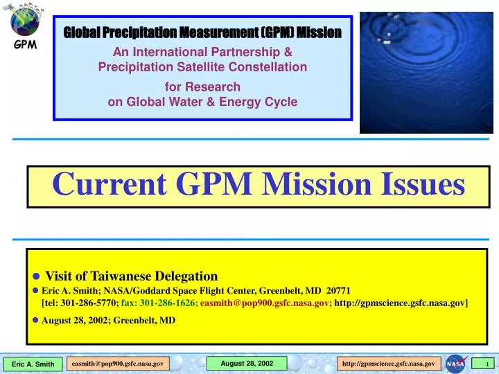
Global Precipitation Measurement (GPM) Mission An International Partnership & Precipitation Satellite Constellation for Research on Global Water & Energy Cycle. Current GPM Mission Issues. Visit of Taiwanese Delegation Eric A. Smith; NASA/Goddard Space Flight Center, Greenbelt, MD 20771

E N D
Global Precipitation Measurement (GPM) Mission An International Partnership & Precipitation Satellite Constellation for Research on Global Water & Energy Cycle Current GPM Mission Issues • Visit of Taiwanese Delegation • Eric A. Smith; NASA/Goddard Space Flight Center, Greenbelt, MD 20771 [tel: 301-286-5770; fax: 301-286-1626;easmith@pop900.gsfc.nasa.gov;http://gpmscience.gsfc.nasa.gov] • August 28, 2002; Greenbelt, MD
Today’s Focus? Discuss Scientific Opportunities in GPM Mission I. Possible Taiwan Contributions to GPM Mission For Example 1. Development & participation of science team. 2. Use of ground measuring facilities (especially at NCU) to participate in GPM validation program. 3. Explore potential for space hardware contribution. II. Possible GPM Mission Contributions to Taiwan For Example 1. Provide near-realtime access to GPM global rain products. 2. Inclusion in international GPM science team activity. 3. Governance participation in GPM science policy.
OBJECTIVES • Understand horizontal & vertical structure of rainfall, its macro- & micro-physical nature, & its associated latent heating • Train & calibrate retrieval algorithms for constellation radiometers • OBJECTIVES • Provide sufficient global sampling to significantly reduce uncertainties in short-term rainfall accumulations • Extend scientific and societal applications GPM Reference Concept Core Constellation • Core Satellite • TRMM-like spacecraft (NASA) • H2-A rocket launch (NASDA) • Non-sun-synchronous orbit • ~ 65° inclination • ~400 km altitude • Dual frequency radar (NASDA) • K-Ka Bands (13.6-35 GHz) • ~ 4 km horizontal resolution • ~250 m vertical resolution • Multifrequency radiometer (NASA) • 10.7, 19, 22, 37, 85, (150/183 ?) GHz V&H • Constellation Satellites • Pre-existing operational-experimental & dedicated satellites with PMW radiometers • Revisit time • 3-hour goal at ~90% of time • Sun-synch & non-sun- synch orbits • 600-900 km altitudes • Precipitation Validation Sites for Error Characterization • Select/globally distributed ground validation “Supersites” (research quality radar, up looking radiometer-radar-profiler system, raingage-disdrometer network, & T-q soundings) • Dense & frequently reporting regional raingage networks • Precipitation Processing Center • Produces global precipitation products • Products defined by GPM partners
Tracibility to ESE's Strategic Plan IV. What are consequences of change in Earth system for civilization? (Consequences) 1. How are variations in local weather, precipitation & water resources related to global climate variation? 2. What are consequences of land cover & use change for sustainability of ecosystems & economic productivity? 3. What are consequences of climate & sea level changes & increased human activities on coastal regions? V. How well can we predict future changes in the Earth system? (Prediction) 1. How can weather forecast duration & reliability be improved by new space obs, data assim, & modeling? 2. How well can transient climate variations be understood & predicted? 3. How well can long-term climatic trends be assessed & predicted? 4. How well can future atmospheric chemical impacts on ozone and climate be predicted? 5. How well can cycling of carbon through Earth system be modeled, & how reliable are predictions of future atmospheric concentrations of carbon dioxide & methane by these models? How is Earth changing and what are consequences for life on Earth? I. How is global Earth system changing? (Variability) 1. How are global precip, evap, & water cycling changing? 2. How is global ocean circulation varying on interannual, decadal, & longer time scales? 3. How are global ecosystems changing? 4. How is stratospheric ozone changing, as abundance of ozone-destroying chemicals decreases & new substitutes increases? 5. What changes are occurring in mass of Earth’s ice cover? 6. What are motions of Earth & its interior, & what information can be inferred about its internal processes? II. What are primary forcings of Earth system? (Forcing) 1. What trends in atmospheric constituents & solar radiation are driving global climate? 2. What changes are occurring in global land cover & land use, & what are their causes? 3. How is Earth’s surface being transformed & how can such information be used to predict future changes? III. How does Earth system respond to natural & human-induced changes? (Response) 1. What are effects of clouds & surf hydrology on climate? 2. How do ecosystems respond to & affect global environmental change & carbon cycle? 3. How can climate variations induce changes in global ocean circulation? 4. How do stratospheric trace constituents respond to change in climate & atmospheric composition? 5. How is global sea level affected by climate change? 6. What are effects of regional pollution on global atmosphere, & effects of global chemical & climate changes on regional air quality? Asrar, G., J.A. Kaye, & P. Morel, 2001: NASA Research Strategy for Earth System Science: Climate Component. Bull. Amer. Meteorol. Soc., 82, 1309-1329.
GPM Mission is Being Formulated within Context of Global Water & Energy Cycle with Foremost Science Goals Focusing On • Improved Climate Predictions:through quantifying trends & space-time variations in rainfall with associated error bars and improvements in achieving water budget closure from low to high latitudes -- plus focused GCM research on understanding relationship between rain microphysics/latent heating/DSD properties & climate variations as mediated by accompanying accelerations in global water cycle (both atmosphere & surface branches). • Improved Weather Predictions:through accurate, precise, frequent & globally distributed measurements of instantaneous rainrate & latent heat release -- plus focused NWP research on advanced techniques in satellite precipitation data assimilation & error characterization of precipitation retrievals. • Improved Hydrometeorological Predictions:through frequent sampling & complete continental coverage of high resolution rainfall measurements including snowfall -- plus focused research on innovative designs in hydrometeorological modeling encompassing hazardous flood forecasting, seasonal draught-flood outlooks, & fresh water resources prediction.
Validation Expectations from Research &Operations End Users Validation should be treated as important as retrieval because improved prediction depends on it. Error characterization of satellite precipitation retrievals is needed to support: (a) Algorithm Improvement -- for reducing bias & precision errors in retrieved precipitation estimates; (b) Climate Diagnostic Analysis -- for assessing physical significance of trends/variations in observed precipitation time series; (c) Data Assimilation -- for improving climate reanalyses, numerical weather prediction, & hydrometeorological forecasting. (d) Validation Research -- for advancing validation techniques, validation measuring systems, & space instrumentation.
Currently Conceived Constellation Architecture Reference NPOESS-1 GPM Core (CMIS) N-GPM b DMSP-F18/20 (NPMR) (GMI / DPR) (SSMIS) E-GPM NPOESS-2 DMSP-F19 TRMM (EPMR / NPR) (CMIS) Co-Op Drone Partners Optimization and Compromise Potential New Drones/Partners (SSMIS) DMSP-F16 AQUA FY-3 NPOESS-Lite DMSP-F17 ADEOS-II (CMIS) NPOESS-3 (CPMR) (CMIS) MEGHA TROPIQUES GCOM-B1 (MADRAS) (AMSR-FO) TBD
GPM: Constellation Mission of Opportunity & Good Citizenship SatelliteMain PurposeCritical Role in Constellation 1. GPM Core GPM rain reference calibration, [NASA/NASDA] system rain radar physics, liquid/frozen precip, tropical-midlatitude sampling 2 & 3. DMSP US: NOAA/DOD met-ops & res liquid/frozen precip, [IPO] full global sampling 4. NPOESS-Lite US: NOAA/DOD met-ops & res liquid/frozen precip, [IPO] full global sampling 5. GCOM-B1 Japan: environ/hydro res liquid/frozen precip, [NASDA] & JMA met-ops full global sampling 6. E-GPM EU: cold seasons/flash flood/ rain radar physics, [ESA] data-assim res & EU met-ops liquid/frozen precip, full global sampling 7. N-GPM US: MW radiometer technology testbed liquid precip, [NASA] full global sampling 8. Megha Tropiques India/France: tropical water cycle res liquid/frozen precip, [ISRO/CNES] intensive tropical sampling 9. FY-3 China: CMA met-ops & res liquid/frozen precip, [CSM] full global sampling
Mid-Lat Continental Tropical Continental Tropical Oceanic Extratropical Baroclinic GPM Validation Strategy I. Basic Rainfall Validation Raingauges/Radars new/existing gauge networks new/existing radar networks Research Quality Data Confidence sanity checks II. GPM Supersites Basic Rainfall Validation hi-lo res gauge/disdrometer networks polarametric Radar system Accurate Physical Validation scientists & technicians staff data acquisition & computer facility meteorological sensor system upfacing multifreq radiometer system Do/DSD variability/vertical structure convective/stratiform partitioning GPM Satellite Data Streams Continuous Synthesis error variances precip trends Calibration Algorithm Improvements Supersite Products III. GPM Field Campaigns GPM Supersites cloud/ precip/radiation/dynamics processes GPM Alg Problem/Bias Regions targeted to specific problems FC Data Research cloud macrophysics cloud microphysics cloud-radiation modeling High Latitude Snow
Potential GPM Validation Sites Canada England Germany NASA Land Spain Italy South Korea ARM/UOK Japan NASA KSC Taiwan France (Niger & Benin) India NASA Ocean Brazil Australia Regional Raingage Site Supersite Supersite & Regional Raingage Site
Supersite Template Legend Data Acquisition- Analysis Facility Focused Field Campaigns Multiparameter Radar GPM Core Satellite Radar/Radiometer Prototype Instruments Uplk Mtchd Radiom/Radar S-/X-Band Profilers 90 GHz Cloud Radar Meteorological Tower & Sounding System Piloted Site Scientist (3) Technician (3) UAVs Retrieval Error Synthesis DELIVERY Meteorology-Microphysics Aircraft Algorithm Improvement Guidance Validation Analysis 150 km 50-Gage Site Hi-Res Domain Center-Displaced with Uplooking Matched Radiom/Radar [10.7,19,22,37,85,150 GHz/14,35 GHz] UpwardS-/X-bandDoppler Radar Profilers & 90 GHz Cloud Radar 150 km 5 km Triple Gage Site (3 economy scientific gages) Single Disdrometer/ Triple Gage Site (1 high quality-Large Aperture/ 2 economy scientific gages) 100-Gage Site Lo-Res Domain Centered on Multi-parm Radar
Principles of Physical Error Modeling difference between retrieved & RTE modeled hydrometeor profiles yields retrieval "bias" mismatch in 2-ended RTE model solution based on absorption-scattering properties assigned to characterization volume yields retrieval "bias uncertainty" Note: ground Radars & regional raingage networks in conjunction with coincident satellite retrievals can generate "space-time correlation structure functions" & "space-time error covariance matrices". Radiance Tube TOA TOA meteorology & microphysics characterization volume observed by independent instruments Doppler Profilers (2) for precip/cloud hydrometeor profiles Radiosonde for T(z)/q(z) profiles Downward-pointing Radiometer for surface emissivity Raingage & Disdrometer Network for cross-checking matched core satellite radiometer/Radar ground instrument “Eyeball” [with active target calibration] Surface Surface
Error Characterization (Accuracy) Bias (B) & Bias Uncertainty (DB) At Supersite B(RRi)tk = ∑ j = -NT/2,+NT/2 [1/(NT+1)] [ RRiSR(tj,RRi)RRiPEM(tj,RRi] B(RRi)tk end-to-end uncertainties in PEM {for i = 1 , L rainrate intervals (~5) and time period tk} Based on Physical Error Model based on: physical error model ( passive-active RTE model ) matched satellite radiometer/radar instrument on ground with continuous calibration (eyeball) independent measurements of observational inputs needed for error model (DSD profile, T-q profile, surface) All retrievals from constellation radiometers & other satellite instruments are bias- adjusted according to bias estimate from reference algorithm for core satellite.
Error Characterization (Precision) J(x) = (xb – x)TF-1 (xb – x) + ( yo – H(x))T ( O + P )-1 ( yo – H(x)) F, O, & P are error covariance matrices associated with forecast model, observations, & forward model (precip parameterization), where yo , H, & x are observation, forward model, & control variable. Space-Time Observational Error Covariance (O) At Supersite (regional expansion rule based on DPR) O(rrj,j,tj)tk = ∑ rj = 0,100 ∑ ri = 0,100.∑ j = 0,360 ∑ i = 0,360 ∑ j = -NT/2,+NT/2 ∑ i = -NT/2,+NT/2 [1/NT] [ SR(rrj,j,tj) GV(rMOD(ri+rj,100),MOD(i+j,360),ti+j) ]2 {given polar coordinates (r,) for r out to 100 km and time period tk} Space-Time Autocorrelation Structure Given By volume scanning ground radars ( dual-polarization enables DPR calibration cross-checks ) research-quality, uniformly distributed, dense, & hi-frequency sampled raingage networks
Use of Korean AWS Raingage Data to Determine Satellite Validation Properties in Space-Time [Jun - Aug 2000] Corr Coef(±10 min time window) AWS Network 30 dy 15 dy 10 dy 5 dy 3 dy 1 dy 12 hr 6 hr 3 hr 2 hr 1 hr 39N 38N 37N 36N 35N 34N 33N Time Dimension (hr or day) 125E 126E 127E 128E 129E 130E 131E 0.1 0.2 0.3 0.4 0.5 1.0 1.5 2.0 2.5 3.0 RMSE(±10 min time window) Mean Bias(±10 min time window) 30 dy 15 dy 10 dy 5 dy 3 dy 1 dy 12 hr 6 hr 3 hr 2 hr 1 hr 30 dy 15 dy 10 dy 5 dy 3 dy 1 dy 12 hr 6 hr 3 hr 2 hr 1 hr mm hr-1 mm hr-1 Time Dimension (hr or day) Time Dimension (hr or day) 0.1 0.2 0.3 0.4 0.5 1.0 1.5 2.0 2.5 3.0 0.1 0.2 0.3 0.4 0.5 1.0 1.5 2.0 2.5 3.0 Space Dimension (deg) Space Dimension (deg)
Comparisons of Various GMS Retrival Algorithms with KMA-AWS Raingage Measurements Oh, H.J., B.J. Sohn, E.A. Smith, J. Turk, A.S. Seo, and H.S. Chung, 2002: Meteorol. Atmos. Phys., in press.
QPF Data Assimilation Experiments Over Korea Ou, M., and E.A. Smith, 2002