Download
1 / 9
90 likes | 180 Views
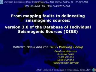
Database of Individual Seismogenic Sources (DISS), version 3. What is DISS? (1). DISS is a georeferenced repository of tectonic, fault and paleoseismological information. The core objects of DISS are:

E N D
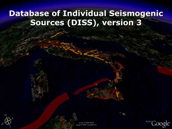
Database of Individual Seismogenic Sources (DISS), version 3
What is DISS? (1) DISS is a georeferenced repository of tectonic, fault and paleoseismological information. The core objects of DISS are: (1) the individual seismogenic source, a simplified and three-dimensional representation of a fault plane. Seismogenic sources are assumed to exhibit "characteristic" behaviour with respect to rupture length/width and expected magnitude; (2) the seismogenic area, an elongated region containing an unspecified number of aligned seismogenic sources that cannot be singled out. Seismogenic areas are not associated with a specific set of earthquakes or earthquake distribution.
3D View of an Individual Source and its Parameters Fault projection to ground surface North Strike Top edge Width Top depth Rake Fault plane Bottom edge Dip Bottom depth Length
3D View of a Seismogenic Area and its Parameters N Strike min polygon that encloses the projection at the ground surface of an entire fault system N Strike max Dip min Rake max Rake min branches of the fault system Effective Depth Dip max This is a branching point, NOT a segment boundary
What is DISS? (2) DISS presently contains information on the Italian territory and its surrounding regions but it’s structured to include data from anywhere. theme #2 theme #1 thematic layers fault database regional databases cropped on the fly
What is DISS? (3) DISS is expressly devoted to many potential applications in the assessment of seismic hazard at regional and national scale. • it represents faults in 3D • all its records are fully parameterized • it tends to completeness DISS content is ready to use and does not require any further manipulation of fault data by analysts and modelers.
Hazards Associated with Active Faults ground shaking surface deformation surface rupture seismogenic layer
Hazards Associated with Active Faults ground shaking: happens always but is transient affects the widest area is responsible for most of the damage may trigger other geological effects (liquefaction, landslides, secondary ruptures) surface deformation: happens always and is permanent affects a wide area (fault size x2) produce limited damage (critical facilities) trigger other geological effects (stream avulsion, slope instability, tsunami) surface rupture: happens only if fault is not blind but is permanent affects a limited area (smaller than fault length) may produce significant damage trigger other geological effects (water ponding, damming)