Download
1 / 87
870 likes | 1k Views
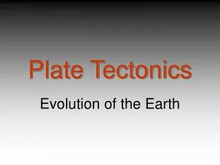
What does the bottom of the ocean look like? OR What is the topography or bathymetry of the ocean floor?. Fnft: The major plates of the earth's crusts. Courtesy of Reto Stockli, NASA Earth Observatory. Topography of the Ocean Floor. echo soundings (1920’s)

E N D
What does the bottom of the ocean look like?ORWhat is the topography or bathymetry of the ocean floor?
Fnft: The major plates of the earth's crusts Courtesy of Reto Stockli, NASA Earth Observatory
Topography of the Ocean Floor • echo soundings (1920’s) • ocean was not deepest in the center • deepest part of the ocean lie near its edges
An echo sounder trace. A sound pulse from a ship is reflected off the seabed and returns to the ship. Transit time provides a measure of depth. For example, it takes about 2 seconds for a sound pulse to strike the bottom and return to the ship when the water depth is 1,500 meters (4,900 feet). Bottom contours are revealed as the ship sails a steady course. In this trace, the horizontal axis represents the course of the ship, and the vertical axis represents the water depth. The ship has sailed over a small submarine canyon.
Bathymetry can tell you where things are: Oceanic ridge system Fig nft
BATHYMETRY – OCEAN FLOOR CONTOURS Fig 4-5, g
Atlantic Ocean
Fnft: Some large-scale features of the North Atlantic seafloor Courtesy National Geophysical Data Center/NOAA
Mid-Atlantic Ridge between Florida and western Africa • Canyon in middle of ridge
Topography of the Ocean Floor REMEMBER: • deepest part of the ocean lie near its edges
Topography of the Ocean Floor • Submerged outer edge of the continents are called continental margins • Deep-sea floor beyond these is called the ocean basin
but • What goes UP must go DOWN! & • There are 2 sides to every…OCEAN!
2 types of “margins” • PASSIVE MARGIN: Continental margins that face diverging plates. These do not coincide with plate boundaries. Little or no activity. Typically associated with the Atlantic. • ACTIVE MARGIN: Continental margins that face converging plates. These coincide w/plate boundaries. A lot of activity (earthquake/volcano). Typically associated with the Pacific.
Continental Margins • Passive margins – • continental margins not located on plate boundaries • Atlantic-type margins
Continental Margins • Active margins- • continental margins on the edge of convergent or transform plate boundaries • Pacific-type margins
Continental Margin:Continental SHELFContinental BREAKContinental SLOPEContinental RISE
Continental Margins (Shelves) • Width of Continental Shelf is determined by : • proximity to a plate boundary (active margins have narrow shelves while passive margins have broad shelves)
Continental Margins (Shelves) • Continental Shelves • Shallow, submerged extension of a continent • broad, gently sloping • 7.4% of earths Ocean area
Continental (Passive) Margins • Shelf break – • transition between the continental shelf and the continental slope There are also changes from the continental slope (edge of shelf) to the continental rise (ends at edge of ocean floor).
Continental Margins • Continental Slopes • Steeper than the shelf • end at the deep ocean
Continental Margins • Continental rises • at the base of continental slope • covered by a blanket of accumulated sediment • gradual slope
Folded ridges of sediment cover the ocean floor west of Oregon
Continental Margins • Submarine Canyons • cut into the continental shelf and slope • formed by turbidity currents (avalanche-like sediment movements)
Submarine Canyon Off of The coast Of New Jersey
What comes next? • Where the Continental Slope/Rise (granite rock) meets the “deep” ocean floor you get a sediment covered area (Continental Rise) that meets the “true” ocean floor (basalt rock)…what do you find there? What does it look like?
Ocean Basin • thick layer of sediment (up to 5 km or 3mi thick) covering basaltic rocks • Make up more than ½ of the earth’s surface
Ocean Basin • Oceanic ridges • Underwater mountain chain • an active spreading center • offset at regular intervals by transform faults • You know this as “Sea Floor Spreading” (divergent plate boundary)
WHERE THE RIDGES ARE! Fig nft