Download
1 / 26
260 likes | 417 Views
Groundwater Science Potential Activities in the Mountain Aquifer of the Eastern Basin. Jack Eggleston and Verne Schneider June 22-23, 2013. A Safe and Sustainable Groundwater Supply Depends on:. Scientific understanding of ground water Water use planning and practices based on science

E N D
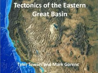
Groundwater SciencePotential Activities in theMountain Aquifer of the Eastern Basin Jack Eggleston and Verne Schneider June 22-23, 2013
A Safe and Sustainable Groundwater Supply Depends on: • Scientific understanding of ground water • Water use planning and practices based on science • Monitoring
Groundwater Science Approach • Monitor – collect data to build a foundation • Map – display the data • Model – develop mass balance models to understand and predict groundwater processes • Assess and Predict – understand how management policies will affect water resources • Connect Science to Management - publish study results, present to regulators • Continue Monitoring – to reassess and modify management practices
Examples of Groundwater Science in Other Stressed Aquifer Basins Columbia River Plateau California Central Valley Middle Rio Grand Basin
California Central Valley • Semi-Arid – 300 mm/yrprecip • Population increasing, from 1985-2005 population doubled • Large groundwater withdrawals • Water level declines and salinization are problems • Water restrictions cause debate • Complex management options • Better understanding and tools were needed
California Central Valley- Groundwater Science Program • Monitoring – • Water levels • Water use • Water quality • Land Use and Climate • GIS Database Construction and Data Analysis • Compartmentalized Model– • Groundwater • Surface Water • Land Use • Water Use and Management
California Central Valley – Groundwater Budget 5 4 3 2 1 0 1000’s of MCM -1 -2 -3 -4 -5 • Outflow mostly to agricultural wells pumping • Inflow mostly from recharge
California Central Valley Groundwater –Study Report • Study is the basis for planning and regulation • Model used as tool by regional water managers • Monitoring continues to measure changing conditions and effects of management actions • http://pubs.usgs.gov/pp/1766/
Examples of Groundwater Science in Other Stressed Aquifer Basins Columbia River Plateau California Central Valley Middle Rio Grand Basin
Middle Rio Grand Basin • Water use regulated by both state and federal agencies • Groundwater is primary drinking water supply • Semi-arid, 275 mm/yrprecip • Competition for scarce water • Groundwater levels declining • Better understanding needed for water supply planning
Middle Rio Grand Basin – Study • Data compiled • Natural tracers used to measure groundwater flowpaths and ages • Existing MODFLOW models updated
Middle Rio Grand Basin – Study Results • Aquifer not being replenished as quickly as had been assumed • Less ground water available in storage than previously believed • Results provide basis for comprehensive local water policy Public Reports: http://pubs.usgs.gov/wri/wri03-4286/ http://pubs.usgs.gov/circ/2002/circ1222/
Examples of Groundwater Science in Other Stressed Aquifer Basins Columbia River Plateau California Central Valley Middle Rio Grand Basin
Online Geologic Model
Geology is Known
Borehole Logs Used to Build 3D Geologic Model
Elevation surfaces generated to represent each hydrogeologic unit
Model provides 3D geology representation of layers and faults
Model is available online http://or.water.usgs.gov/proj/cpras/index.html
Groundwater Science Approach • Monitor – collect data to build a foundation • Map – display the data • Model – develop mass balance models to understand and predict groundwater processes • Assess and Predict – understand how management policies will affect water resources • Connect Science to Management - publish study results, present to regulators • Continue Monitoring – to reassess and modify management practices
Applications to the Eastern Basin • Monitor – • Map – • Model – • Assess and Predict – • Connect Science to Management - • Continue Monitoring -