Download
1 / 43
430 likes | 586 Views
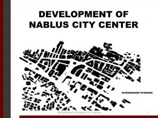
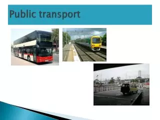
Inter- City Public Transport System for Nablus. Introduction. Nablus is the largest city in the West Bank after Jerusalem . 150,000 inhabitants live in Nablus . Nablus has the largest university in the West Bank with around 20,000 students.

E N D
Introduction • Nablus is the largest city in the West Bank after Jerusalem. • 150,000 inhabitants live in Nablus . • Nablus has the largest university in the West Bank with around 20,000 students.
Many businesses have either moved from or have been established outside Nablus. • Three complexes were constructed to serve the inter-city public transportation in Nablus City.
Current Problems • Congestion • Delay • Safety • Pollution • Time waste and fuel consumption • Economic view
Objectives • To improve the current traffic system in order to create a new system that connect the internal and external movements through the city. • Applicable solution to solve the current problems for at least 20 years.
Data Collection Composition • Maps • Photos • Traffic counts • Average headway • Routes specification • Number of spaces
Table 3.1: Total number of vehicles entering and leaving the complexes over two hours period
Table 3.2: Total number of registered vehicles and parking spaces
Solutions • Reallocation of the public transport complexes away from the CBD. • Providing an internal transport system .
Reallocation the complexes • Two separate public transport complexes at the two outskirts of the city. • Two available land spaces each is around 17 donums.
to estimate the number of passengers during the project period. The following relationship was used: F = P (1+ i ) ^n
The project has a design period of 20 years. • An assumed value of 1.5% is considered as Passenger’s growth rate. • 1900 passengers/hr is the current maximum number of passengers(271 veh/hr)
Total area of 4.6 dunoms is required as parking spaces and circulation area for vehicles in the new western public transport complex. • Only 3.2 dunoms required for the eastern complex.
Remaining area can be used as vehicles storage, private cars parking “ park and ride” ,coffee shops and restaurants, shopping centers, waiting hall, etc
Internal Public Transport System • Connect between the suggested locations of the public transport complexes. • Cover the needs of the city. • Several options can be suggested as internal transport system .
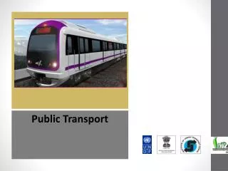
International Systems of Internal Public Transportation • Light Rail System
Bus Rapid Transit : provide faster than an ordinary bus line
Why Tram? • Provide higher capacity service than buses. • Load faster that other type of vehicles. • Trams’ stops are easily accessible • Right-of-way are narrower than for buses.
Can adapt to the number of passengers . • Can be driven from either end. • Create less pollution than the vehicles using rubber tires. • Efficient and operating costs are low.
Distance reserved by trams from each street along tram path is around 7 meters except when the two track separate at Faisal street. The distance will be 4 meters.
Capacity of the tram was calculated based on the following assumptions • Tram will carry 60% of the whole number of passengers. The other 40% may not need to use the tram to go into or out of the city center.
Two trams will serve each public transport complex. • Each tram needs an estimated time of 30 minutes to complete one round (including stops).
The two trams serving one route will be separated by 15 minutes. • Most common vehicle is currently the shared-taxi which carries 7 passengers • Annual growth rate of 1.5% for passenger demand.
For a design period of 20 years the tram required to carry 383 every 30 minutes. • Tram of 400 capacity will be efficient to serve the city such as the tram in Stockholm. • 25% of daily trips to Balata Camp and Al-Ain Camp will be replaced by the tram.
Faisal street is considered as a multilane highway . • LOS for Faisal street was calculated by using HCS2000 program (Highway Capacity Software)
The current Level of service for Faisal street is D which is resulted from the high volume of traffic along the street. • The provision of tram along Faisal Street will improve the LOS to become C.
Project Constraints • The studied project will serve for 20 years. • Available budget. • Tram transit system feasibility.
Bus rapid transit can be considered as an alternative transportation system for the near future. • The BRT will follow the same route designed for the tram.
Recommendations • Study the impact of the tram on the overall movement of traffic along and crossing the tram path at intersection. • Provide a preemption system at intersections controlled by signals to give priority for the tram path.
Conduct a feasibility study for the suggested system to take into consideration capital and operating costs of the tram system, estimated impact on the overall traffic operation for the network impacted by the tram, etc.
Consider overpass for tram at intersection with major location in the CBD area. • Study for the suggested tunnel of pedestrians that will connect the main station at Al- Watani Hospital with the CBD area.