Download
1 / 26
260 likes | 436 Views
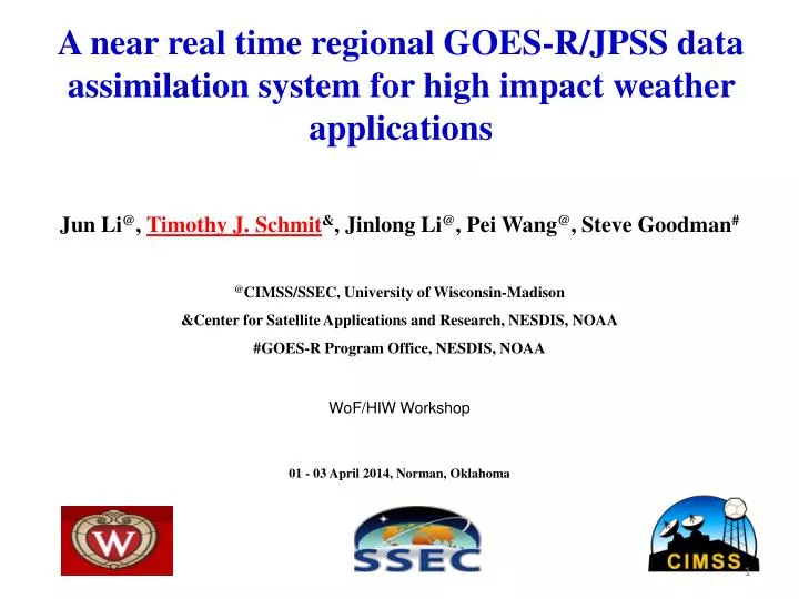
A near real time regional GOES-R/JPSS data assimilation system for high impact weather applications. Jun Li @ , Timothy J. Schmit & , Jinlong Li @ , Pei Wang @ , Steve Goodman # @ CIMSS/SSEC, University of Wisconsin-Madison &Center for Satellite Applications and Research, NESDIS, NOAA

E N D
A near real time regional GOES-R/JPSS data assimilation system for high impact weather applications Jun Li@, Timothy J. Schmit&, Jinlong Li@, Pei Wang@, Steve Goodman# @CIMSS/SSEC, University of Wisconsin-Madison &Center for Satellite Applications and Research, NESDIS, NOAA #GOES-R Program Office, NESDIS, NOAA WoF/HIW Workshop 01 - 03 April 2014, Norman, Oklahoma
In collaboration with: Mark DeMaria, John L. (Jack) Beven, Sid Boukabara, FuzhongWeng etc. Acknowledgement: GOES-R HIW Program,JPSS PGRR Program, JCSDA S4 computer, SSEC Data Center Motivation • Research to better use of JPSS/GOES-R data in a mesoscale NWP model for applications; • Accelerate the R2O transition • offline case studies followed by online demonstration • Transfer research progress (e.g., handling clouds, using moisture information etc.) to operation with collaborating with NCEP team Tropical storm Humberto http://cimss.ssec.wisc.edu/sdat
Recent progress • A regional Satellite Data Assimilation system for Tropical storm forecasts (SDAT) has been developed and running in near real time (NRT) at CIMSS since August 2013, analysis and evaluation of SDAT are ongoing; • Based on WRF/GSI; • Conventional and satellite including GOES Sounder, AMSU-A (N15, N18, N19, metop-a, aqua), ATMS (Suomi-NPP), HIRS4 (N19, metop-a), AIRS (aqua), IASI (metop), and MHS (N18, N19, metop). • “Tracker" program was implemented since October 2013 for post process; • Besides GOES radiance assimilation, Layer Precipitable Water (LPW) forward operator has been developed within GSI for assimilating GOES-R water vapor information; • Research progress has been made using SDAT on • Radiance assimilation versus sounding assimilation; • Better cloud detection for radiance assimilation; • Cloud-cleared radiance assimilation.
Satellite Data Assimilation for Tropical cyclone forecast (SDAT) http://cimss.ssec.wisc.edu/sdat GDAS/GFS data GSI/WRF Background & boundary preprocessing Conventional obs data GSI background at time t-t0 hrs Data preparation Radiance obs data GSI analysis at time t-t0 hrs WRF boundary update JPSS and other satellite DP data WRF 6 hours forecast Analysis and forecast cycle above process to time t Bufr conversion GSI background at time t CIMSS SFOV rtv (AIRS/CrIMSS) Satellite standard DP (soundings, tpw, winds) GSI analysis at time t IMAPP/CSPP data transfer update WRF 72 hours final forecast Diagnosis, plotting and validation WRF postprocessing Data archive
Hurricane Sandy (2012) − Horizontal resolution impact(Sandy: 18 UTC 20121022 – 00 UTC 20121030) Track forecast error SLP forecast error Maximum wind forecast error High resolution (15 km) run shows consistent improvement in hurricane track and maximum wind speed.
Flow chart to run standard vortex tracker No Check NATL hurricane Exit Loop each NATL hurricane Yes Prepare tcvital data, Prepare input parameter, data Link wrf output file Loop forecast time Run tracker Disjoin wrf output (extract individual time data) Reorganize tracker output Prepare ncl plot input Run unipost (diagnosis and vertical interpolation) Plot individual storm track/intensity Do copygb (horizontal interp. and map conversion) Plot all hurricane track together File archive/storage Merge all single diagnostic files into one grib file (Tracking variables: mslp, vorticity and gph at 700,850 mb, winds at 10m, 700, 850 mb)
SDAT serves as research testbed • Research progress has been made using SDAT on • Impact of Infrared (IR) and Microwave (MW) sounders; • Radiance assimilation versus sounding assimilation; • Better cloud detection for radiance assimilation; • Cloud-cleared radiance assimilation.
Hurricane Irene (2011) – data impact studies 4AMSUA from N15, N18, Metop-a and Aqua Data are assimilated every 6 hours from 06 UTC August 22 to 00 UTC August 24, 2011 followed by 48-hour forecasts (WRF regional NWP model with 12 km resolution). Hurricane track (HT) (left) and central sea level pressure (SLP) root mean square error (RMSE) are calculated.
Hurricane Sandy (2012) – radiance vs sounding 4AMSUA from N15, N18, Metop-a and Aqua Sounding retrievals use much more channels. (m/s) “On the Equivalence between Radiance and Retrieval Assimilation” By Migliorini (2012) (University of Reading ) – Monthly Weather Review “Assimilation of transformed retrievals may be particularly advantageous for remote sounding instruments with a very high number of channels or when efficient radiative transfer models used for operational assimilation of radiance measurements are not able to model the spectral regions (e.g., visible or ultraviolet) observed by the instrument.”
Better cloud detection for hyperspectral IR radiance assimilation AIRS stand-alone cloud detection MODIS cloud detection Channel Index 210, Wave number 709.5659 AIRS data at 06 UTC 25 October 2012 (Sandy) AIRS sub-pixel cloud detection with MODIS Wang et al. 2014 (GRL) AIRS 11.3 µm BT (K)
Handling clouds in radiance assimilation (cont.) Hurricane Sandy (2012) forecast RMSE (m/s) 500 hPa temperature analysis difference (AIRS(MOD) - AIRS(GSI)) 72-hour forecasts of Sandy from 06z 28 to 00z 30 Oct, 2012 Wang et al. 2014 (GRL)
AIRS longwavetemperature Jacobian with a cloud level at 700 hPa. Challenges on assimilating radiances in cloudy situation: (1) Both NWP and RTM have larger uncertainty; (2) Big change of Jacobian at cloud level COT = 0.05 COT = 0.5
Aqua MODIS IR SRF Overlay on AIRS Spectrum Direct spectral relationship between IR MODIS and AIRS provides unique application of MODIS in AIRS cloud_clearing !
R1 R2 AIRS/MODIS cloud-clearing (Li et al.2005) is NEdR for MODIS band solve
For each cloudy AIRS FOV, 8 pairs are used to derive 8 AIRS CC radiance spectra; • Compare AIRS CC radiances with MODIS clear radiance observations within the AIRS FOV, find the best pair and the corresponding CC radiance spectrum. AMSU-A AIRS
AIRS global clear and cloud clearing brightness temperature (descending) on Jan. 1, 2004.
Rienecker et al. 2008: GMAO’s Atmospheric Data Assimilation Contributions to the JCSDA and future plans, JCSDA Seminar, 16 April 2008. • GEOS-5 model resolution: 1°x1.25°x72L • Time frame: Jan 01 to Feb 15 2004 • Other Radiance data: – HIRS-2/HIRS3 (clear channels) – AMSU-A/EOS-AMSU-A – AMSU-B/MHS – SSM-I – GOES Sounders
AIRS Channel 210, 2012-10-26-06 Z AIRS clr AIRS clr+ AIRS cc Track forecast error GTS+4AMSU+AIRS (GSI) GTS+4AMSU+AIRS (clr) GTS+4AMSU+AIRS(clr+cc) Maximum wind speed forecast error T analysis difference at 500 hPa between AIRS clr+cc and AIRS clr
SDAT evaluation • Hurricane Sandy (2012) and 2013 hurricanes • Near real-time demonstration • GOES Imager brightness temperature measurements
Hurricane Sandy (2012) 72-hour forecast experiments with SDAT Track forecast RMSE SLP forecast RMSE Sandy forecast RMSE (km) from CIMSS experimental (WRF/GSI with 12 km resolution) with GTS, AIRS and CrIMSS data assimilated, operational HWRF, and GFS (AVNO). Forecasts start from 12 UTC 25 Oct and valid 18 UTC 30 Oct 2012.
Realtimeforecasts: storm Karen (2013) Upper Left: NHC 4 AM CDT (09 UTC) Advisory (Friday 04 October 2013) Lower left: SDAT track forecasts started at 06 UTC 04 October valid 06 UTC 07 October 2013) Lower right: Other dynamic models (06UTC) (09UTC) SDAT 3-day forecasts
Hurricane Karen 72 hours forecast 2013100312 - 201100612 sdat ofcl hwrf avno Best track data only available until 06 UTC 6 Oct. 2013 Hurricane Karen track forecasts matched with available observations.
Life cycle- Humberto 72 hours forecast 2013090900 - 2013091618
During the week starting on September 9, 2013, a slow-moving cold front stalled over Colorado, clashing with warm humid monsoonal air from the south. This resulted in heavy rain and catastrophic flooding along Colorado's Front Range from Colorado Springs north to Fort Collins. The situation intensified on September 11 and 12. Boulder County was worst hit, with 9.08 inches (231 mm) recorded September 12 and up to 17 inches (430 mm) of rain recorded by September 15, which is comparable to Boulder County's average annual precipitation (20.7 inches, 525 mm). 7-day observed precipitation (inches) valid at 9/16/2013 12 UTC The 72 hour cumulative forecasts (mm) from SDAT started at 18 UTC on 10 September 2013.
Forecast verification with GOES Imager/GOES-R ABI This verification with GOES Imager will be part of SDAT before May 2014 Simulated GOES-13 Imager 11 µm BT from SDAT experimental forecasts (36 hour forecasts for Hurricane Sandy started 18 UTC 27 October 2012) GOES-13 Imager 11 µm BT observations
Summary and plans • Summary • A near realtime satellite data assimilation for tropical cyclone (SDAT) system has been developed at CIMSS. • A few tools have been developed for satellite data preparation, conversion, model; validation and post-analysis. • Researches have been conducted on satellite data impacts, handling clouds, assimilation strategies, etc. • The system has been run in near realtime since August 2013. The system is pretty stable and the preliminary validations are encouraging. • Plans • Collaborate with CIRA on the application of SDAT in proving ground the coming hurricane season to get the track/intensity information in the Automated Tropical Cyclone Forecast (ATCF) system that NHC uses; • Collaborate with EMC on using hybrid GSI and HWRF etc; • Collaborate with Dr. Mark DeMaria to put our realtime hurricane forecast into his statistical model ensemble for realtime application; • Develop layer precipitable water (LPW) module and tools in GSI, test its impact; • More focus on how to use moisture information (radiance, soundings, TPW, LPW) • Combine both GOES and LEO sounder data, prepare for GOES-R data application; • Simulated GOES imager (11 and 6.7 µm) and ABI IR bands from SDAT forecasts in NRT. http://cimss.ssec.wisc.edu/sdat