Download
1 / 11
110 likes | 230 Views
Belgium Geography, Government, War of Independence, and WWII Involvement. Think of these three regions like states. Even though NC is not a part of SC, we are still a part of the US. Flanders, Wallonia, and Brussels are all a part of Belgium. Three Main Regions. Three Geographic Regions .

E N D
BelgiumGeography, Government, War of Independence, and WWII Involvement
Think of these three regions like states. Even though NC is not a part of SC, we are still a part of the US. Flanders, Wallonia, and Brussels are all a part of Belgium. Three Main Regions
Three Geographic Regions • Upper, Lower, and Central Belgium are geographic regions, not states. If I were to say I enjoy visiting the mid-west in America, I could be referring to several states. It is the same way when I say Lower, Central, or Upper Belgium.
Flanders is usually described as Lower Belgium. If you refer back to the map that may seem strange since Flanders is in the North. It is called “Lower” Belgium because the land is below sea level, not because it is at the bottom of Belgium. Lower Belgium
Lower Belgium begins at the coast of the North Sea and moves east towards the coast, sand dunes, and small hills. It has fertile valleys and pastures. Pastures are where animals graze, and fertile means that they are able to grow things. Does it seem like they would have good farming here? Yes. Lower Belgium
Has low and fertile plateaus (remember a plateau is like a table top). It has forested areas and large farms and pastures. Parts of Wallonia could be considered Central Belgium, and Brussels is considered Central Belgium. Central Belgium
The top picture is of the Ardennes Forest, which are mostly in Upper Belgium. The bottom picture is of the Semois Valley (a popular tourist attraction) and a river. Upper Belgium has fast moving rivers which cut into the landscape and make the hills steeper in this area than in any other region. There are also vineyards here (where they grow grapes). Notice the differences between the Ardennes Forest and our forests in NC. Upper Belgium
Belgium was taken over by Germany, who invaded them the same year as France (1940). Belgium surrendered instead of losing more innocent lives than needed, since they are small and knew they could not win. France and Belgium are close to each other, which is why they were invaded at about the same time Belgium is sometimes referred to as one of the “low countries” because it is below sea level. In 1940 Germany invaded other “low countries) WWII Involvement
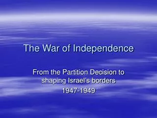
Belgium and The Netherlands were once united at The Kingdom of The Netherlands and were ruled by King William. 60% of the kingdom spoke Dutch, 40% spoke French In April of 1830 rioting (fights) began outside of the Opera that was playing for King William’s birthday and spread throughout the country. The French felt they were treated unfairly They were unemployed, poor, and had no rights The causes of this war are very similar to the causes of The American Revolution Belgian Revolution
On November 18, 1830 Belgium declares independence. Not until July 21, 1831 were they officially independent of The Netherlands Did the colonists in America get independence just because they declared it? No. It took 8 more years to officially get it. 7 years longer than it did in Belgium. The borders of Belgium established during the war are still recognized today.
Questions? • We skipped “Government” so don’t worry if you don’t have it. • If you aren’t sure about something leave a comment on this page, or email me. • You should have completed a KWL Chart for Belgium as well as a Venn Diagram that compares The American and Belgian Revolutions.