Download
1 / 29
320 likes | 587 Views
GAGAN is a Reality Today. Let us Use It. SATNAV is the Future. MSAS. Operational SBAS. 2. World wide SBAS Systems. GAGAN System Commissioned on 14 th February 2014 and is the 4 th SBAS operational in the world. Why Augmentation?.

E N D
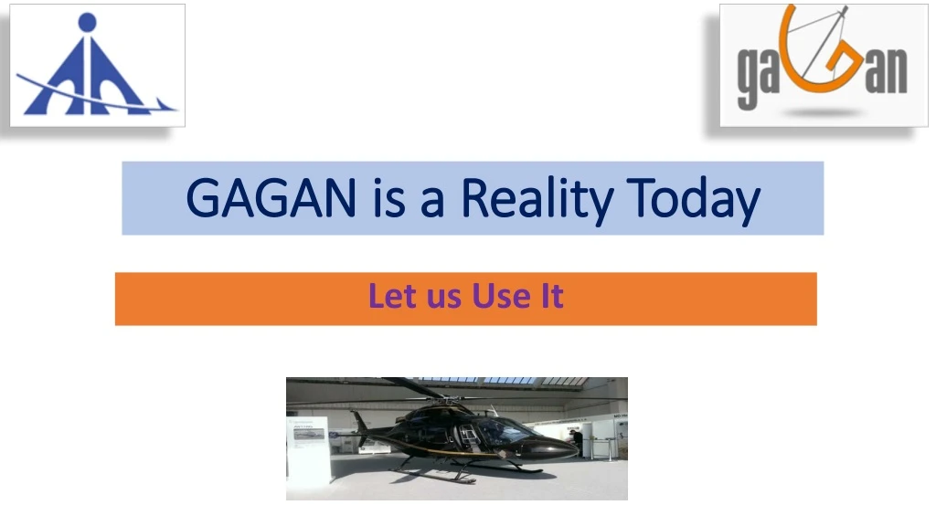
GAGAN is a Reality Today Let us Use It
SATNAV is the Future MSAS Operational SBAS 2
World wide SBAS Systems GAGAN System Commissioned on 14th February 2014 and is the 4th SBAS operational in the world
Why Augmentation? • Current GPS and GLONASS Constellations Cannot Support Requirements For All Phases of Flight • Integrity is Not Guaranteed • Not all satellites are monitored at all times • Time-to-alarm is from minutes to hours • No indication of quality of service Augmentation • Accuracy is Not Sufficient • Vertical accuracy > 10 m • Availability and Continuity Must Meet Requirements
INLUS-1 INLUS-2 1SG 1RF 1SG 1RF GEO In-orbit Spare GPS Const. PRN 127 PRN 128 Backup to INLUS 1/2 Bangalore Delhi INLUS-3 1SG 1RF DATA Communication Network - 1 Data Communication Network - 2 INMCC - 2 INMCC - 1 INRES # 1 - 15 Bangalore Bangalore GAGAN Configuration
GAGAN GEO Footprint GSAT-8 GSAT-10 GAGAN
Advantage GAGAN - Accuracy Position Error 20 m (99%) • GAGAN reduces • Satellite orbit error • Satellite clock error • Ionospheric delay error Without GAGAN With GAGAN Position Error 5 m (99%)
Advantage GAGAN - Integrity Without GAGAN • GAGAN removes outliers • GAGAN guarantees error bounds • GAGAN provides integrity limits • Most important for Aviation Outliers No error bound With GAGAN
Horizontal Position Accuracy Horizontal Protection Limit RNP 0.1: 185m APV 1.5: 40m GPS Only: 9.0m (99%) GPS-GAGAN: 3.2m (99%)
Vertical Position Accuracy Vertical Protection Limit RNP 0.1: N/A APV 1.5: 50m GPS Only: 17.0m (99%) GPS-GAGAN: 4.9m (99%)
GAGAN Services 8.7.2014 Certified RNP 0.1 Service over Indian FIR APV 1 Service over Indian Landmass, service expected to be certified by end of 2014
GAGAN Application • GAGAN Signals provide standard GAGAN Messages, which can be decoded by SBAS enabled receiver ONLY • GAGAN improves the reliability, accuracy and availability compared to GPS-only solution • High dynamics users could use GPS safely and confidently ONLY IF GAGAN declares it healthy and un-corrupted. • GAGAN Application in various fields are the by-products of the navigation information available from GAGAN • GAGAN is accessible, through • COTS product • Specifically developed Application ( hardware + software)
GAGAN: Benefits in Civil Aviation • Primary Means of Navigation - Take-Off, En Route, Approach and Landing • More Direct Routes - Not Restricted By Location of Ground-Based Equipment • Precision Approach Capability - At Any Qualified Airport • Reduced fuel consumption, Co2 emission, noise levels • Reduced/Simplified Equipment On Board Aircraft • Increased Capacity - Reduced Separation Due to Improved Accuracy • Increase safety by using 3D approach operations
GAGAN implementation plans • For Runways equipped with ILS: • GAGAN approaches will provide an alternate to ILS, when ILS becomes unserviceable or under maintenance. • At runways not equipped with ILS or at terrain constrained airports where ILS installation is not practicable, GAGAN approaches will provide the requisite vertical guidance. • At small airports where only few aircraft movement exist. • At new airports where traffic density is expected to be less than 10 movements.
Helicopter Navigation using GAGAN • Helicopter Navigation • Offshore • Rough terrain operations • Emergency medical services • Search and Rescue • GAGAN Advantage • No dependency upon ground navigation infrastructure at heliport • No more VFR operations • Reduction in Decision Height • Helipads accessibility under poor weather conditions • Solution through • COTS products from leading SBAS enabled receiver manufactures
Avionics Equipage • First Air’s entire fleet of B-737-200’s, B-727’s and ATR’s has UNS-1Fw dual equipage (TSO-C-145B) • Horizon Air, Inc., a US regional air carrier, has certified SBAS in a Bombardier Q-400. The plan is for the installation of WAAS avionics in their Q-400 fleet. • Airbus Industries announced their plans to install satellite landing systems (SLS) in the Airbus 350 XWB • Several general aviation and commercial aircraft come pre-fitted with SBAS receivers. • Exhaustive list of SBAS receiver manufacturers can be found at http://egnos-portal.gsa.europa.eu/node/1910
Helicopters with SBAS Capability in Europe Source : Helios Report
On-board SBAS Receiver equipage Share in Europe Source : Helios Report
EGNOS HEDGE Project • HEDGE (Helicopters Deploy GNSS in Europe) project with an objective to • Develop the helicopter SBAS Offshore Approach Procedure. • Develop helicopter Point In Space (PINS) procedures for mountain rescue and Helicopter Emergency Medical Services. • Demonstrate fixed wing EGNOS based Approaches with Vertical Guidance • Demonstrate an integrated navigation/surveillance concept • Successful demonstration • Mountain rescue approach • Oil rig approach • Emergency medical service approach • Navigation / surveillance concept demonstration Onboard data was recorded and analyzed to determine if there were any issues with EGNOS performance for helicopter operations.
HEDGE NEXT • Implementing EGNOS specific procedures for helicopters across Europe. • Helicopter low level IFR procedures are being developed in Spain and Poland, demonstrating the benefits to access hospitals in critical conditions. • Implementation of Rotorcraft LPV Procedures • Development of new navigation concepts • Guidance between oil rig platforms • Curved approaches and departure procedures with SBAS
EGNOS GIANT Project • GNSS Introduction In the AviatioN sector • Phase 1: Introduction of EGNOS as a complementary means to existing operations (En-route: BRNAV, TMA: P-RNAV & Approach operations: RNAV SIDs&STARs). • Phase 2: Approval for new operations: The introduction of APV approach operations using GNSS (EGNOS) vertical guidance to enhance safety and accessibility • Phase 3: Combined use of Galileo/GPS, reinforced by regional integrity systems (EGNOS). In addition to that, the most stringent precision landing requirements (CAT II-III) would be met by means of local components, such as the Ground Based Augmentation Systems (GBAS).
Purpose of the User Meet • Helicopter operator bring out their expectation and equipage requirement. • Airports Authority of India • Work in close cooperation with Helicopter operators • Look into feasibility of making procedures for helicopters, at the places as desired by helicopter operator. • Conduct trial runs for performance Analysis • Helicopter operators to come forward for required data collection • DGCA • Provides approval for flight procedures • Advise on certification requirements.
EGNOS experience • The message was given by MieszkoSyski from LPR, a Polish Helicopter Emergency and Medical services operator. “Our priority is safety for the client and the pilot: to be safe back home when after take-off the weather doesn’t allow performing the mission. And this is when EGNOS comes into the picture. You can fly safely also at night!”. He added that efficiency is a must for the company and EGNOS allows extending operational capabilities of medical transport with no on-ground equipment costs.
EGNOS experience • Avionics manufacturers have already chosen EGNOS • Speaking in the workshop, Trevor Pegrum from Garmin said that EGNOS is a key element of the present avionics and of his company’s view of the future flight management system. He recognized that helicopter operations have unique requirements and have optimized the features of their recognized EGNOS GTN touch screen avionics for rotorcraft operations. • He explained that not only navigation can benefit from SBAS (Satellite based augmentation systems), since it is also an enabler of surveillance applications, terrain awareness and warning systems and will improve traffic management
REQUEST • Please provide response to questionnaire.