Download
1 / 24
240 likes | 329 Views
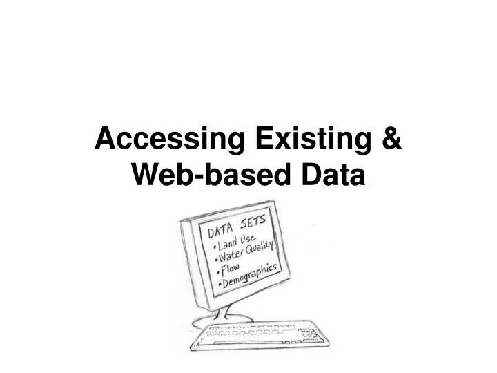
Accessing Existing & Web-based Data. Collection of existing data, Creation of a data inventory, and Identification of important gaps are essential early steps in the process of watershed planning and monitoring. See what’s already been done. Avoid duplication and repetition

E N D
Accessing Existing & Web-based Data
Collection of existing data, • Creation of a data inventory, and • Identification of important gaps • are essential early steps in the process of watershed planning and monitoring
See what’s already been done • Avoid duplication and repetition • Use existing knowledge • Build on experience to design monitoring program • 305(b) and 303(d) • TMDL reports • Source water assessments • Past watershed projects
Sample Data Sources • Watershed Coverages: • 8-digit: http://water.usgs.gov/GIS/huc.html • 14-digit:www.ncgc.nrcs.usda.gov/products/datasets/watershed • EPA Reach Files - 3 versions RF1, RF2, RF3-Alpha (most detailed) • www.epa.gov/waterscience/ftp/basins/gis_data/huc/ • Elevation Data • USGS: http://edc.usgs.gov/geodata • GIS data depot: http://data.geocomm.com • Land Use/Population • USGS: http://edc.usgs.gov/geodata • EPA: www.epa.gov/nrlc/nlcd.html • BLM Management Plans • www.blm.gov/planning/plans.html
Other Data Sources • State 303 (d) lists and TMDL reports • www.epa.gov/owow/tmdl • Point source discharge permits • www.epa.gov/enviro/html/pcs/index.html • Agricultural Statistics • http://www.nass.usda.gov/ index.asp • Septic tank use • http://quickfacts.census.gov/
Federal • Geodata portal http://gos2.geodata.gov/wps/portal/gos
Federal USEPA • Environmental Data Registry http://www.epa.gov/edr/ • Surf your watershed http://cfpub.epa.gov/surf/locate/index.cfm • STORET http://www.epa.gov/storet/
Federal USDA Geospatial Data Gateway http://datagateway.nrcs.usda.gov/ ·Ortho imagery ·Land use/land cover, cropland data ·Hydrologic units ·Topo, elevation ·Soils ·Climate
Federal USFWS http://www.fws.gov/data/datafws.html • Geospatial Data Inventory http://www.fws.gov/data/index.html • NWI http://www.fws.gov/nwi/ • Biological Data http://www.fws.gov/data/gisbio.html • Regional ecosystem coverages http://www.fws.gov/stand/standards/allshape.html
Federal USGS • NAWQA Data Warehouse http://infotrek.er.usgs.gov/traverse/f?p=NAWQA:HOME:1077806720594134922 • Real time streamflow data http://waterdata.usgs.gov/nwis/rt
IDEM Indiana Water Quality - Indiana's Integrated Water Monitoring and Assessment Report http://www.in.gov/idem/programs/water/305b/index.html • Monitoring strategy • Methods • Schedules • Reports (305(b)) • Summary data • 303d listhttp://www.in.gov/idem/programs/water/303d/index.html
IDEM Surface Water Quality Assessment Program Probabilistic Monitoring Program 5-yr rotating targeted basins; >38 sites randomly selected in basin E. coli, water chemistry, chlorophyll a, fish, macroinvertebrates, habitat Stacey L. Sobat IDEM-Office of Water Quality, Assessment Branch ssobat@idem.IN.gov
IDEM Surface Water Quality Assessment Program Surveys Section • Fixed Station Monitoring Program, • Trace Metals Sampling Program, • Source Identification Program, • E. coli Sampling Program, • Nutrients Sampling Program, • Special Projects Sampling Program Art Garceau IDEM-Office of Water Quality, Assessment Branch Survey agarceau@idem.IN.gov
IDEM Surface Water Quality Assessment Program Surveys Section Current reports http://www.in.gov/idem/programs/water/quality/surveys/index.html examples: 2000 Williams Ditch Low Dissolved Oxygen and Impaired Biotic Community Source Identification Study 2001 Blue Creek (Adams County) Elevated E. coli Counts Source Identification Study
IDEM Surface Water Quality Assessment Program Fish community sampling program 5-yr rotating targeted basins Fish community assemblage data for the Index of Biotic Integrity (IBI), Qualitative Habitat Evaluation Index (QHEI), in-situ water chemistry, and other parameters determined necessary (land use, etc.). Stacey L. Sobat IDEM-Office of Water Quality, Assessment Branch ssobat@idem.IN.gov
IDEM Surface Water Quality Assessment Program Fish Tissue Contaminant Monitoring Program 5 yr rotating basin targeting of sites on rivers, lakes, and reservoirs; emerging problem areas of the state; and water bodies never before monitored; regular revisit to 20 designated CORE river locations and near shore Lake Michigan; based on a probabilistic draw in wadable streams Chemical contaminant levels in fish flesh – metals, pesticides, organics James R. Stahl IDEM Office of Water Quality – Assessment Branch, Biological Studies Section jstahl@idem.IN.gov
IDEM Surface Water Quality Assessment Program Fish consumption risk assessment Advisory tables for Hg, PCBs for fish in IN rivers and streams, lakes, and Lake Michigan tribs/Ohio River 2007 Indiana Fish Consumption Advisory http://www.ai.org/isdh/dataandstats/fish/2007/advisory_groups.htm#group5 James R. Stahl IDEM Office of Water Quality, Assessment Branch, Biological Studies Section jstahl@idem.IN.gov
IDEM Surface Water Quality Assessment Program Lake Water Quality Assessment State: 500-600 lakes on 5 – 6 yr rotation Volunteers: >100 additional lakes Physical: transparency, temperature, cond, SS Chemical: DO, P, N Biological: chlorophyll a, algae) Carol NewhouseWilliam Jones IDEM/OWQ/Assessment Branch/BSS Indiana University cnewhous@idem.IN.govjoneswi@indiana.edu
IDEM Surface Water Quality Assessment Program Macroinvertebrate Community Assessment Program Sampling of wadeable streams and rivers at 890 sites on over 500 different rivers and streams including 90 of 92 counties to establish reference conditions. Concurrent aquatic habitat assessments conducted to either site specific habitat degradation or water quality causes. Steven A. Newhouse IDEM Office of Water Quality, Assessment Branch Biological Studies Section snewhous@idem.IN.gov
IDEM Surface Water Quality Assessment Program Sediment Contamination Monitoring Program 5 year rotating basins Chemical contaminant levels in composite grabs of surficial aquatic sediments from river, stream, reservoir and lake sediments. Many of the contaminants analyzed for may bioaccumulate in fish. James R. Stahl IDEM Office of Water Quality, Assessment Branch, Biological Studies Section jstahl@idem.IN.gov
Indiana Spatial Data Service http://www.indiana.edu/~gisdata/ Statewide aerial photos Topo maps, DEMs Municipal data Links to USFWS and USGS spatially-referenced data
Indiana GIS Atlas http://129.79.145.7/arcims/statewide_mxd/index.html Interactive maps and GIS downloads, e.g., • Ag census, crops • Soils • Geology • Aquifers, karst • Land use/land cover • Impervious surfaces • Brownfield, LUST, Superfund sites
Indiana Water Quality Atlas http://149.166.110.236/IWQA/ Collaboration of IDEM, Indiana Geographic Information Council (IGIC), Indiana Land Resources Council (ILRC), Upper White River Watershed Alliance (UWRWA), and Natural Resources Conservation Service (NRCS). Access to a wide variety of spatially and temporally referenced data through a common interface. Tools to combine, analyze, and display multi-dimensional data from a wide array of disciplines, e.g., spatial and attribute queries, on-line geocoding, and custom mapping.