Download
1 / 7
70 likes | 152 Views
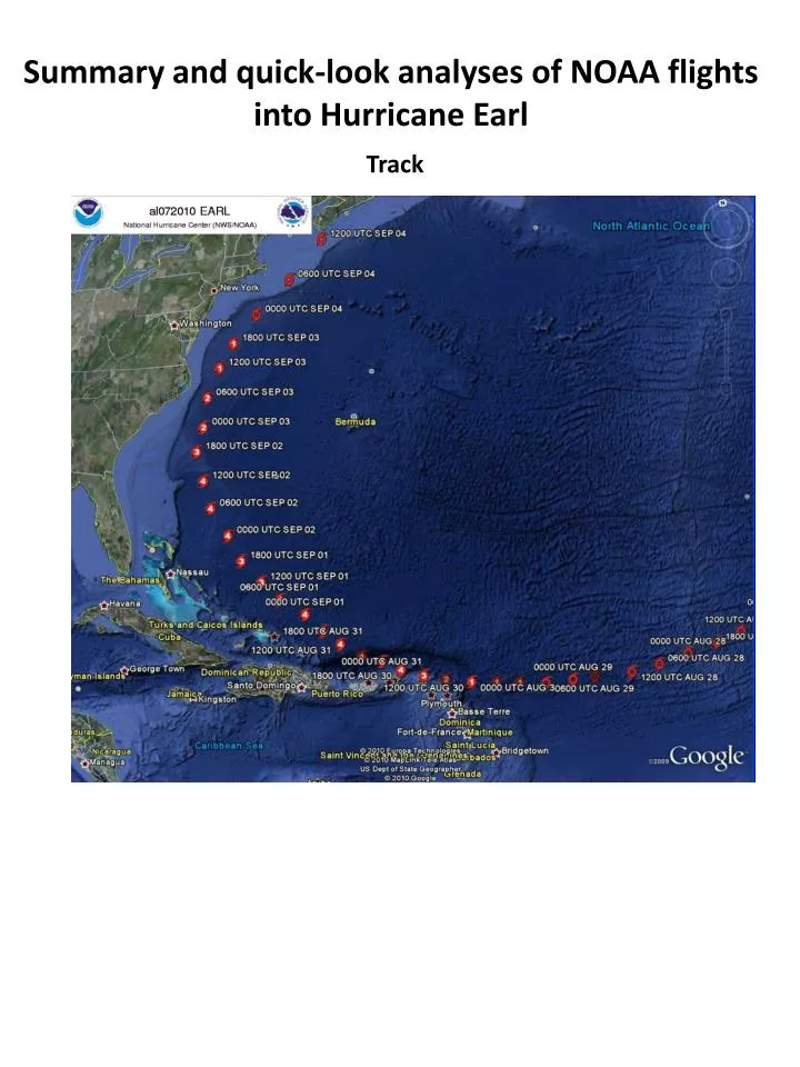
Summary and quick-look analyses of NOAA flights into Hurricane Earl. Track. Geographic coverage of P-3 flights. P-3 and G-IV coverage during intensity evolution. P-3 missions. G-IV missions. Evolution of axisymmetric tangential wind (shaded, m/s) during RI. 12:33Z Aug 30. 21:44Z Aug 28.

E N D
Summary and quick-look analyses of NOAA flights into Hurricane Earl Track
P-3 and G-IV coverage during intensity evolution P-3 missions G-IV missions
Evolution of axisymmetric tangential wind (shaded, m/s) during RI 12:33Z Aug 30 21:44Z Aug 28 13:21Z Aug 29 13:40Z Aug 30 23:03Z Aug 28 21:00Z Aug 29 21:23Z Aug 30 00:18Z Aug 29 22:13Z Aug 29 22:31Z Aug 30 09:39Z Aug 29 23:22Z Aug 29 23:33Z Aug 30 10:52Z Aug 29 00:44Z Aug 30 11:58Z Aug 29 11:17Z Aug 30
Evolution of wind speed (shaded, m/s) from 1-9 km altitude 0114Z Sept 2 2343Z Sept 2 9 km 9 km 5 km 5 km 1 km 1 km
Hodographs of environmental winds (m/s) from 0.5-12 km altitude 9 5 3 6 7 10 4 8 11 11 8 9 12 10 2 12 7 6 1 5 4 3 2 1
Summary • historic dataset collected in Hurricane Earl • nearly complete lifecycle, sampled at 12-h intervals for inner core by P-3’s, 24-h intervals for environment by G-IV • significant RI episode sampled by Doppler radar prior to, during, and after • steady-state period as a major hurricane sampled, including vortex interaction with increasing upper-level SW shear • weakening stages sampled, including period leading up to ET First thoughts on questions to address • how does vortex evolve during RI? Symmetric and asymmetric evolution? Kinematic and thermodynamic evolution? • what’s relative role of convective-, vortex-, and environmental-scale processes in RI? • how does mature hurricane respond to increasing vertical shear (tilt, wind field asymmetries)? • what is structural change during weakening and prior to ET? • and many more…..