Download
1 / 16
160 likes | 447 Views
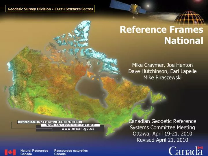
Reference Frames National. Mike Craymer, Joe Henton Dave Hutchinson, Earl Lapelle Mike Piraszewski Canadian Geodetic Reference Systems Committee Meeting Ottawa, April 19-21, 2010 Revised April 21, 2010. Outline. National NAD83(CSRS) realizations New NAD83 v6 Velocity Model

E N D
Reference Frames National Mike Craymer, Joe Henton Dave Hutchinson, Earl Lapelle Mike Piraszewski Canadian Geodetic Reference Systems Committee Meeting Ottawa, April 19-21, 2010 Revised April 21, 2010
Outline • National • NAD83(CSRS) realizations • New NAD83 v6 • Velocity Model • Velocity grid generation • Version numbering • Future improvements • Issues
NAD83 Realizations • Details provided in comments of CACS coordinate files on CGRSC FTP site Version (epoch) Frame Adopted Description _____________________________________________________________________ v0 Original 1986-1993 Horizontal adjustments v1 (1988.0) CSRS96 1996 Transformed from ITRF??, limited use v2 (1997.0) CSRS98* 1998 Transformed from ITRF96 v3 (1997.0) 2000 Transformed from ITRF97 v4 (2002.0) 2002 Transformed from ITRF2000 v5 (2006.0) 2009 Transformed from ITRF2005 * Adopted ITRF-NAD83 transformation (CSRS98=CSRS)
NAD83 v6 • Based on ITRF2008 • Transform ITRF2008 coordinates of CACS to NAD83 • 9 more CACS sites in ITRF2008 than ITRF2005BAIE, ESCU, KUUJ, PICL, QIKI, SASK, TUKT, VALD, WSLR • ITRF2008-NAD83 transformation • Updated using ITRF2008-ITRF2005 transformation parameters adopted by IERS (in collaboration with U.S.) • Update TRNOBS and add epoch transformation • Update epoch to 2010.0 • Will provide up-to-date coordinates, especially in GIA areas • U.S. will adopt 2010.0 epoch for all CORS coordinates • Propagate ITRF2008 coordinates to 2010.0 epoch and transform to NAD83
Velocity Model • Current version • Based on NAREF+CBN velocity solution using data up to Nov/06 • Sparse coverage in north • See last year’s CGRSC presentation for info on development and comparisons among CACS & CBN adjustments • Next version • Will be based on reprocessed NAREF+CBN data up to 2011.0 • Including 4th CBN epoch • Velocities will be more accurate & consistent • Will attempt to improve accuracy in spare areas with a GIA model • Collaborative research with Tom James (GSC)
Vertical Velocity Grid Need more sites
Velocity Grid • Generated with GMT (Generic Mapping Tools) • Adjustable tension continuous curvature surface gridding algorithm • Separate grids for north, east and vertical velocities • Std. deviations not generated by GMT • Grid interpolated with NTv2 bi-linear interpolator • Extended grid format to 3D • No std. deviations included in grid file • Residual fit of velocity field to grid (mm/y) North East Vertical Mean 0.0 0.0 0.0 StDev 0.4 0.4 0.6 Max 2.7 1.9 4.3 Min -1.9 -1.6 -4.0
Vertical Velocity Field Residual Fit to Grid (outliers removed) Need to improvevel field May need to tweak grid generation
Quebec PPP Tests • PPP results for GPS data at CACS & CBN sites in 2009.0 • Only a test of velocity field, not grid interpolation • PPP results in NAD83 v5 at 2009.0 and propagated to 1997.0 PPP(2009.0) – NAD83v2(1997.0) Ave (hz/vt) 3/3 cm Max(hz/vt) 5/14 cm PPP(1997.0) – NAD83v2(1997.0) Ave (hz/vt) 1/1 cm Max(hz/vt) 3/3 cm
Yukon PPP Tests PPP(2009.6) – NAD83v3.1(1997.0) Ave (hz/vt) 7/1 cm Max(hz/vt) 7/2 cm PPP(1997.0) – NAD83v3.1(1997.0) Ave (hz/vt) 2/2 cm Max(hz/vt) 3/3 cm • PPP results for GPS data along Dempster Highway in 2009.6 • PPP results in NAD83 v4 at 2009.6 and propagated to 1997.0 • Illustrates limitations of velocity grid in north
National Epoch TransformationSoftware • NET software • Propagates coordinates to different epochs using velocity grid • Fortran program based on NTv2 interpolation and grid format • Will also be implemented in TRNOBS (when updated to ITRF2008) • NETv1 – available now • Used in on-line PPP service • Command-line (Unix) program with no user prompts • Only reads GHOST code 4 records • Does not output GHOST/GeoLab-compatible records
National Epoch TransformationSoftware • NETv2 – to be completed end of this week • Simple Unix/DOS-style program with user prompts (similar to TRNOBS) • Will read/output standard GHOST/GeoLab records • UTM not currently supported • Is it needed? • Horizontal coordinates not affected much by epoch transformation • Main computational part isolated to one subroutine call for easier implementation in other software (same with new TRNOBS) • May take some time to add to GSD web site • Windows & Web GUI • Will allow for input and output of other formats (e.g., csv records) • Software library in development • Plan to use for NET, TRNOBS and other GSD software
Velocity Grid Version Numbering • Use same scheme as coordinate numbering • Velocities come from same solution as coordinates • Numbering scheme really represents version of solution/adjustment • Coordinate/velocity numbering scheme • NAD83 va.b.c.X.d…a = version of realization of NAD83b = version of CACS coordinates (0 for ITRF soln)c = version of CBN or primary horizontal control networkX = sub-network/agency ID (Canada Post codes); can be multiple charactersd = province/agency version numbering scheme; e.g., a new field can be added for each hierarchy of the network • Current version: v5.0.0 (based on NAREF+CBN solution)
Future Improvements • Update velocity solution • Reprocessing all NAREF+CBN data with IGS Repro1 orbits • Will provide more consistent velocities • Densify velocity field for future solutions • Need at least 3 years to get a reliable velocity estimate • Will try to obtain more GPS measurements west of Hudson Bay • Continuous and semi-continuous sites • Provide std. deviations for interpolated velocities • Based on residual misfit of velocity field to grid • Or use more sophisticated gridding algorithm that provides st. dev. • Incorporate GPS velocity field with GIA model • Constrain GIA model to GPS velocities • Evaluate new ICE-6G GIA model (constrained to CACS+CBN velocities)
Canada Land Surveys Issues • Coordinate epoch for Territories? • Published coordinates in a variety of NAD83 versions and epochs • Most coordinates in NAD83(Original) => no epoch defined • CACS/CBN/GPSonBM in NAD83(CSRS) at different epochs • Significant horizontal crustal motions in Yukon • Velocity field/grid inadequate in north – too sparse • Coordinate epoch for off-shore? • Positions are relative to shore-based control => use epoch of control • Epoch of shore control varies with province • PPP coordinates • Coordinates propagated to desired epoch using velocity grid • Will need to evaluate extrapolation of velocity grid to off-shore