Download
1 / 22
220 likes | 359 Views
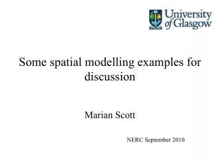
Some spatial modelling examples for discussion. Marian Scott NERC August 2013. ECCOMAGS Project. Funded by EC FPV – Nuclear Safety, Partners

E N D
Some spatial modelling examples for discussion Marian Scott NERC August 2013
ECCOMAGS Project • Funded by EC FPV – Nuclear Safety, • Partners • BfS (Germany), CEA (France), DEMA/DTU (Denmark), GBA (Austria), HSK (Switzerland), IGM (Portugal), SSI (Sweden), SGU (Sweden), STUK (Finland), SURRC (UK) • Airborne Gamma-ray Spectrometry (AGS) • To assess comparability of the European AGS systems • To assess comparability of AGS with ground-based systems.
Three spatial scales of measurement: • Ground based soil sampling • In-situ monitoring • Aerial monitoring • How comparable are the three sets of measurement? What issues do we need to consider (downscaling/upscaling)?
Pre-Characterisation-sampling plan for in-situ measurement • Expanding hexagonal sampling pattern showing the radial numbers and shell designations.
Example: Mapping SO2 over Europe and through time How has SO2 levels changed over time as a result of international agreements? How is SO2 distributed over Europe? A spatial model (over Europe), which may change over time- a spatio-temporal model
Example: River quality over a river basin How have nitrate levels changed over time as a result of changes in management and diffuse pollution control? How are nitrate levels distributed over river basin? A spatio-temporal model
some comments modelling over space and time is challenging- it lies at much of the controversies we have seen about climate change predictions some simple approaches are to look at each spatial location over time, to look at each spatial pattern at each timepoint A spatio-temporal model combines these approaches and may introduce an interaction, so that the change over time is not uniform over space
Spatial patterns of change- at river basin scale • Spatial patterns of change may be important • interpolation over the entire network from the stations is possible, but needs a spatial model-a river distance model (where river distance is defined as the shortest distance between two locations, along the river network) is useful the circles represent the stations on the network, clearly not spatially representative Joint work with David O’Donnell, Mark Hallard (SEPA), Adrian Bowman
Spatial patterns of change- at river scale- the river Dee euclidean Joint work with Stephen Reid, David O’Donnell, Mark Hallard (SEPA), Adrian Bowman river
Examples to try • try the Mururoa and Rosyth examples and look at the map that is produced and compare it with the truth- try various sampling strategies • Library(rpanel) • rp.mururoa() • rp.firth()
Summary • Spatial modelling is an important skill, since much environmental data are spatially registered • the complexities include describing the spatial correlation structure and considering if there is a temporal component how this can be modelled.