Download
1 / 21
210 likes | 330 Views
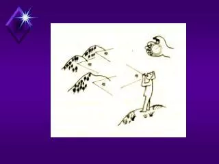
The Haunts of Cloud Climatologies; Diurnal cycles, Sensor scan angles, FOV size and, Sensor Calibrations. Donald Wylie Space Science and Engineering Center University of Wisconsin-Madison Madison, WI 53706. Local Noon. Average Diurnal Cycle of Low Clouds.

E N D
The Haunts of Cloud Climatologies; Diurnal cycles, Sensor scan angles, FOV size and, Sensor Calibrations Donald WylieSpace Science and Engineering CenterUniversity of Wisconsin-MadisonMadison, WI 53706
Local Noon Average Diurnal Cycle of Low Clouds Average Diurnal Cycle of High Clouds Sunrise Sunset Local Midnight Average Diurnal Cycle of Low Clouds Average Diurnal Cycle of High Clouds From B. Cairns, 1995, Atm. Res. 37, 133-146, Fig. 2
Smallest cycle magnitude (0.08 range) High clouds lag low clouds Largest cycle magnitude (0.30 range) From J.W. Bergman and M. L. Salby, 1996, J. Climate, 9, 2802-2820
Diurnal Cycle in NOAA HIRS Data From the data use in Wylie, Jackson, Menzel, and Bates, 2005, J. Climate, 18, 3021-3031 Boreal summer 1986-97 (June, July and August) Boreal winter (Austral summer) 1986-97 (December, January and February)
Sunrise Sunset
Sunset Sunrise
High Cloud Diurnal Cycle from GOES VAS Data Local Midnight 10% range Local Noon From D. P. Wylie and H. M. Woolf, 2002, Monthly Wea. Rev., 130, 171-179
Diurnal Cycle Summary Cloud studies that use visible data will over report cloud cover over land and under report cloud cover over oceans from their diurnal cycles. Magnitude of the error is around 2-10%. Averaging of the ascending and descending orbits with an analysis technique that does not depend on solar reflection measurements, will greatly reduce the diurnal cycle errors. Diurnal cycles in high clouds mainly occur where there are strong diurnal cycles in cumulus clouds – sub-tropical mountain slopes and coastal land areas. The high cloud maxima lag the low cloud maxima by 4-6 hours. Over oceans high cloud diurnal cycles are weak and absent in many areas. In winter diurnal cycles in high clouds are usually absent.
Change of Cloud Frequencies with Scan Angle (Tropics) 45°
The Increase in Reported Cloud Cover from Nadir to the Highest Scan Angle
Reasons why the reported cloud cover increases with scan angle 1. Slanted path through atmosphere increases cloud optical depth by 141% or by a factor of 1.41. This could increase reported cloud cover by 0.01-0.02. 2. FOV size increases by a factor of 2. Using pairs of HIRS FOVs this will increase cloud cover reported by 0.06. vs. vs. Counting a pair as cloudy if either is cloudy. Count pixels individually
HIRS will recognize the cloud HIRS will not find the cloud 2% of clouds 4% of clouds
GLAS There are many small clouds but it’s the It’s the large ones that account for the coverage.
All Clouds High Clouds
Sensor calibration Use AIRS hyper-spectral measurements to estimate HIRS
Summary • Diurnal cycles can cause errors of 2% to 10% in reported cloud • cover. The largest error is when only the day time part of the • 2 pm NOAA orbit is used. • 2. Scan angle - changes reported cloud cover by 7-24%, but averaging • all FOVs from all angles changes together biases cloud cover by only 3%. • 3. Holes and clouds below the 20 km FOV size of HIRS cause • over reporting of cloud cover where the clouds are cold, • but under reporting of clouds that are very small and optically • thin at all altitudes. The second error cancels part of the first. • 4. Sensor calibration problems – a preliminary comparison of HIRS-3 • to AIRS shows +0.3 to +0.9 K possible biases. We need to compare HIRS-2 on NOAA 14 to AIRS to see if there is a bigger bias or if • there is a bias of the opposite sign.