Download
1 / 36
360 likes | 365 Views
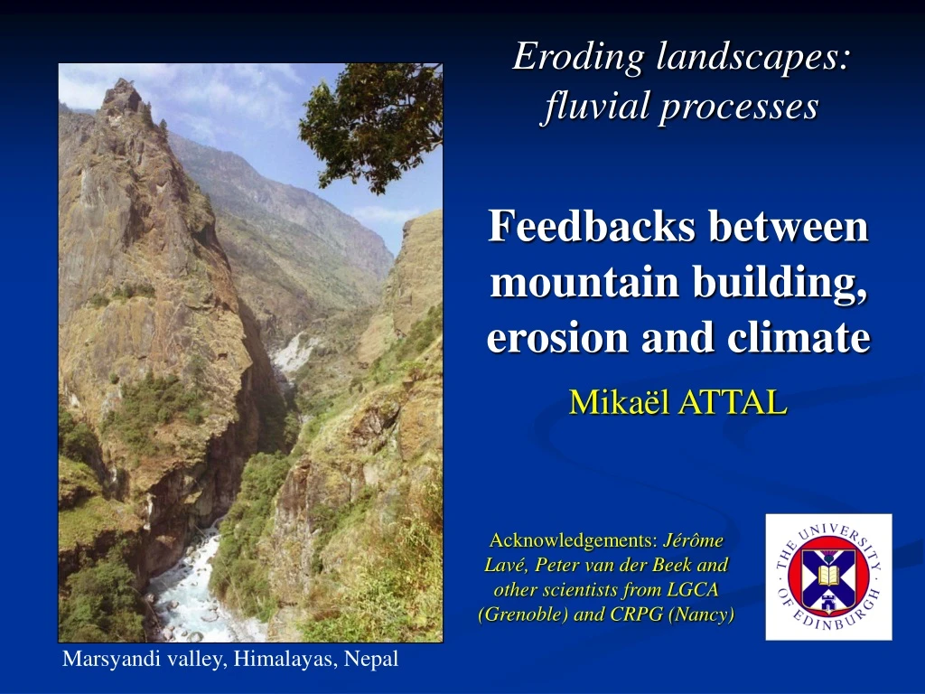
This lecture explores the relationship between mountain building, erosion, and climate, focusing on the Marsyandi valley in the Himalayas, Nepal. It examines the role of erosion in shaping the geometry and structure of mountains and the extent to which it affects deformation. The critical taper theory and examples from different mountain ranges are discussed.

E N D
Eroding landscapes: fluvial processes Feedbacks between mountain building, erosion and climate Mikaël ATTAL Acknowledgements: Jérôme Lavé, Peter van der Beek and other scientists from LGCA (Grenoble) and CRPG (Nancy) Marsyandi valley, Himalayas, Nepal
Lecture overview I. Introduction: mountain building and the critical taper theory. II. Erosion controls the geometry of mountains? III. Erosion controls the structure of mountains? 1) Orographic effect. 2) The curious case of the Himalayas. IV. To which extent does erosion affect deformation in mountains? “Revisiting river anticlines”.
I. Introduction: mountain building and the critical taper theory.
Convergence friction accretion 1. Subduction
Example : Barbados accretionary prism The Atlantic plate plunges under the Caribbean plate Source: C. Beck, Chambery
Example : Barbados accretionary prism Structure of the prism (seismic imagery + bathymetry) Source: C. Beck, Chambery
Convergence friction accretion 2. Collision Building of the Alps (schematic representation): Structural map of the Alps The “piémontaise” units (dark green) correspond to the relicts of the Alpine ocean: to the west, units are European; to the east, they are African Source: "GEOL-ALP" (http://www.geol-alpes.com), Maurice GIDON, 1998-2003
Geological cross-section of the Alps (Schmid, 2000) New tectonic interpretation of the ECORS-CROP profile NW SE Flexural basin African Units European Units Suture zone
Geological cross-sections across the Himalayas Indus-Tsangpo suture is what remains of the ocean which has been closed due to the convergence and collision of the Asia and India plates. To the south, Indian units; to the north, Asian units. Zhao, 1993 Lavé & Avouac, 2001
The critical taper theory “Mechanics of Fold-and-Thrust Belts and Accretionary Wedges” Davis, Suppe & Dahlen, JGR, 1983 Characteristics of the accretionary wedge: - basal decollement, - important compressive deformation above decollement, minor deformation below, - taper shaped.
Mechanical model Coulomb failure criterion : τ = shear traction at failure, S0 = cohesive strength, μ = coefficient of friction, σn = normal traction, pf = pore fluid pressure.
The critical taper The Mohr diagram is used to solve the equation and describe the shape of the taper
α β and μ = coefficient of friction (μb = basal coef.) where α Linear relationship between α and β β
α β Topographic profiles (Western Range of Taiwan): values of α
α β Determination of the parameters producing the best fit between model and field data
α β Other examples: values of α and β
α β Constraining the parameters Linear relationship between α and β
A B C α α α β β β Modification of the equilibrium Example: mountain building A: subcritical / “stable” α can increase. X C B: critical taper. α cannot increase anymore. If α > critical value, the taper becomes supercritical / unstable and collapses. B A C: to carry on growing, the taper cannot steepen anymore so it has to “expand” horizontally as well as vertically.
II. Erosion controls the geometry of mountains? D Steady-state: FE = FA C B A A: no topography, FE = 0. B: mountain grows FE increases. C: critical taper stage, slope α cannot increase anymore. D: FA = FE steady-state. The topography does not evolve anymore. Flux D FA Willett & Brandon, Geology, 2002 C B FA= flux of material accreted, FE = flux of material eroded. FE A Time
II. Erosion controls the geometry of mountains? F D D-E Steady-state: FE = FA A D: FA = FE steady-state. E: drop in FE (e.g., climate change with less rain) erosion rate decreases the topography is not at steady-state anymore. F: mountain grows again FE increases until a new steady-state is reached (FA = FE) Flux D F FA Willett & Brandon, Geology, 2002 C B E FA= flux of material accreted, FE = flux of material eroded. FE A Time
II. Erosion controls the geometry of mountains? Steady-state: FE = FA Erosion controls the GEOMETRY of the mountain range Remark: “real” mountains are more complex: - presence of discontinuities (e.g. faults), - different lithologies (more resistant in the core of the range), - change in crust rheology (e.g. lower crust partially molten under Tibet no basal friction). Willett & Brandon, Geology, 2002 FA= flux of material accreted, FE = flux of material eroded.
II. Erosion controls the geometry of mountains? Evolution of the Alps (Schlunegger et al., 2001, 2002) Schlunegger et al., 2001
II. Erosion controls the geometry of mountains? Evolution of the Alps (Schlunegger et al., 2001, 2002) Schlunegger et al., 2001 Crystalline rocks exhumed ~20 Ma ago decrease in erosion rate range grows and widens.
II. Erosion controls the geometry of mountains? F D D-E Steady-state: FE = FA A D: FA = FE steady-state. E: drop in FE (e.g., more resistant rocks exposed) erosion rate decreases the topography is not at steady-state anymore. F: mountain grows again FE increases until a new steady-state is reached (FA = FE) Flux D F FA Willett & Brandon, Geology, 2002 C B E FA= flux of material accreted, FE = flux of material eroded. FE A Time
III. Erosion controls the structure of mountains? 1) Orographic effect. Willett et al., 1993
III. Erosion controls the structure of mountains? 1) Orographic effect. Dominant wind/rain on retro - side Dominant wind/rain on pro - side Willett, JGR, 1999
III. Erosion controls the structure of mountains? 1) Orographic effect. Field data: Southern Alps, New Zealand Rainfall Metamorphism grade Willett, JGR, 1999
III. Erosion controls the structure of mountains? 1) Orographic effect. Field data: Olympic Mts, NW USA Metamorphism grade Rainfall Laumontite (L), prehnite-pumpellyite (Pr+Pu), pumpellyite (Pu), and chlorite-epidote (Cl+Ep). Willett, JGR, 1999
III. Erosion controls the structure of mountains? 1) Orographic effect. Southern Alps, New Zealand: erosion on the retro side Willett, JGR, 1999
III. Erosion controls the structure of mountains? 1) Orographic effect. Olympic Mts, NW USA: erosion on the pro side Willett, JGR, 1999
III. Erosion controls the structure of mountains? 2) The curious case of the Himalayas Break NOTE: deadlines for essays = Monday 23rd March, 16:00
III. Erosion controls the structure of mountains? 2) The curious case of the Himalayas (Patriat & Achache, 81)
III. Erosion controls the structure of mountains? 2) The curious case of the Himalayas India – Asia collision mm/yr ~50 mm/yr at the moment Convergence rate India / Asia (Patriat & Achache, 81)
The highest mountain range + the largest high-altitude plateau on Earth (Tapponnier et al., 2001)