Download
1 / 21
210 likes | 221 Views
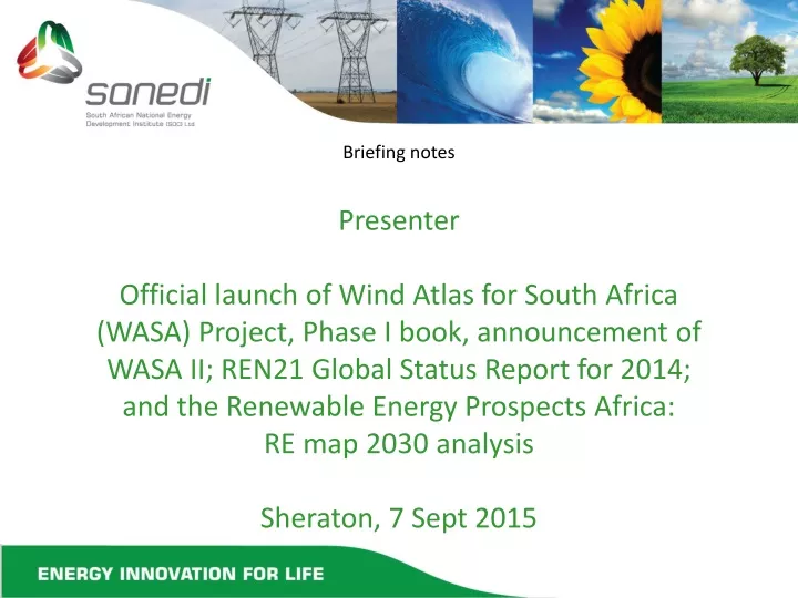
Briefing notes Presenter Official launch of Wind Atlas for South Africa (WASA) Project, Phase I book, announcement of WASA II; REN21 Global Status Report for 2014; and the Renewable Energy Prospects Africa: RE map 2030 analysis Sheraton, 7 Sept 2015. Outline.

E N D
Briefing notes Presenter Official launch of Wind Atlas for South Africa (WASA) Project, Phase I book, announcement of WASA II; REN21 Global Status Report for 2014; and the Renewable Energy Prospects Africa: RE map 2030 analysis Sheraton, 7 Sept 2015
Outline • Historical Wind Atlases for South Africa • WASA Phase 1 methodology • WASA Phase 1 main results • WASA Phase 1 Application • WASA Phase 1 Highlights • WASA II • Conclusion • Acknowledgements and Implementation team
Historical South African Wind Atlases SARERD, 2001 DME; R. Diab 1995 • Tripod Review of Wind Energy Resources in South Africa (2002) concluded: • These studies are inconclusive and under estimate the true wind energy potential as weather measurement stations at 10 m were used and in may cases these stations are shaded by buildings etc from measuring the true wind potential; and • Recommended that a dedicated wind energy measurement program be • undertaken to confirm South Africa’s true wind energy potential
Wind Atlas for South Africa (WASA Phase 1) : The Wind Atlas for South Africa is a Capacity Development and Research Cooperation Initiative of the South African Department of Energy (DoE). • Phase 1 (2009 – 2014) covers Western Cape and parts of Northern and Eastern Cape provinces and were funded by the Global Environment Facility (GEF) R8 million with UNDP support through the South African Wind Energy Programme (SAWEP) and co-funded by Danida (DKK9.9 million). • SANEDI(South African National Energy Development Institute) • executing agency – contracting the implementing partners • coordination and dissemination • UCT CSAG (Climate System Analysis Group, University of Cape Town) • mesoscale modelling • CSIR(Built Environment, Council for Scientific and Industrial Research) • Measurements, microscale modelling, application • SAWS(South African Weather Service) • extreme wind assessment • DTU Wind Energy* (Dept of Wind Energy, Technical University of Denmark) • partner in all activities
WASA Phase 1 Methodology Six work packages (WPs) WP1 Mesoscale Modelling WP2 Wind Measurements WP3 Microscale Modelling WP4 Application WP5 Extreme Wind Atlas WP6 Documentation & Dissemination, see: http://www.wasaproject.info
WASA Main Results: Wind Measurements for Verification“you can’t manage what you can’t measure” 10 minutes data and graphs available online: http://www.wasa.csir.co.za Data download: http://wasadata.csir.co.za/wasa1/WASAData • Table showing the mean wind speed for some of the WASA sites for the first year and after three years’ measurements with an excellent data recovery rate. The measured wind data is used to create the statistics of the wind at each of the WASA meteorological stations that are used to verify the Numerical Wind Atlas.
WASA Main Results cont: Verified Numerical Wind Atlas (VNWA) VNWA for South Africa, based on WRF, launched in April 2014 (generalised wind climate – flat terrain, 3 km x 3 km grid spacing) (WRF Weather Research & Forecasting model)
WASA Main Results cont: Extreme Wind Atlas 1:50 yr 10 min wind speed [m/s] @ 10 m above ground level (standard conditions)
Application: Extreme Wind Atlas • Providing input data 1:50 yr 10 min average wind speed (standard conditions) in calculating the 10 minute average wind speed at hub height that is used to determine the Wind Turbine Class that would stand the extreme winds. • Outside energy sector – Informing national building standards, since wind constitutes most critical environmental loading affecting structural design of built environment in South Africa
Application cont. Wind time series data • The wind time series are particularly useful: • to study the annual, seasonal and diurnal variations in wind resources; • as input to power system modelling; • to study the geographical cross correlation of wind across South • Africa; and • for long-term corrections of the wind resources given by the WRF • wind climate files.
Application cont. WASA Large Scale High Resolution Wind Resource map Large-scale high-resolution wind resource map launched in April 2014 (local wind climate, 250 m grid spacing) with the mean wind speed
WASA Large Scale High Resolution Wind Resource map usage • The high-resolution wind resource map depicts the local wind climate that a wind turbine would encounter. It also offers important benefits for developers, policy makers, utilities and the industry, including the following: • Saves time and costs as the bankability of a potential wind farm site can now be estimated and physical wind measurements are only undertaken for bankable wind sites. • Levels the playing field between small and large industry players to identify and develop wind hot spots. • Assists Government in estimating the real wind resource potential. • Identifies possible wind development zones in line with the strategic environmental assessment (SEA) studies or in line with frameworks. The DEA’s SEA for solar photovoltaic and wind is an example of such an SEA study and is available at http://www.csir. co.za/nationalwindsolarsea/ • Long-term grid planning to connect with high-potential wind development areas. • Wind farm planning in positioning (micro siting) the wind turbines for optimal wind exposures.
WASA Phase 1 Highlights • Website user statistics captured through registration on http://wasadata.csir.co.za/wasa1/WASAData 1759 registered users from 66 countries with 55150 downloads (April 2015) • Some projects, programs etc referencing, making use of WASA: Dept of Environmental Affairs (DEA) Strategic Environment Assessment (SEA) study making use of WASA in the identification of wind development zones (https://redzs.csir.co.za/). World Bank Energy Sector Management Assistance Programme, Renewable Energy Resource Mapping Initiative. 2013. Renewable Energy Mapping: Wind in Pakistan, South Asia Region, Project ID: P146140, Selection: 1118422. Palestinian Energy Authority. 2013. Request for Proposal for the Energy Section Assistance in Palestine, Phase V (RFP No. Phase V-PEA/CS-W).
WASA Phase 1 Highlights cont. Feasibility of the WWF Renewable Energy Vision 2030 - South Africa http://www.wwf.org.za/media_room/publications/?14461/feasibility-of-the-wwf-renewable-energy-vision-2030---south-africa CSIR Energy Centre, SANEDI Eskom PV & Wind Aggregation study (to be presented at SAIREC) Danish RE EE Program: System adequacy and reserve margins with increasing levels of variable generation WASA is a technical partner and included in the IRENA Global Atlas for Renewable Energy(http://irena.masdar.ac.ae/?map=405) and used in the verification of the EUDP Global Wind Atlas (globalwindatlas.com) to feature in the IRENA Global Atlas for Renewable Energy.
WASA Phase 1 Highlights cont. Courses at Department of Wind Energy, Technical University of Denmark (DTU), making use of WASA: WasP, WAsP e-learning courses, DTU course 46200 on Planning and Development of Wind Farms The WASA is the first project that used the DTU wind resource mapping tool, Frogfoot, successfully at a large scale when it created the large-scale high-resolution WASA resource maps. The WRF- based WASA wind atlas is the first wind atlas study where the generalisation has been carried out on the WRF-model output with excellent results. WASA in the press: http://www.sanews.gov.za/south-africa/wind-resource-map-boost-renewable-energy-efforts http://www.energy.gov.za/files/media/pr/2014/PressRelease-WASA-Seminar-08April2014.pdf http://www.engineeringnews.co.za/print-version/sa-wind-atlas-to-be-expanded-after-first-phase-highlight-priority-zones-2014-04-08
WASA II • Phase 2 (2014 to 2018) to cover the remaining areas of Eastern Cape, KZN and Free State provinces and is funded by the Government of Denmark (DKK 12 million) with an additional 5 wind measurement masts to become operational by Sept/Oct 2015. • SAWEP Phase 2 (USD 3.5 mill) include GEF funding with UNDP support, amongst other, for an interim WASA II Wind Atlas and Resource map (2016) as well as expanding WASA II to cover the remaining areas of the Northern Cape province. • The Weather Research and Forecasting model (WRF) that was characterized and parameterized for wind resource assessment during WASA Phase 1 will be used and further refined in WASA II.
Conclusion • State of the Art Wind Atlas method • Public domain through websites • Transparent methodology no “black box” • Verified with proper wind measurements, traceable • Data + Application, Guidelines, Training • Level playing field • Save time and money • Not a substitution for mandatory wind measurements • http://www.wasaproject.info/ (information, presentations etc) • http://www.wasa.csir.co.za (wind measurement mast online graphs) • http://wasadata.csir.co.za/wasa1/WASAData (final reports, guides, data downloads) • WRF http://veaonline.risoe.dk/wasa (WRF wind forecasting) • Numerical Wind Atlas database access through Tadpole • http://wasaclimates.eu/Tadpole/Viewer?gid=08aee5e5-e31f-416a-ad12-9a7a4d26f92e
Acknowledgements • WASA Phase 1 Funders: Global Environment Facility (GEF) with UNDP support (R8 million) Co funded by Danish International Development Agency (DANIDA) (DKK9.9 million) through the Danish Embassy • WASA Project Steering Committee (PSC): Noma Qase (DoE), Surprise Zwane (DEA), Dee Fischer (DEA), Somila Xosa (DST), Tumi Mailula (DST), Maria Mbengashe (UNDP), T Mali (SANEDI), A Otto (SANEDI) Past members: Carsten Laugesen, Winnifred Mandhlazi, Dominic Milazi, Jacques Pretorius • WASA Phase 1 Contributors: Claire L Vincent (DTU), Jake Badger (DTU), Joakim Refslund (DTU), Patrick Volker (DTU), Karen Enevoldsen (DTU), Michael Rasmussen (DTU), Poul Hummelshøj (DTU), Steen Arne Sørensen (DTU), Søren W Lund (DTU), Mark C Kelly (DTU), Morten Nielsen (DTU), Tom Cronin (DTU), Charlotte McBride (SAWS), Snyman Sekele (SAWS), Yvette Spamer (formerly with CSIR), Adam Goliger (CSIR), Johan Retief (US) • South African Wind Energy Association (SAWEA): Johan van den Berg (CEO) and team
Minister of Energy, Tina Joemat-Pettersson (speech delivered by Acting DG at the Windaba 2014) “I am now happy to say the key results of the First Phase that have been independently verified by a team of scientists working on the Wind Atlas project of South Africa using both numerically modelled data and practical observational methods and analysis, confirm that South Africa has an excellent wind resource” The WASA Phase 1 Book can be downloaded here http://www.wasaproject.info/docs/WASABooklet.pdf