Download
1 / 48
480 likes | 488 Views
This text discusses the hydrologic cycle, human uses of freshwater, and the components of freshwater ecosystems. It also explores the different life zones in freshwater and the importance of inland wetlands.

E N D
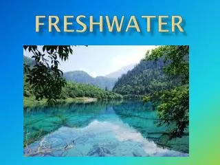
Freshwater Human uses and Ecosystems
The Hydrologic Cycle Figure 3-26
Water’s Unique Properties • H bonds – high surface tension = capillary action =move against gravity • does not change temp quickly. • carries energy • Universal solvent. • expands when it freezes.
ECOSYSTEM COMPONENTS • Terrestrial = biomes • Aquatic = life zones Figure 3-9
Human Water Uses • Agricultural • Industrial • Residential
Surface water • Ex - streams, rivers, and lakes • Watershed – area of land where all of the water drains Ex. Rio Grande River originates from snow in Rocky Mtns in CO 1800 miles from Gulf of Mexico
Groundwater • Aquifers –underground layer of permeable rock, sediment, or soil that allows water to flow through • Water Table –ground below saturated with water • Renewability – slow circulation (300 to 4,600 years).
Aquifers cont. • Recharge area – land where water passes downward into aquifer • Confined aquifer – surrounded by impermeable rock layers (Edward’s) • Unconfined aquifer – aquifer w/water table, reaches surface water • Human impact: runoff with chemicals; depletion of water stores
FRESHWATER LIFE ZONES: Figure 6-14
Freshwater Streams and Rivers:From the Mountains to the Oceans • Water flowing from mountains to the sea creates different aquatic conditions, habitats and ecosystems. Figure 6-17
Natural Capital Ecological Services of Rivers • Deliver nutrients to sea to help sustain coastal fisheries • Deposit silt that maintains deltas • Purify water • Renew and renourish wetlands • Provide habitats for wildlife Fig. 12-11, p. 267
Headwater Stream Characteristics • Narrow • Cold, clear water • Waterfalls and rapids • High DO • Fish like trout
Downstream Characteristics • Slower-moving, warmer H2O • Less DO • Algae and cyanobacteria more prevalent.
Life in Layers • Life in aquatic systems layers: organisms determined by temperature, sunlight, DO, nutrients.
Lakes: Water-Filled Depressions • Littoral zone (near shore, shallow, with rooted plants). • Limnetic zone (open, offshore area, sunlit). • Profundal zone (deep, open water, too dark for photosynthesis). • Benthic zone (muddy bottom of lake, nourished by dead matter).
Sunlight Painted turtle Green frog Blue-winged teal Muskrat Pond snail Littoral zone Limnetic zone Diving beetle Plankton Profundal zone Benthic zone Northern pike Yellow perch Bloodworms Fig. 6-15, p. 137
Amount of sunlight • Varies, affecting producers/consumers • Summer: direct sunlight deeper into water • Winter: light may not reach as deep into water
Thermal Stratification • The temperature difference in deep lakes where there are warm summers and cold winters.
Lakes: Fall and Spring Turnover • During fall and spring in deep temperate zone lakes, the water becomes stratified into temperature layers and will overturn. • Equalizes the temperature at all depths. • O2 is moved from the surface to the lake bottom and nutrients from the bottom are brought to the top. • What causes this overturning?
Turnover • In the summer sunlight warms surface waters creating a thermocline - middle layer of water that acts as a barrier preventing nutrients and dissolved oxygen from easily moving through these layers. • In fall when water gets colder it sinks and mixes!!! • In winter water freezes and floats on top. • In spring ice melts and cold heavy water sinks and mixes!!!!
Nutrients from a lake’s environment effect the type of and numbers of organisms it can support. • Oligotrophic (poorly nourished) lake: • Usually newly formed lake with small supply of plant nutrient input.
An abundance of nutrients • Eutrophic (well nourished) lake: Over time, sediment, organic material, and inorganic nutrients wash into lakes causing excessive plant growth. • Cultural eutrophication: Human inputs of nutrients from the atmosphere, urban and agricultural areas can accelerate the eutrophication process.
Pick a coastal state • With a partner, research a river and lake in a coastal state. Research: • - ecological importance • -economic importance • -river headwater vs downstream comm. • -lake life, turnover
Freshwater Inland Wetlands • Places “inland” where land is covered all or part of the time with water. • Excludes lakes reservoirs, streams Figure 6-18
Marshes • Areas of temporarily flooded, often silty land beside a river or lake.
Swamps • Lowland regions permanently covered with water.
Hardwood Bottomland Forest • Areas down by rivers or streams where a lot of hardwoods – oaks - grow.
Prairie Potholes • Depressions that hold water out on the prairie, especially in Canada. Excellent duck habitat.
Peat Moss Bog • Wet areas that over time fill in with water/ sediment/organic material (the last stage of succession is peat moss). Can be very deep.
Freshwater Inland Wetlands: Vital Sponges • Filter and degrade pollutants. • Reduce flooding and erosion by absorbing slowly releasing overflows. • Help replenish stream flows during dry periods. • Help recharge ground aquifers. • Provide economic resources and recreation.
Freshwater Inland Wetlands: Vital Sponges • Same important value as coastal wetlands. Figure 6-18
Impacts of Human Activities on Freshwater Systems • Dams, cities, farmlands, and filled-in wetlands alter and degrade freshwater habitats. • Dams, diversions and canals have fragmented about 40% of the world’s 237 large rivers. • Flood control levees and dikes alter and destroy aquatic habitats. • Cities and farmlands add pollutants and excess plant nutrients to streams and rivers. • Many inland wetlands have been drained or filled for agriculture or (sub)urban development.
Colorado River Basin • There are dams & reservoirs that feed from the Colorado River to San Diego, LA, Palm Springs, Phoenix & even Mexico. • Causes incredible problems.
Wetland Draining Figure 6-19
Case Study:Dams, Wetlands, Hurricanes, and New Orleans • Dams and levees have been built to control water flows in New Orleans. • Reduction in natural flow has destroyed natural wetlands. • Causes city to lie below sea-level (up to 3 meters). • Global sea levels have risen almost 0.3 meters since 1900.
Natural Capital Degradation Coral Reefs Ocean warming Soil erosion Algae growth from fertilizer runoff Mangrove destruction Bleaching Rising sea levels Increased UV exposure Damage from anchors Damage from fishing and diving Fig. 6-12, p. 135
Effects of Human Activities on Marine Systems: Red Alert • Human activities are degrading destroying or many ecological and economic services provided by the world’s coastal areas. Figure 6-13
Water Pollution Problems in Streams • Compare to lake – think of pond ecosystem gizmo Figure 21-4
Dissolved Oxygen (DO) • Needed by aquatic organisms • As level of sewage, bacteria, and other microorganisms bloom because of increase of nutrients: • Less O2 for fish and other consumers • Organisms die • Only a few fish species can survive in water less than 4ppm at 20°C.
Problems for consumers • Low oxygen levels, fish are less active and don’t grow as large as in higher oxygen levels. • Bottom-feeder fish, like catfish, can tolerate low oxygen (2-4ppm). Trout can not survive same conditions. • Can happen in rivers, lakes, ponds, oceans, estuaries, etc
Industry Nitrogen oxides from autos and smokestacks, toxic chemicals, and heavy metals in effluents flow into bays and estuaries. Cities Toxic metals and oil from streets and parking lots pollute waters; Urban sprawl Bacteria and viruses from sewers and septic tanks contaminate shellfish beds Construction sites Sediments are washed into waterways, choking fish and plants, clouding waters, and blocking sunlight. Farms Runoff of pesticides, manure, and fertilizers adds toxins and excess nitrogen and phosphorus. Red tides Excess nitrogen causes explosive growth of toxicmicroscopic algae, poisoning fish and marine mammals. Closed shellfish beds Closed beach Oxygen-depleted zone Toxic sediments Chemicals and toxic metals contaminate shellfish beds, kill spawning fish, and accumulate in the tissues of bottom feeders. Oxygen-depleted zone Sedimentation and algae overgrowth reduce sunlight, kill beneficial sea grasses, use up oxygen, and degrade habitat. Healthy zone Clear, oxygen-rich waters promote growth of plankton and sea grasses, and support fish. Fig. 21-10, p. 505
“Dead Zones” • Aka oxygen-depleted zones • Sedimentation & algae overgrowth reduce sunlight and kill beneficial sea grasses, use up oxygen, and degrade habitat • Red/brown tides – excessive nutrients causes explosive growth of algae (some produce toxins), killing fish and marine mammals.
Example Northern Gulf of Mexico • A large zone of oxygen-depleted water forms for half of the year in the Gulf of Mexico as a result of HAB. (Harmful algal blooms) • Cause might be nutrient rich & sediment water from Mississippi river