Download
1 / 24
240 likes | 407 Views
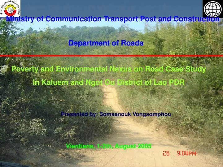
Ministry of Communication Transport Post and Construction. Department of Roads. Poverty and Environmental Nexus on Road Case Study In Kaluem and Ngot Ou District of Lao PDR. Presented by: Somsanouk Vongsomphou. Vientiane, 1-2th, August 2005. Contents of Case Study. Introduction Objectives

E N D
Ministry of Communication Transport Post and Construction Department of Roads Poverty and Environmental Nexus on Road Case Study In Kaluem and Ngot Ou District of Lao PDR Presented by: Somsanouk Vongsomphou Vientiane, 1-2th, August 2005
Contents of Case Study • Introduction • Objectives • Methodology of Study • Profile of Study Area • The Result of Study Area • Comparison between Villages have Road and no Road Access • The Linkage between Environment, Poverty and Road Access • Conclusion and Suggestion
Introduction: • PEN phase I, completed in October 2002: the finding showed a strong • linkages between poverty and environment the following indicators: • deforestation, fragile land, outdoor and indoor air pollution, access to clean • water and sanitation which this work had mainly driven by immediate • research objectives by the World Bank • PEN II work has to be undertaken at the disaggregated/local levels like district, • village and households in order to clarify poverty environment linkages • This case study mostly relevant data/information and policy guideline for the • National and Provincial Committee on Poverty Eradication through the access • to roads and other services
NGPES: Investment in infrastructure particularly road, it continue to be an • essential component in promoting economic growth nation wide, • comprehensive infrastructure is essential to help farmers access improved • services and local, national and regional market. • Because on above reasons, this case study have to find the relationship • between the Environmental, poverty on Road Development.
- The Objectives: + This case study implemented in 2 poorest districts (Representative of first priority of the 47 poorest Districts: Kaluem and Yot Ou) + To study the natural resources status (NTFP) in the villages with road access and without road access. + To study the livelihood of poor villages and household with the road access and without. + To study the decline of NTFP between villages with road and without road access
- Methodology: + Questionnaires were used for interviewing in Villages chief and households + Observation in the field + Group discussion in Provinces, Districts and villages • Main contents of questionnaire: + Poverty status in villages with road and without road + NTFP status in villages with road and without + Types of transportation use in 2 districts
- Villages selection: - Data Analysis: + Selected the villages with road and without road (6 villages in Kaleum “ 3 Villages o road access” and 4 villages in Ngot Ou “ 1 villages no road and 1 village with new road”).Selected new and focal villages.Selected 142 households for 2 districts (kaluem = 70 HH, Ngot Ou = 72 HH) + Secondary data was used: road network, maps, books, reports, Govn. Policy documents. + SPSS and Excel software was used for data interpretation.
Ngot Ou District Vietnam Saravan Dakchym Lamam Kaluem District National Road Network Profile of Study Areas
Vietnam Saravan Ban Vak Nuea Ban Yorn Ban Hat Pae Ban Chale Ban Pakxai Ban Tak Dakchym Lamam Kaluem Map
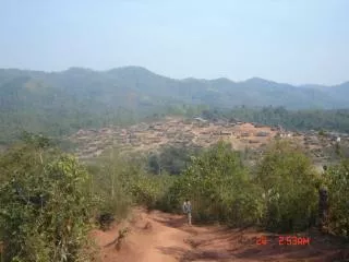
Kaluem District Kaluem District located in the southern part of Sekong Province, Land cover 351,750 Km2 = 95% is mountainous areas, population of 12, 053 of which 6,300 are women, Forest covered 323,400 ha, and agriculture and livestock land there is 2,330 ha of all district area. The paddy field there is 181.57 ha and shifting cultivation area is 699.5 ha within district area. and rainy season started early from April to October, it cause of flooding but some time it was drought. Most of population live along the Sekong River, remote and mountain areas mainly 8 ethnic groups namely Katou, Ngey, Chatong, Ta Oy, Ta Lieng, Pako, Alak and Lao Loum. Road Statistic
Ban Long Thang Ban Cheow Chai Ban Som Heung Ban La Ngot Ou Map
Ngot Ou District Ngot Ou District is located in the north-western part of the Phonsali Province, is the sole district the provinces sharing a border with China and Vietnam It occupies an area of 3,318 km2; there are 91 villages, with population of 27, 235 people and 13, 400 women, 4,328 households population composes of mainly 11 ethnic groups such as Lie, Ho, Yao, Khea, Kor, Tainea, Sida, Yang, Lolo, Hagy and Phounoy The forest covered 70% of whole area, paddy field there were 2,323. 3 ha occupied 38% of paddy field in Province, irrigated paddy field covered about 563.8 ha, shifting cultivation covered 1,153.68 ha about 10% of whole shifting cultivation in Province Road Statistic
Result from study areas + Population + Agriculture land
+ Road Condition Ban Vaknuea Ban Longthang
+ Forest and people understanding The understanding of Local people in Natural Resources The reasons of Natural Resources preservation
Comparison between villages have road and no road • NTFP Status • The Reasons for NTFP Collection in villages
Poverty and Road Access Facilities Equipment in villages
The linkage between Env., Poverty and Road Access (Continue)
Conclusion Population increase in rural area then they increase their shifting cultivation cause they has limited paddy field and opportunity to go to outside for job People collect NTFP for their household using only but some time they sell it for additional income, when the road access to their village they may increase a little bit harvesting Local people has limited facility equipments to use in their HH cause they have not much chance to go to district and province particularly in rainy season Local people use forest for house’s material building, fence making and fuel wood using
Suggestion During the planning of road construction should involve with other sectors for natural resources management in national, province, district and villages Rural road is very important and it is the main factor for poverty eradication like mention on NGPES (to improve the arterial network, to facilities for po0rest districts, giving them year round access to basic service, market and new opportunity)