Download
1 / 29
290 likes | 700 Views
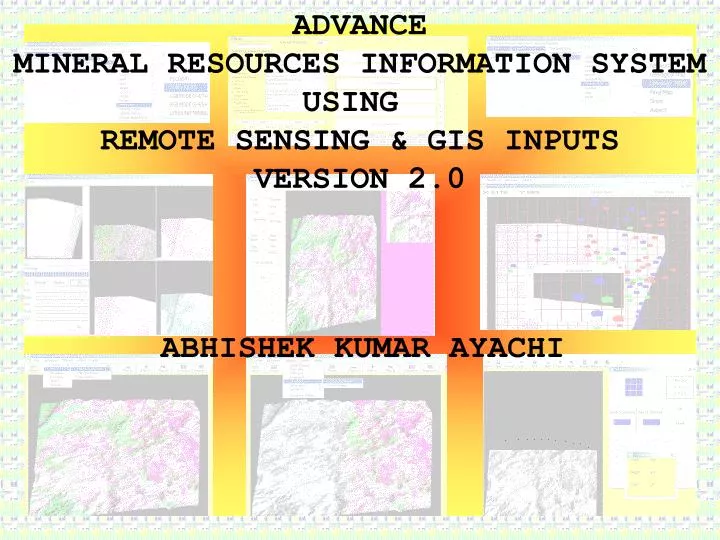
ADVANCE MINERAL RESOURCES INFORMATION SYSTEM USING REMOTE SENSING & GIS INPUTS VERSION 2.0. ABHISHEK KUMAR AYACHI. Needs. Ample data is available on all issues that go into decisions making in mining and explorations With the expansion of the industry as a whole the data volume has

E N D
ADVANCE MINERAL RESOURCES INFORMATION SYSTEM USING REMOTE SENSING & GIS INPUTS VERSION 2.0 ABHISHEK KUMAR AYACHI
Needs Ample data is available on all issues that go into decisions making in mining and explorations With the expansion of the industry as a whole the data volume has risen exponentially Because of share volume of data ,all data does not go into decision making User friendly interface for non-GIS professional MRIS v 2.0 ………… this solution fulfils the data requirement and coupled with artificial capability ,useful information can go into decision making process
Aim and Objectives Conceptualisation & development of Mineral Resources Information System • Non-spatial information on mineral deposits such as geology,Mining, • Production,environment,chemical analysis etc • 2. Spatial information related to ground control points of mineral deposits • 3. Relation between spatial and non-spatial information • Extract user defined information from spatial data and/or correlated with • non-spatial data (for better use as per their needs) by using MRIS • The final product should be upgrade their level in the name of information • system • The final product will not only produce information by user inputs but also • produce information (some thing more) in the form of spatial and/or related to • non-spatial • 7. Packaging of MRIS as a software product
Methodology Literature review to understand geology & geomorphology of the region Visual and digital analysis of IRS,TM,ERS-SAR data Conceptualisation of MRIS,software and hardware selection MRIS prototype development using visual basic Ground truthing,field data collection and user interaction for assessment of components of MRIS Data analysis integration and finalisation of components of MRIS Development of MRIS Opinion of expert and users Packaging of MRIS as a software product
In the present scenario ….. Why we need option of analysis in MRIS Remote sensing is vast subject and used in different fields like Geology, Geomorphology,Hydrogeology,Environmental geology,,Human settlements, Water shade Management,Soil,Agriculture &Forestry etc Approx 40%-60% spatial & non-spatial information are commonly used in all the applications Most of the GIS layers (like:land use,land cover)are commonly used in all the applications If image processing like histogram equalization is useful for minerals but linear stretch is useful for finding the linear features like roads railway etc Maximum information extracted by MRIS can use in different other application
Most of the applications requires common types of information but Only the wattage of information are change for finding the potential Zone Defined spatial layers give information for particular mineral but if we need (some thing) information of associated adjacent mineral or exposed Intrusive they need some different image processing for better interpretation MRIS is not bound for only mineral deposits but they also used for other application & extract other final imagery which is user defined as per their needs
Mineral Resource Information System Salient features (General) • Comprehensive database on mineral deposits with information on Geology • Mining • Production • Chemical Analysis of ore and rock samples • Environment(Air,Water,and Land) • User friendly, information available on point click • Linear and polar grid available • User define Easting Northing for better accuracy
Salient features (General) Multi Purpose Multi window multi resolution zoom tool available which is used for other software also where this tool is not available Commercial Remote sensing & GIS software independent Produces report, various types of line graphs, bar graphs, etc. Filter define for core data for quick finding the location of the Database Database integrity with password option Define Filter convert spatial data in different file format as *.bmp, *.jpeg, *.gif, *.tiff, *.tif etc
Image Processing: Different types of enhancement techniques, edge enhancement, Linear, non linear stretch etc User defined contrast ratio, gray scale Defined & user defined filters like high pass, low pass filter etc Image information Rotation angle Shifting flipping etc Editing imagery or maps in the form of line point polygon Interpolation 2,4 imagery or maps for creating a one Analysis by using coordinates for position accuracy Slide show for comparative study Multi windows for analysis of different bands
Salient features (General) MRIS is developed using Visual Basic 6.0 Software uses mostly Microsoft resources (Access and Word) System used: P-III and Windows 2000 System requirement: 167 MB of disk space Package named as "MRIS version 2.0" is developed with all components including database Information output in report form
Target Use • Easy accessibility of geological • Information • Sharing of geochemical data • Mineral Exploration • Environmental assessment & • management • Mineral customer support • Infrastructure development based on • mining activites Contents Geological Information Geochemical Information Terrain Information Mining Information Production status Environmental Information Users:Academicians,Researchers,Industry,Government and Public
Data Used • Remote Sensing data 1)IRS-1C 2)IRS-1D 3)TM 4)ERS-1-SAR • Ancillary data Geological Map Geomorphological Map Mining and various environmental data from DM,DG,TISCO,IBM, Private mine owners etc • Survey of India Topographical maps • G/10,G/11,G?14,G/15,K/2 1:50,000 • F/4,F/8,G/5,G/8 1:50,000 • 73 F,G 1:250,000
Contents of Non-Spatial Data Layers - Raipur, Chhattisgarh & Keonjhar, Orrisa Mine Name Latitude Longitude Ore Body Host Rock Structure Mode of Occurrence Stratigraphy Mineral Relief Owners Name Address Lease Area Production (Monthly) Lease Period Date of Execution of the Lease Agreement Detailed Production Chemical Analysis Environmental Information Chemical Analysis Place Number Sg Fe Mn Si O2 Al2 O3 P2 O5 P Detailed Production Year Place Grade 1 Production Grade 2 Production Grade 3 Production Grade 4 Production Total
Environmental Information Land Water Air Noise Place Year Q-Area Dump Area Other Area Deforest Afforest Wasteland Place Number pH Turbidity TSS TDS Mn OIL Pb Zn Hg Place Year Number SPM SO2 NOX Dust fall Place Number Daytime Nighttime
Spatial data layers Thematic Lithological map Lineament map Drainage map DEM Slope Map Aspect map Mine location map Place location map Road network Remote Sensing IRS-LISS Raw Bands FCCs Processed data IRS-Wifs Raw Bands FCCs Processed data TM Raw Bands FCCs Processed data ERS-SAR Raw Bands FCCs Processed data
Mine Name Latitude Longitude Ore Body Host Rock Structure Mode of Occurrence Stratigraphy Mineral Relief Owners Name Address Lease Area Production (Monthly) Lease Period Date of Execution of the Lease Agreement Detailed Production Chemical Analysis Environmental Information Query at mine location
Queries for Non-Spatial information extraction Query on non-spatial information like what was the last year production on Joda mining block Which block is producing less than the average of last 3years Leading to revenue loss What is the grade wise production of a mine Comparison of various grades of ore production for last 3 years
Multi date data analysis • Multi resolution data analysis • Those information which are not used in a project time is extract by analysis in other project in the same area Queries for Spatial information extraction
Spatial Data Linking with Non-spatial data with index pull down menu and password option,Core Data base,Graph,Excel Sheet
Filter Laplacian Convolution mask or Edge Enhancement
Conclusion Remote sensing data products (IRS-LISS,Wifs;TM and ERS-SAR)provide wealth of Information on geology and mining of the region The study demonstrated that an information system with spatial and non- spatial Information can be developed and can be used by clients without expensive commercial GIS packages In the present case only for preparing spatial data layers , GIS and DIP packages were used ,for data access ,display and query and updating of spatial and non-spatial data , MRIS was used Visual basic was found suitable for handling all types of spatial and non- spatial data For developing MRIS The system can be packaged and given to users who can update the database and use it as per their needs Such MRIS can be easily develop for other mineral deposits of the world