Download
1 / 42
420 likes | 577 Views
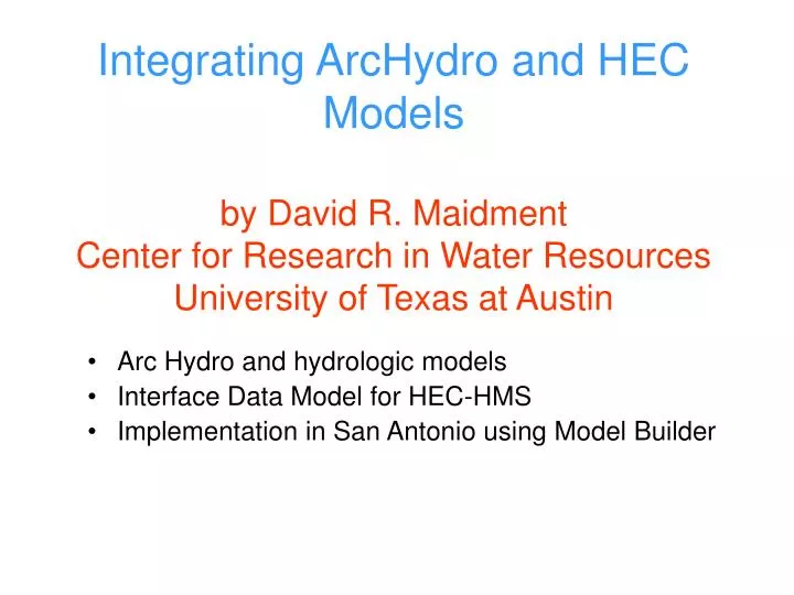
Integrating ArcHydro and HEC Models by David R. Maidment Center for Research in Water Resources University of Texas at Austin. Arc Hydro and hydrologic models Interface Data Model for HEC-HMS Implementation in San Antonio using Model Builder. Integrating Arc Hydro and HEC Models.

E N D
Integrating ArcHydro and HEC Modelsby David R. MaidmentCenter for Research in Water ResourcesUniversity of Texas at Austin • Arc Hydro and hydrologic models • Interface Data Model for HEC-HMS • Implementation in San Antonio using Model Builder
Integrating Arc Hydro and HEC Models • Arc Hydro and hydrologic models • Interface Data Model for HEC-HMS • Implementation in San Antonio using Model Builder
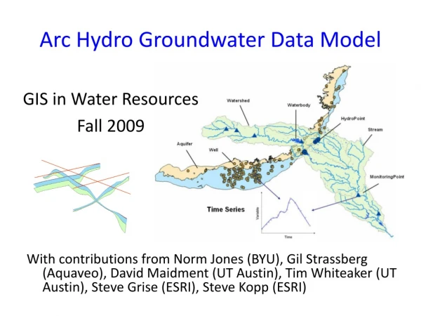
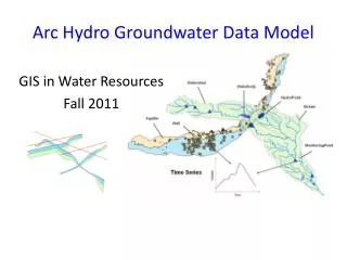
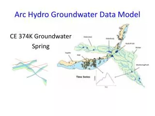
Modeling Geodatabase Hydrologic Information System A hydrologic information system is a combination of geospatial and temporal hydrologic data with hydrologic models that supports hydrologic practice, science and education
GIS Preprocessors for Hydrologic Models GIS InterfacePrograms HMS Geo HMS Database RAS Geo RAS
Connecting Arc Hydro and Hydrologic Models GIS Interfacedata models HMS HMS IDM Geo Database Arc Hydro data model RAS RAS IDM
GeoRAS Connecting Arc Hydro and Hydrologic Models GIS Interfacedata models HMS HMS IDM GeoHMS Geo Database Arc Hydro data model RAS RAS IDM
Integrating Arc Hydro and HEC Models • Arc Hydro and hydrologic models • Interface Data Model for HEC-HMS • Implementation in San Antonio using Model Builder
Basin Interface Data Model
Project Interface Data Model
IDM Performance Goal • To provide a database for all HMS data, so that the data may be queried and retrieved efficiently.
IDM Data Transfer Goal • To store data in a manner so that it is readily transferable from geodatabase to HMS files, and visa versa. HMS files HMS geodatabase
IDM Spatial Analysis Goal • To store watershed (spatial) data in a manner that can be easily viewed and analyzed in ArcMap.
IDM Intuitive Use Goal • To create a data structure that is logical to the HEC-HMS user
IDM Arc Hydro Compliance Goal • Arc Hydro connectivity and naming conventions Arc Hydro Geodatabase IDM Geodatabase HEC-HMS Program files HydroID FeatureID HMSCode Element Names
Flow Network Connection between HMS feature classes and parameter tables Connection between HMS and IDM elements The HMSCode .basin HMS text file HMSSubbasin attribute table HMSInitialConstant table IDM
IDM Geodatabase Design Purpose: To provide a HMS data storage structure that meets IDM design goals Visio 2000 UML ArcGIS Repository Geodatabase Schema
UML The Unified Modeling Language
UML UML Diagram Geodatabase Table
Basin GDB
Project GDB
Importing HMS Data Use Visual Basic to develop codes for transferring data.
Constant Loss Rate (inches/hour) Llano at Junction Model Rainfall lost to infiltration
Snyder Time to Peak (hours) Llano at Junction Model Time to Peak
Modified Puls Storage (ac-ft) Llano at Junction Model Storage required to produce 5000 cfs flow
Integrating Arc Hydro and HEC Models • Arc Hydro and hydrologic models • Interface Data Model for HEC-HMS • Implementation in San Antonio using Model Builder
Regional Storm Water Modeling Program and Master Plan for San Antonio City of San Antonio
San Antonio Regional Watershed Modeling System Geospatial Data: City, County SARA, other “Bring the models together” Modeling System Rainfall Data: Rain gages Nexrad Calibration Data: Flows Water Quality Floodplain Management Capital Improvement Planning Water quality planning Integrated Regional Water Resources planning Flood Forecasting
Sources of Rainmap data • Historical Nexrad data – NWS and TNRIS archive • Design rainfall maps – 2, 5, 10, 25, 50, 100 year design rainfalls as used for FEMA floodplain studies • Real-time Nexrad data using web services (Tom Wesp)
NEXRAD WSR-88D Radars in Central Texas(Weather Surveillance Radar-1988 Doppler)scanning range = 230 km NEXRAD Products: Stage I: Just Radar Stage II: gages, satellite, and surface temperature Stage III: Continuous mosaic from radar overlaps EWX – NEXRAD Radar in New Braunfels Source: PBS&J, 2003
Reading Historical Archives of NEXRAD Datasets from Internet FTP Server Internet Local
Design Rainfall Maps 100yr 06h 100yr 12h 100yr 24h
Regional Watershed Modeling System Case Study Salado Creek watershed Components: • Arc HydroGeodatabase • for whole watershed • HEC-HMShydrology model • for whole watershed • HEC-RAShydraulic model • for Rosillo Creek Bexar County Rosillo Creekwatershed
Arc Hydro and HEC-HMS HEC-HMS Hydrologic Model Arc Hydro Schematic Network Calculates Flows
Arc Hydro and HEC-RAS HEC-RAS Hydraulic Model Calculates Water Surface Elevations Arc Hydro Channel Cross Sections
HEC Data Storage System (DSS)(binary data file system shared by HEC models) • An exact replica of the binary DSS files is stored in the ArcGIS geodatabase • An Arc 9 Toolbox exchanges data between DSS and the geodatabase Time series catalog Many time series
Flow Change Points Models communicate with one another through Arc Hydro at designated points
FLOODPLAIN MAP Nexrad Map to Flood Map in Arc 9 Model Builder Flood map as output Model for flood flow HMS Model for flood depth Nexrad rainfall map as input
Conclusions • An interface data model provides a convenient way of storing and visualizing the content of a hydrologic model • Combination of interface data models and ArcGIS Model Builder provides a very efficient means of work flow automation