Download
1 / 37
410 likes | 657 Views
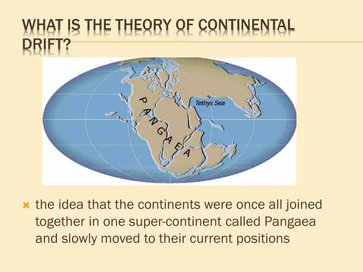
What is the theory of continental drift ?. the idea that the continents were once all joined together in one super-continent called Pangaea and slowly moved to their current positions. Alfred Wegener. Continental drift- alfred wegener. Evidence of “continental drift”— .

E N D
What is the theory of continental drift? • the idea that the continents were once all joined together in one super-continent called Pangaea and slowly moved to their current positions
Alfred Wegener Continental drift- alfredwegener
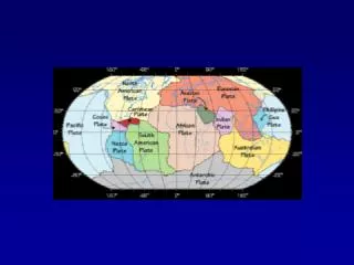
Evidence of “continental drift”— • . • Physical fit of continents • Fossil evidence • Rock layer sequences • Glacial evidence • Coal Deposits in Antarctic Alfred Wegener Proposed theory 1912
Shoreline Fit of the Continents http://www.abdn.ac.uk/zoohons/lecture1/img008.GIF
Fossil Evidence The fossils from the exact same animals are found on continents separated by vast oceans.
Matching Rock Layers Matching Mountain Ranges
Glacier Evidence Glaciers scars are found on continents which are today too warm for glaciers.
Alfred Wegener Continental drift- alfredwegener
Evidence of Sea Floor Spreading • Radiometric Dating • Older rocks further from ridges • Sediment Samples • Sediment layers thicker further away from ridges • Rheology • Higher temps @ ridges • Magnetic Anomalies • Poles reverse, magnetic minerals frozen in place as rock cools and hardens • Direct measurements of plate movement
Outer layer 5-100 km thick 2 types of crust Oceanic (very dense, made of basalt) Continental (less dense, made of granite) The Crust
Convection currents move the plates Watch Convection Currents of Magma Move the Tectonic Plates
What landforms are associated with a diverging plate boundary between two ocean plates?
What land forms are associated with a transforming plate boundary between two continental plates?
What land forms are associated with a converging plate boundary between a continental plate and an oceanic plate?
http://www.thirteen.org/savageearth/hellscrust/assets/images/ringoffire.jpghttp://www.thirteen.org/savageearth/hellscrust/assets/images/ringoffire.jpg
What landform(s) are associated with converging boundary between two continental plates?
What landform(s) are associated with converging boundary of two oceanic plates?
HOT SPOTS Tectonic plate moves slowly over the Hot Spot
SONAR = Sound Navigating and Ranging • Developed early 1900’s • Originally – detect icebergs • WWI – detect submarines • After WWII – map seafloor • Revealed features of seafloor in great detail – new to scientists! So, how do we know what’s on the seafloor?
Depth = ½ x Velocity x Time If sonar takes 100 seconds to return….how deep is the water? D = ½ x 1500 m/s x 100 seconds D = 75,000 meters deep