Download
1 / 31
320 likes | 470 Views
. Dr. Lothar Sch?llerSAF NetworkScientific Coordinator. SAF Network Scientific Coordinator at EUMETSATContractor at ESA-ESTEC, Noordwijk, The Netherlands. Support to ADM-AEOLUS and EarthCARE mission preparationVisiting Scientist at Meteo-France, Toulouse: worked on aerosol-cloud-precipitation i

E N D
1. EUMETSAT�s Network of Satellite Application Facilities SAFs
3. EUMETSAT�s Network of Satellite Application Facilities SAFs
4. Outline
5. Deployment of the EUMETSAT SAF Concept
6. New generation of Meteorological Satellites (like MSG and MetOp) have much wider areas of application
Specific expertise available in EUMETSAT's Member and Cooperating States
Objectives:
SAF concept encourage the utilisation of existing skills and infrastructure in Member- and Cooperating States for developing geophysical data products and services
Facilitating cost-effective exploitation by ensuring services are distributed in the most appropriate way
SAFs improve the ability of EUMETSAT Member States to exploit satellite data
Fostering development of cooperation with non-Member States and other organisations SAF objectives and benefits
7. SAF Objectives and Benefits (2)
8. Distributed Application Ground Segment
9. SAFs Role
To undertake on a distributed basis such necessary R&D and operational activities that can be carried out in a more effective way than at the EUMETSAT central facility.
To develop and deliver services/products aimed at enhancing the value and use of data for applications considered to be a common need of all, or the least a majority, of Member States.
EUMETSAT�s role
The Secretariat of EUMETSAT coordinates and monitors the development and operations of the entire SAF Network
The EUMETSAT STG (Science and Technical Group) and AFG (Administrative and Financial Group) review as appropriate the progress of the SAF development and operational phases. SAF Organisation: Roles of SAFs and EUMETSAT
10. SAF organisation: Life Cycle and Funding
11. SAF organisation: Life Cycle and Funding
12. Life Cycle and Funding (3)
13. Data Sources and Dissemination SAFs use inputs from meteorological (and other) satellites in both geostationary and polar orbits
during Development phase: use of data from any suitable satellite system including research missions
during Operations phases: focus on operational satellites, and in particular EUMETSAT Geostationary and Polar systems
EUMETSAT SAF products are distributed via
The Global Telecommunication System GTS/ Regional Meteorological Data Communication Network RMDCN
EUMETCast
Internet (FTP)
14. Data Sources and Dissemination (2)
15. Data Sources and Dissemination (2)
16. Distribution of Software to Users
NWC SAF Software Packages
NWP SAF Software Libraries
elements of the GRAS SAF Software
Near-real-time Products services
LSA SAF, OSI SAF, O3M SAF, GRAS SAF, H-SAF
Off-line Products services
LSA SAF, CM SAF, OSI SAF, O3M SAF, GRAS SAF, H-SAF
Data Sources and Dissemination (3)
17. Current SAF themes and projects SAF in Initial Operations Phase
Ocean & Sea Ice SAF
Support to Nowcasting & Very short range forecasts SAF
Climate Monitoring SAF
NWP SAF
Land Surface Analysis SAF SAF under Development
Ozone Monitoring SAF
GRAS Meteorology SAF
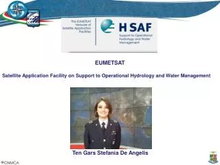
Support to Operational Hydrology and Water Management SAF
18. SAF locations
19. Nowcasting SAF �Support to Nowcasting and Very Short Range Forecasting� (NWC SAF)
established to utilise the new data from MSG and the future EPS for enhancing Nowcasting
Development of Software packages for the operational extraction of products relevant to Nowcasting and for local installation
Leading Entity is the Spanish Meteorological Institute INM in Madrid
NWC SAF is in its Initial Operation Phase since March 2002
First official software versions released in October 2004
20. Ocean and Sea Ice SAF Ocean and Sea Ice (OSI) SAF routinely produces and disseminates products characterising the ocean surface and the energy fluxes across the sea surface
Operational produces information on the sea ice characteristics (extend, concentration, �)
Leading Entity is M�t�o-France in Lannion
OSI SAF distributes near real-time products based on NOAA, MSG, Seawinds, DMSP and GOES data
OSI SAF is in its Initial Operational Phase since July 2002
21. Ozone SAF SAF on Ozone Monitoring (O3M SAF)
developed for the processing of data on ozone, other trace gases, aerosols and ultraviolet radiation
Emphasis on preparation of the Global Ozone Monitoring Experiment (GOME-2) on EPS (MetOp)
Host Institute is the Finnish Meteorological Institute FMI, Helsinki
The O3M SAF is scheduled to be operational in 2007
22. Climate Monitoring SAF SAF on Climate Monitoring
generates and archives high-quality data-set for specific climate application areas
Currently concentrates on:
cloud parameters
radiation budget parameters
atmospheric humidity
Leading Entity is the German Weather Service DWD, Offenbach
In Initial Operational Phase since January 2004
NOAA-AVHRR based data pre- operationally produced since November 2004, MSG based data from October 2005
23. NWP SAF SAF on Numerical Weather Prediction
aims at increasing the benefits to Met.-Services from Numerical Weather Prediction (NWP)
develops advanced techniques for the effective use of satellite data
Leading Entity is the UK MetOffice, Exeter
The NWP SAF is in its Initial Operations Phase since March 2004
24. GRAS SAF SAF on GRAS Meteorology
GRAS: Global Positioning System (GPS) Receiver for Atmospheric Sounding to be flown on EPS
Will provide near real-time and offline:
sounding data (temperature, pressure, humidity)
corresponding validation products, and
assimilation software
The Host Institute is the Danish Meteorological Institute DMI, Copenhagen
The GRAS SAF will start its Operations Phase in 2007
25. Land Surface Analysis SAF SAF on Land Surface Analysis
established to increase the benefit from MSG and EPS data related to land, land-atmosphere interaction and biospheric applications
Leading entity is the Portuguese Institute for Meteorology IM, Lisbon
The Initial Operations phase of the LSA SAF started in January 2005
26. Hydrology SAF SAF on Support to Operational Hydrology and Water Management
Host institute: Italian Meteorological Service (UGM), involving Member States and 4 Cooperating States
SAF products focuses on
precipitation
soil moisture
snow parameters
utilisation of these parameters in hydrological models and NWP
The H-SAF started Development Phase in September 2005
27. Current SAF Themes, Projects and Products
28. Establishment of the WMO Global Climate Observing System (GCOS) in 1992, to
Ensure the data needs for climate system monitoring
Improve the observing capabilities
Integrate observation into useful products
GCOS focus on Essential Climate Variables
The SAF Network is involved in related discussions and workshops and already contribute to prototyping addressing GCOS requirements SAF Network contribution to GCOS
29. Global Monitoring of Environment and Security (GMES)
establish a European capacity for the provision and use of operational information for Global Monitoring of Environment and Security SAF Network contribution to GMES
30. SAF Network contribution to GMES
31. Conclusions SAFs are dedicated centres of excellence for processing application specific satellite data
form an integral component of EUMETSAT�s distributed application ground segment
located at National Meteorological Services in Member States
use expertise of the EUMETSAT community
use geostationary and polar orbiting satellite data
have generated new products and services for the meteorological and climate user communities
Already provide a relevant contribution to GMES and GCOS
7 SAFs will enter the new Continuous Development and Operations Phase (CDOP) in March 2007