Download
1 / 35
350 likes | 474 Views
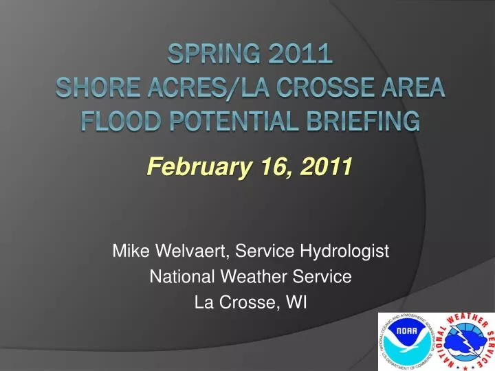
Mike Welvaert, Service Hydrologist National Weather Service La Crosse, WI. February 16, 2011. Spring 2011 SHORE ACRES/LA CROSSE AREA Flood POTENTIAL Briefing. Discussion Points. Setting The Stage This Past Fall and Winter 2011 Spring Flood Outlooks River Reading Locations In The Area.

E N D
Mike Welvaert, Service Hydrologist National Weather Service La Crosse, WI February 16, 2011 Spring 2011 SHORE ACRES/LA CROSSE AREAFlood POTENTIAL Briefing
Discussion Points • Setting The Stage This Past Fall and Winter • 2011 Spring Flood Outlooks • River Reading Locations In The Area
Precipitation: Sept 1 2010 – Jan 24th 2011 • Much of southeast Minnesota is 150% to 200%+ of Normal Fall 2010 was very wet, mainly from the September and October storms
Soil Information Frost Depth Feb 15, 2011 4” Soil Temp Feb 15, 2011 • Soils were wet prior to the freeze. • Frost depths are shallow – 1.5 ft or less • Snow arrived around the same time as the cold weather • The ground is not “solidly frozen”
Streamflow Prior to Freeze • Most Rivers in WI, MN, and IA were running above or much above normal • Reservoirs and lowland areas are full. • River ice has efficiently formed. • Ice jams are possible.
Water in the Snow Pack Snow depth was over 2 ft in western and northern MN last week. Now in the teens. - Minnesota and upper Mississippi basins Snow pack has diminished considerably since last week. But still over 10” upstream. Liquid water in the snowpack (SWE) has also diminished. Was 3-5” last week, but now 1-3” on average. Portions of western MN still have over 5” and 3-5” across much of MN/WI upstream of our area.
Normal Liquid Precipitation February Roughly 0.5 to 1 inch March Roughly 0.5 in to nearly 2 inches April Roughly 1 inch to around 3 in.
Flood Potential … Above Average Threat • Above average fall moisture • Above average winter precipitation • Above average water already in the rivers Greatest concern– Mississippi River But areas that received severe flooding last fall are also of concern (Zumbro, Trempealeau, and Black Rivers and their smaller tributaries) Unlike last year, the Upper Mississippi basin as well as the Chippewa/St. Croix Rivers in WI will be contributors
Probabilistic Outlooks • Soil Conditions Based on 2/14/11 • Model run from 2/15/11 – 5/23/11 • 60 year statistical analysis • (Does not include • 2009 or 2010 data.) La Crosse AHPS webpage http://water.weather.gov/ahps2/index.php?wfo=arx
L&D 7 La Crescent Mississippi River 1965 level = 647.48 ft 2001 level = 645.20 ft 1969 level = 644.87 ft 1997 level = 643.76 ft Percent chance that the river will exceed various levels. Blue Line– 60 year history of river stages for this period (Flood Climatology). Black - Range of possible stages given current soil moisture and Snow pack • Flood Stages • 59% – 645 ft Major Flood • 86% – 643 ft Moderate Flood • >98% -- 641 ft MinorFlood • Likelihood of Some Impacts • 9% – 649 ft– Water begins to go over the protective earthen dikes • 18% – 647.48 ft– Water reaches the flood of record • 26% – 646 ft– Lock & Dam goes out of operation
La Crosse Mississippi River 1965 level = 17.90 ft 2001 level = 16.41 ft 1969 level = 15.70 ft 1997 level = 15.01 ft Percent chance that the river will exceed various levels. Blue Line– 60 year history of river stages for this period (Flood Climatology). Black - Range of possible stages given current soil moisture and Snow pack • Likelihood of Some Impacts • 4% - 20.7 ft – Water reaches the top of protective dikes • 23% – 16.5 ft – Road Closures at Rose St. near I-90 and the eastbound exit of I-90. Riverside Park is flooded • 79% – 14 ft– Flooding impacts homes in Shore Acres and along Bainbridge Street on French Island. Water goes into ball fields at Copeland Park and is over the road at Houska Park near the water treatment plant • 92% – 13 ft– Access road to Shore Acres is impacted by flooding • >98% – 12 ft– Pettibone Campground and RV Park is flooded • Flood Stages • 59% – 15.5 ft Major Flood • 95% – 13 ft Moderate Flood • >98% - 12 ft MinorFlood
Other Factors that Will Impact The Spring Flood • Additional precipitation which occurs prior to the melt? • Type of Melt • Slow (optimal)- This is what we have been having! • little to no rain/snow and dryer Relative Humidity. • temperatures – highs mid 30s to lower 40s, overnight lows 20’s(or colder) • Rapid (increases flooding threat) • Rain on snow increases melt rate and adds more water to the situation. • Temperatures – Highs mid 40s and warmer, lows around 30 and warmer (Colder overnight lows slows down or shuts off the melting process) • A delayed thaw increases the possibility of a faster melt and the likelihood that a rain on snow event would occur.
Summary Ingredients are there for flooding this spring along the Mississippi. • Spring Flood Outlook Updates: • February 17th • March 3rd • March 10th(If the melt has not already started and deterministic or hydrograph forecasts are not already being issued.)
Local River Gauges • History • River readings have been taken and archived in La Crosse since 1874. • Actual location has changed many times • Most locations were somewhere between the present-day Riverside Park and the Cass Street Bridge crossing. • Dams were built in the late 1930s.
Local River Gauges • History • This gauge building was built in the 50s at present location in Riverside Park. • Readings were taken from this building from the 50s through the 90s.
Local River Gauges • History • In the late 90s, the measuring location was moved downstream to the water treatment plant. • The building remains in place, but there is no equipment inside.
Local River Gauges • History • In the late 90s, the measuring location was moved downstream to the water treatment plant. • Readings have been taken from here since then.
Local River Gauges • There is a difference in values • Several causes • Slope of river will result in a small difference • Higher flow of water “rounding the corner” along the Mississippi? • Most likely it is the constriction difference as water flows under the bridges, and the “spreading out” of the river south of the bridges. • Can be almost a foot difference! • This is why the NWS started reporting two values during and after the 2001 flood.
Local River Gauges • But this is causing confusion… • What should we do moving forward? • We do plan to install equipment in the Riverside Park shelter to obtain readings. • The plan was to obtain more data to try and document the differences • We can report 2 values… • Or we can report one (water treatment plant), and allow you to “alter” the level at which precautions are needed.
Questions? • Comments?
Contact Information Mike Welvaert NWS La Crosse (608) 784-8275 ext 493 Mike.Welvaert@noaa.gov
Links NCRFC http://www.facebook.com/pages/NOAA-NWS-North-Central-River-Forecast-Center/111945998874873?v=wall
Appendix A:Where to find the Probabilistic Outlooks on NWS Web pages.
Finding the Probabilistic River Outlooks 2) From the “Hydrograph Page,” Select either the “Weekly Chance of Exceeding Levels”or “chance of Exceeding Levels in an Entire Period.” 1) From the “Rivers and Lakes Tab Page,”Click on one of the River Forecast points of interests (the Circles)
Finding the Probabilistic River Outlooks “ Chance of Exceeding Levels in an Entire Period” “Weekly Chance of Exceeding Levels”
Understanding River Flood Outlooks Video Tutorial http://test.crh.noaa.gov/fgf/?n=webinar_probabilistic_outlook
“Normal” Flood Risk • The blue line can be considered “the normal” for the risk of flooding or Flood Climatology. • Fargo reaches Minor Flood stage 63% of the time or the 37.8 out of the last 60 years. • Moderate flood stage 22% if the time or 13.2 of the past 60 years. 63 % 22 %
“Conditional” Flood Risk Outlooks based on the current soil moisture and snowpack.
Condition Traces (CS) Simulation Based on 2001 conditions • 60 years of Temperature and Precipitation information included. (1949 – 2008) • Each line represents what a flood this year may look like if the temperatures and Precipitation in Feb, Mar and April were the same as XX year. • For example, the simulation highlighted used “current” snow and soil moisture as of 1/27 and the “2001 repeat “of temperatures and precipitation for Feb through April, a crest of around 42ft would be possible.
“Conditional” Flood Risk • As of 1/27, Fargo had a 99% confidence to reach/exceed Minor Flood . • 96% confidence to reach Moderate Flood. • 87% confidence to reach Major Flood • The 2001 what if scenario is the 4th highest crest. 2001 99% 96% 87% Black line plot of all the “peaks” from the “what if” scenarios based on the past 60 years.
Flood Risk • Rule of thumb – when the Black line is to the Left of the blue, Much above normal flooding Risk. • Historically the dryer and or slower melt years are driving the “higher” CS probabilities. • Historically the wetter and faster melt years are driving the “lower” CS probabilities. Simulations from Wet/fast melt years Simulations from Dry/slow melt years Combined plot of the “Normal or Historical Simulation (HS)” and the Conditional Simulation (CS) or outlook based on the current soil moisture and snow pack.