Download
1 / 26
260 likes | 478 Views
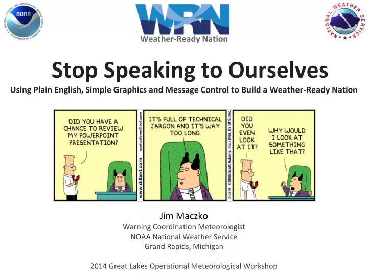
Weather-Ready Nation. Stop Speaking to Ourselves Using Plain English, Simple Graphics and Message Control to Build a Weather-Ready Nation. Jim Maczko Warning Coordination Meteorologist NOAA National Weather Service Grand Rapids, Michigan

E N D
Weather-Ready Nation Stop Speaking to Ourselves Using Plain English, Simple Graphics and Message Control to Build a Weather-Ready Nation Jim Maczko Warning Coordination Meteorologist NOAA National Weather Service Grand Rapids, Michigan 2014 Great Lakes Operational Meteorological Workshop
U.S. Weather-Ready Nation Goals • Improve weather decision services for events that threaten lives and livelihoods • Deliver water forecasting services to support management of the Nation’s water supply • Enhance climate services to help understand and adapt to climate-related risks • Improve information in support of economic productivity • Enhance forecast services supporting healthy communities and ecosystems • Sustain a workforce and infrastructure to meet our mission Simple Enough? What Does This Really Mean for Forecast Offices?
It Means that Forecast Offices Can Help Build a Weather-Ready Nation Doing One Thing! Communicate Better
How Do We Communicate Better? At Grand Rapids We Focus On… • What Needs to Be Communicated • When Information Delivery is Needed • Where to Deliver this Information • How Can We Improve on 1-3
At Grand Rapids We Focus On… • What Needs to Be Communicated • When Information Delivery is Needed • Where to Deliver this Information • How Can We Improve on 1-3 What Good Are Our Efforts If No One Knows What We Are Saying?
What Needs to Be Communicated? What Is Needed What We Often Say When a Mommie and a Daddie love each other very much and they want their family to be more than just the two of them they make a wish. When their wish came true a stork dropped off a baby boy on the steps in front of the house and now we have a BABY ON BOARD
What Needs to Be Communicated? What Is Needed What We Often Say • Severe Thunderstorm Warning • Anywhere County • Until 900pm • Hail- Golf Ball or Larger • Wind - 85mph • Take Shelter Now
What Needs to Be Communicated? Images and Words that are Simple USE PLAIN ENGLISH – NO ACRONYMS Keep the Why of Weather to OURSELVES Science Talk is Good Internally – Does Nothing to Help People Take Action What People Need to Know to Make Decisions What, When, Where, How Long, How Certain Especially What Weather Typically Results In – POTENTIAL IMPACTS What We Know, When We Know It The Perfect Forecast Always Occurs as Weather is Happening Planning, Preparation, Response Begin Days Before Weather Happens
Keep This Stuff to Ourselves! If We Have to Explain It (to Anyone Other Than Weather Nerds) We Must Find Another Way to Show It or Say It Wind Chills of -20 to -30 QPF Upper Level Disturbance Cap Zones Action Stage POPS Warm Front Cold Front CAPE 1 to 2 inches of Rain 30% Chance Low Pressure System CWA
Keys to Improved Communication Keep it Brief – Hit the High Points - Most Important First Avoid Wordy Phrases & Watch/Warning/Advisory Terms What, When, Where - No Why Use Images That Speak For Us – No Explanation Necessary Alternate Using Lessons Learned As Issued
At Grand Rapids We Focus On… • What Needs to Be Communicated • When Information Delivery is Needed • Where to Deliver this Information • How Can We Improve on 1-3 Are We Doing Our Job If No One Gets Information Before They Need It?
When is Our Information Needed? • Media Meteorologists • The Message Carriers for the Masses • Help Us Get The Word Out Early and Often • Increase Public Awareness, Encourage Proper Action • Use Their Own Message if Ours is Not There to Help • Include: Television Personalities, Web Bloggers, Online Newspapers, etc. When Do They Need New Information? All Media Updates Needed All The Time Television Meteorologists At Least 30-60 Minutes Before News Broadcasts (Many broadcasts starting at 4am or 4pm now)
When is Our Information Needed? • Decision Makers Tasked with Safety • Get Life Back to Normal As Soon As Possible • Prepare for Action, Plan for Response/Recovery • Use Multiple Sources – Especially Local Media • Include: Local/State/Federal Emergency Managers, Road Crews, School Superintendents, Recovery Agencies, etc. When Do They Need New Information? Emergency Management & Recovery Agencies Days, Many Days or Weeks in Advance All Decision Makers Early Enough Today to Plan for Tomorrow
Core Partner Delivery Needs The General Public Will Benefit Greatly if We Meet the Delivery Needs of Core Partners • Television Media • Can Use All Traditional Services if Delivered by 330am/330pm • Especially the Area Forecast Discussion So We Focus On: 330am/330pm for Delivering Our Message Grand Rapids Weather Service - Area Forecast Discussion Delivery Times Discussions include both new Short Term and Long Term Forecast Long Term Goal = 100%
Core Partner Delivery Needs The General Public Will Benefit Greatly if We Meet the Delivery Needs of Core Partners • Decision Makers • The Earlier in the Day Information is Provided the Better • Can Plan Effectively if Information Delivered by 1pm • At Least 2 Hours Notice for Webinars • Provide Consistency in Delivery of Emails/Notifications • If the Forecast is Wrong, What is the Next Most Likely Outcome • Larger the Impact the Greater Notice & More Updates Needed So We Focus On: Providing Sufficient Time for Planning • Event Driven Webinars: Typically Conducted at 1pm – 1 to 3 days before weather • Email Notifications For Webinars: Minimum 2 Hours Notice Before Webinar • Use ONLY Two Subject Lines: NWS Weather Message, NWS Webinar Scheduled • Email Notifications Sent: 24-48 Hours before Weather, Greater Impact = Greater Notice
At Grand Rapids We Focus On… • What Needs to Be Communicated • When Information Delivery is Needed • Where to Deliver this Information • How Can We Improve on 1-3 Why Do We Deliver Information That Forces People to Spend Time Searching and Sorting?
Write Discussions for All Audiences The Discussion is No Longer Just a Briefing Tool for Weather Nerds It is a Way for Us to Provide All Customers our Thoughts, Concerns, What Ifs Deliver Impact Potential First - Stay Out of the Dictionary Red and Underlined = Potential Impact Weather Instead of…. Write Something Like... WINDS ALOFT TURN SOUTHWEST AND STRENGTHEN THROUGH THE DAY AS A PACIFIC STORM SYSTEM SETS UP OVER THE PACIFIC NORTHWEST. AN UNUSUAL DUAL JET PATTERN WILL PROVIDE GOOD ASCENT OVER WESTERN ZONES WEDNESDAY AFTERNOON AND EVENING ALONG WITH SEVERAL WEAK DISTURBANCES. LOW LEVEL MOISTURE ADVECTION WILL CONTINUE ON EASTERLY SURFACE TO 850MB WINDS. THE SHEAR PROVIDED BY THE CONTRASTING LOW LEVEL AND JET LEVEL WINDS SHOULD PROVIDE AMPLE SHEAR FOR STRONG TO SEVERE THUNDERSTORMS WEST OF A XXX TO XXX LINE. HEAVY RAIN WILL REMAIN A THREAT WITH STORMS WEDNESDAY WHICH MAY FORM INTO ONE OR MORE CONVECTIVE SYSTEMS THROUGH THE EVENING AS THEY MOVE NORTHEAST. LARGE HAIL LOOKS TO BE THE MAIN THREAT WITH STORMS WEDNESDAY WITH HEAVY RAIN SECOND DUE TO FASTER STORM MOTION THAN TODAY...ISOLATED DAMAGING WINDS ARE ALSO POSSIBLE. (What, When Where) Severe Thunderstorms likely Wednesday afternoon mostly west of US 131 in the afternoon and early evening. At this time...large hail is the main expected threat with limited potential for damaging winds. Multiple rounds of storms will be possible with heavy rain at times. Storms should be moving fast enough that only some minor localized flooding should occur. Some flash flooding could be possible if multiple showers affect the same areas in a short period of time. (Then Confidence and Some Why)
Deliver Simple Graphics, Emails Attention Spans Are Short – Time Available is Limited Every Slide, Image, Email – Needs to Be Understood Quickly Without Explaining Subject: NWS Weather Message Snow tonight through early Wednesday across all of Lower Michigan* Some hazardous travel conditions expected* Generally 1-3“, higher amounts near the lakeshoreAdditional information* Above Freezing Temperatures Likely Thursday* Ice jam potential continues into next week* Light snow or mixed precipitation possible Thursday* Greater potential for snow and mixed precipitation this weekend
Winter 2012-13: A First Step Traffic Light Slide providing Overall Context to Expected Weather • Pros • Simple, Plain English • How Common/Rare/Historic is Weather • Visual Context to How Bad it Could Be • Typical Time to Getting Back to Normal • Cons • Not Self-Contained • Missing Where and When • No Mention of the Weather • No Forecast Confidence • Designed for One Category Only Significant Confusion Occurred When Check Placed Between Two Categories
Winter 2013-14: A New Approach Graphical Improvement, Adding Social Science, Customer Needs Geographic Display of Potential Impacts Possible or Expected Expected = Yes Possible = Maybe Will This Happen? Near Certain = near 100% Better than 50-50 Chance Unlikely = 0-20% Easy to Understand - Meets Customer Needs
Winter 2013-14: A New Approach Graphical Improvement, Adding Social Science, Customer Needs Colors Mean Colors Winter Weather or Winter Storm Common versus Rare Weather Parameters Always the Same Especially Ice Accumulation Special Thanks for Content Coordination Pat Boyle of UK MetOffice and Megan Taylor of the National Weather Service Training Center
The Long Term Vision Nationally To Go From This… To Something Like This…
At Grand Rapids We Focus On… • What Needs to Be Communicated • When Information Delivery is Needed • Where to Deliver this Information • How Can We Improve on 1-3 Ask - Listen - HearLearn - Adapt - Improve ALWAYS
Thank You! Questions? James.Maczko@noaa.gov