Download
1 / 31
310 likes | 410 Views
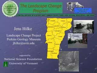
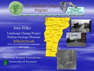
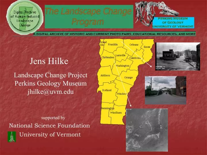
Jens Hilke. Landscape Change Project Perkins Geology Museum jhilke@uvm.edu. supported by. National Science Foundation. University of Vermont. An on-line database of historic and current photo pairs. Paired Historic Photos. Huntington. Huntington River looking Northeast

E N D
Jens Hilke Landscape Change Project Perkins Geology Museum jhilke@uvm.edu supported by National Science Foundation University of Vermont
Paired Historic Photos Huntington Huntington River looking Northeast N 440 19’ 32.4” W 720 59’ 8.6” -No historic date Aug 17 2000
Human-induced landscape change • Landscape Natural History • Cultural History • Interactions (culture and landscape) • Technology
Natural Disasters Barnet 1927
Randolph Flood of 1927
Deforestation Brehmer, L.F. "Mountain Range from Keyes Cottage." June 6, 1913. Panoramic Photographs collection from the Library of Congress. Brehmer, L.F. “Rutland from Quarter Line." July 29, 1913. Panoramic Photographs collection from the Library of Congress.
Reforestation Fairfield pre -1906
Development Route 116 in Hinesburg 1911
Mountain Road Construction in Danby, Vermont
Cultural Change Rutland 1879
Stories of Vermont’s history Winooski 1925 Pontoon Bridge
Resource extraction A Vermont Quarry in 1935
Agriculture Chester, Vermont
Town center Fairfax 1915
Focuson Landscapes Underhill Snow Bowl (Underhill Historical Society)
OLD PHOTOGRAPHcounty: Chittenden town: Richmond date: 1860's photo credit: Jericho Historical Society description: Picture of Winooski valley taken from a hill. RECENT PHOTOGRAPH latitude: N 44° 28' 52.4" longitude: W 73° 13'20.2" photographer: Adam Possidente school: MMU date: May 2000 A summary of the human-induced landscape change by a Vermont high school student.
OLD PHOTOGRAPH county: Chittenden town: Milton date: 1908 photo credit: Special Collections of Bailey/Howe Library at UVM description: bridge over the Lamoille River RECENT PHOTOGRAPH latitude: N 44° 38' 25.4'' longitude: W 73° 6' 51.9'' photographer: L. Persico school: UVM date: June 29, 2000 A summary of the human-induced landscape change by a Vermont high school student.
OLD PHOTOGRAPH county: Chittenden town: Milton date: 1908 photo credit: Special Collections of Bailey/Howe Library at UVM description: bridge over the Lamoille River RECENT PHOTOGRAPH latitude: N 44° 38' 25.4'' longitude: W 73° 6' 51.9'' photographer: L. Persico school: UVM date: June 29, 2000 A summary of the human-induced landscape change by a Vermont high school student. NOT TAKEN FROM THE SAME PLACE
OLD PHOTOGRAPHcounty: Chittenden town: Underhill Flats date: n.d. photo credit: Underhill Historical Society description: This picture is located in the Underhill Flats in Vermont on Route 15. The property is owned by the town of Underhill. RECENT PHOTOGRAPH latitude: n/a longitude: n/a photographer: Cory Blake school: MMU date: May 2000 A summary of the human-induced landscape change by a Vermont high school student.
OLD PHOTOGRAPHcounty: Chittenden town: Richmond date: 1860's photo credit: Jericho Historical Society description: Picture of Winooski valley taken from a hill. RECENT PHOTOGRAPH latitude: N 44° 28' 52.4" longitude: W 73° 13'20.2" photographer: Adam Possidente school: MMU date: May 2000 A summary of the human-induced landscape change by a Vermont high school student.
OLD PHOTOGRAPHcounty: Addison County town: Breadloaf date: n.d. photo credit: Special Collections of Bailey/Howe Library at UVM description: post card from Breadloaf Inn with Breadloaf Mountain in the background RECENT PHOTOGRAPH latitude:{latitude} longitude:{longitude} photographer: L.Mallard school: UVM date: July 16, 2000 A summary of the human-induced landscape change by a Vermont high school student.
OLD PHOTOGRAPHcounty: Addison County town: Breadloaf date: n.d. photo credit: Special Collections of Bailey/Howe Library at UVM description: post card from Breadloaf Inn with Breadloaf Mountain in the background NO HISTORIC DATE RECENT PHOTOGRAPH latitude:{latitude} longitude:{longitude} photographer: L.Mallard school: UVM date: July 16, 2000 A summary of the human-induced landscape change by a Vermont high school student. NO LAT/LONG