Download
1 / 20
200 likes | 330 Views
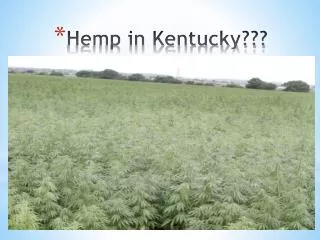
Infrastructure Challenges in Kentucky. Carey Johnson Kentucky Division of Water. 2014 Governor’s Conference on Energy and the Environment. Kentucky Division of Water. Mission To manage, protect and enhance the quality of the Commonwealth’s water resources. Primary Responsibilities

E N D
Infrastructure Challenges in Kentucky Carey JohnsonKentucky Division of Water 2014 Governor’s Conference on Energy and the Environment
Kentucky Division of Water • Mission • To manage, protect and enhance the quality of the Commonwealth’s water resources. • Primary Responsibilities • Clean Water Act • Safe Drinking Water Act • Water/Wastewater Infrastructure • Water Planning • Drought Management • Agriculture Water Quality Act • Floodplain Management / Risk MAP / NFIP • Dam Safety
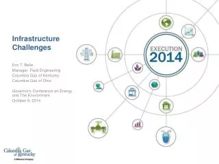
Addressing the Problem • Kentucky Division of Water (KDOW) plays a major role in water-related infrastructure • This presentation will focus on KDOW’s efforts to enhance dam-related infrastructure • Outline KDOW’s role in other infrastructure-related elements
ASCE Water-related Infrastructure Grades for KY • Dams – D+ • Drinking Water - B • Levees – D+ • Wastewater – C- • Overall – C; marginally better than the Nation Source: American Society of Civil Engineers – 2013 Report Card
Vision • Improved Service • Improved Compliance • Effective Communication • Reduced Risk • Integrated programs • Enhanced Productivity • Better Tools • Improved Efficiencies • Access To Data • Better Accuracy • Better Data Collection Tools • Better Data ALL PROGRAMS DIVISION -WIDE
Kentucky’s Dam Safety Program • Kentucky Revised Statutes (KRS) 151.100 • Defines authority (enacted 1966 / amended 1990) • Administer and Enforce • Inspect / Assess • Permit • Set Standards • Safety / O&M • Budget • State-owned Dam Repair (SODR) • $1 million annually • FEMA annual allocation • General Funds • Dam Inventory • 1069 dams • 961 on active inventory • 180 high hazard • 156 moderate hazard • 625 low hazard • Regulated dams in 115 of 120 counties • Ownership • 80% private • 20% public
Kentucky’s Dam Safety Program • Vision • Improved Service • Enhanced Productivity • Better Accuracy • Challenges • Expending the $10M SODR funds in ongoing projects • Knowledge transfers to next generation employees and dam owners • Transitioning from paper files to electronic • Improving databases • Testing new tools (engineering and mapping) • Kentucky Dam Safety Advisory Council • Considering a modern PMP Study • Updating Dam Safety regulations and Engineering Memoranda
Kentucky’s Dam Safety Program Strategy Path to Success Strategic Partnerships Partners FEMA National Dam Safety FEMA Risk MAP USACE USGS NWS Kentucky NRCS Kentucky Emergency Management Kentucky Dept of Fish and Wildlife Kentucky Dept of Parks (Tourism) Kentucky Transportation Cabinet University of Louisville Center for Hazards Research DOW CTP contractors • Respecting missions • Coordinating initiatives • Leveraging funding • Synergizing efforts between programs • Collaboration with federal and state partners
Kentucky Division of Water – Strategic Projects • FEMA Risk MAP • Flood hazard mapping with emphasis on risk assessment and planning initiatives • Levee Analysis and Mapping Procedures (LAMP) pilot project • Kentucky Silver Jackets • USACE-led initiative for flood risk management • Frankfort - dam and levee overtopping inundation mapping • Falmouth - flood inundation mapping • Louisville - levee system evaluation / emergency response plan • “CHAMPS" and "IFLOODRISK“ web-based portals • Interactive web applications for enhanced: • Flood risk outreach • Emergency response • Mitigation planning • Hydraulic model dissemination
Kentucky Division of Water – Strategic Projects • “Proof of Concept” - Avoid large dam capital improvement projects through: • Better engineering • Better data • Downstream risk mitigation • Outreach and education • *This approach allowed Division of Water to redirect > $3M of State-Owned Dam Repair capital funds to priority capital dam projects
Kentucky Division of Water – Strategic Projects • Lake Beshear Dam • Better engineering model → reclassify the dam • Spurlington Lake Dam • Better engineering model → purchase downstream residences and property → Reclassify dam • McNeeley Lake Dam • Better engineering model → reclassify the dam *Downstream zoning change ensured permanent fix • Willisburg Lake Dam • Better engineering model → Identify residences to purchase? → reclassify dam?
Kentucky Division of Water – Strategic Projects • Kentucky Dam Safety Mitigation Project • Components • Validate hazard classification • 100 % (~200) of state-owned and locally owned dams • Dam failure inundation modeling and mapping • Risk mitigation planning • Emergency action plans (EAP) • Catastrophic Long-Term Response Plans (CLTRP) • Expanded outreach and education • Modernization Opportunity • Improved Service • Enhanced Productivity • Better Accuracy • Risk Assessment • Web-based records and data
Dam Risk Map • Risk Map • Per each dam studied • Based on FEMA’s Risk MAP Products • Callout boxes • Useful for: • Community Dam Safety Awareness • Dam Owner Risk Awareness • Dam Owner Risk Mitigation
Kentucky Dam Safety - Datasets Preparedness Report Card • Provides Snap-Shot of dam safety risk preparedness • Useful for: • Communicating risk • Promoting preparedness and mitigation
Levees • 28 systems protect from1% annual chance flood (32 total) • Approximately 105 total miles • 13 systems accredited by FEMA • 7 systems have “Provisionally Accredited” (PAL) status • 6 systems PAL expired; deaccredited • 2 systems (Louisville Metro) undergoing Levee System Evaluation by USACE
Levees – Kentucky Division of Water’s Role • Levee Point of Contact for FEMA • Pilot Project: Levee Analysis and Mapping Procedures (LAMP) – Union County • Collaboration with USACE and local sponsors on accreditation • Member of National Levee Safety Committee (NLCS) • Member of FEMA Levee Integrated Project Team (IPT) • State levee safety programs • 2014 Water Resources Reform and Development Act of 2014 (WRRDA)
Additional Efforts • Risk MAP • Mapping, Assessment, and Planning • Identification of infrastructure that causes flooding • Undersized bridges, culverts, other stream pinch points • Collaboration with local communities to mitigate problem areas
Transportation Infrastructure • Undersized culvert causes flooding and blocks road
Future Vision • Continue to move forward • Implement vision • Budget Scenarios • Tool Development • IT Resources • Strategic Projects • Integrate Programs • Promote Partnerships
Infrastructure Challenges in Kentucky Questions / Comments