Download
1 / 34
340 likes | 465 Views
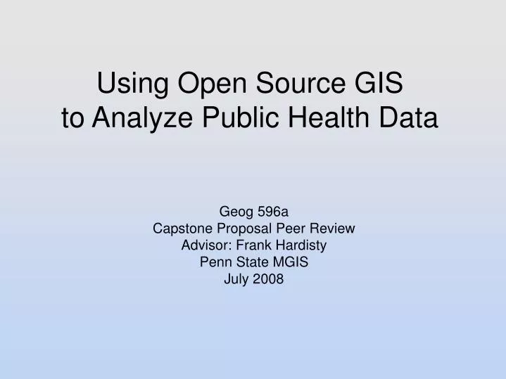
Using Open Source GIS to Analyze Public Health Data. Geog 596a Capstone Proposal Peer Review Advisor: Frank Hardisty Penn State MGIS July 2008. Considering presenting at URISA’s GIS in Public Health Conference Putting Health in Place with GIS June 5-8, 2009 - Providence, Rhode Island.

E N D
Using Open Source GISto Analyze Public Health Data Geog 596a Capstone Proposal Peer Review Advisor: Frank Hardisty Penn State MGIS July 2008
Considering presenting at URISA’s GIS in Public Health Conference Putting Health in Place with GIS June 5-8, 2009 - Providence, Rhode Island
Outline Presentation • Introduce Capstone • Introduce Open Source • Describe Datasets • Describe Analyzes • Open Source Applications Re-visited
Capstone Objective • Employ open source applications to evaluate the spatial relationship of persons with asthma that are within 200% of the federal poverty level* • Secondary Objective • Create an open source GIS model for other organizations to follow • Create a web based GIS with little or no capital investment * Defined by the Department of Health and Human Services
Open Source • Better quality, higher reliability, more flexibility, lower cost, and an end to predatory vendor lock-in • Must comply with 10 criteria for example • Free redistribution • Open access to the source code • License must be technology-neutral Source: Open Source Initiative
Significance of Open Source • Leading edge of technology • Always has been • Becoming part of mainstream computing • Where propriety software often gets its ideas and base code • Runs on older and newer computers • Large learning curve • Community Supported • Ask the right question Get help • ie: show that you tried to fix the problem, not just ask for help • The “tweak factor” • A lot of times it does not work out of the box • Once configured, it just works, and works, and…
Open Source Past Present Future Community Developed Community Developed Community Developed Proprietary Integration Community Supported Proprietary Integration Supported by a select group Proprietary Integration Supported by a larger community $$$ $$$ Mainstream integration Ease of Use & “just works” the Black Hole “Ease of Use” “Ease of Use”
Open Source Applications • Linux (Ubuntu) - operating system • GRASS GIS - spatial analysis, desktop display; plug-in for R-Spatial • R-Spatial - statistical package • PostGIS – spatially enabled database • QGIS – desktop display; plug-in for GRASS • OpenLayers - web map interface • MapServer – GIS server; web map interface
Asthma Dataset • From the UNMCare program at the University of New Mexico Hospital. • UNMCare is a healthcare coverage program for low-income families in Bernalillo County, NM. • Data provided by the New Mexico Department of Health and the UNM Health Sciences Center.
Attributes of UNMCare Dataset • Medical Record Number (Unique ID) • Street level address (de-identified down to a census block to satisfy HIPPA) • Primary, secondary, and tertiary diagnostics (ICD-9 Codes) • Visit type (inpatient, outpatient) • Race, gender, and age • Visit start and end date • Cost to health care system
GIS data clearinghouse for New Mexico http://rgis.unm.edu/data_entry.cfm US Census Data • Tract • Housing type • cost, own/rent • Block Group • Age • Race • Gender • Employment • Income • Block • Population
Emission Data • Sources: • City of Albuquerque • EPA • Constituents: • Particulate Matter <10 µm (PM10) • Particulate Matter <2.5 µm (PM2.5) • Sulfur Dioxide • Carbon Monoxide • Ozone
Analysis of Asthma Admissions • Demographic Correlations • Air Quality Correlations
Analysis - demographics • Identify census blocks with higher percentages of asthma admissions • Look for spatial clustering and correlations between persons with asthma and: • Race, age, and gender • Housing type (own/rent, # of units, cost) • bias that low-income households have sub-standard living conditions
Analysis – air quality • Identify census blocks with higher percentages of asthma admissions • Does a correlation exist between asthma admissions and proximity to an air quality monitoring station that exhibits poor air quality? • If correlation exists, compare the ratios of PM10, PM2.5, sulfur dioxide, and ozone. Is one constituent present more often than another?
Analysis – air qualitycontinued • Does a correlation exist between asthma admissions and proximity to a major traffic corridor? • Do low-income households cluster near air monitoring stations?
WHERE DO LOW-INCOME ADULTS LIVE IN BERNALILLO COUNTY? Most low-income adults live in the southern half of the city and along the north-south corridor. 121,173 adults in Bernalillo County earn less than 200% of the federal poverty level. This number represents 30% of the population 18 years of age or older. Source: Tom Scharmen, NMDOH
WHAT PERCENT OF LOW-INCOME ADULTS ARE ON UNM CARE? 11.2% of Low-Income Adults were Enrolled in UNMCare on July 2003. An estimated 13,513 low-income adults were enrolled in UNMCare in July 2003 of the 121,173 adults in the County earning less than 200% of the federal poverty level. The census tracts with the best UNMCare enrollment rates are not in the poorest sections of the county. ALBUQUERQUE, NM Source: Tom Scharmen, NMDOH
Open Source Applicationsre-visited Briefly discuss features and uses • GRASS GIS • R-spatial • PostGIS • QGIS • OpenLayers • MapServer
Grass GIS • Used for Desktop GIS • Map generation • Data visualization (2D, 2.5D and 3D) • Spatial analysis • Modeling • Data formats supported • Raster (2D and 3D) • Vector (2D and 3D) • Vector Point • DBMS Support • PostgreSQL/PostGIS, mySQL, SQLite, ODBC, ... • Supported platforms • Linux, Windows, Mac, and Handhelds
R-spatial • R is a language and environment for statistical computing and graphics • Provides a variety of statistical and graphical techniques • linear and nonlinear modeling, classical statistical tests, time-series analysis, classification, clustering • Runs on Linux, Windows and Mac. • Provides classes and methods for spatial data • points, lines, polygons, grids • Add-in package for GRASS GIS
PostGIS • PostGIS "spatially enables" the PostgreSQL database. • It is a database server used as a backend spatial database for geographic information systems (GIS) • Functions like ESRI's SDE or Oracle's Spatial extension. • Supports Linux, Windows and Mac
PostGIScontinued The following is an example of a PostGIS script. The script can be called within a GIS, command line, web page, etc. The below example is a script that locates features within a distance of 5km. Source: http://postgis.refractions.net/support/wiki/index.php?ExamplesFindNearby
QGIS • Quantum GIS (QGIS) runs on Linux, Windows, and Mac • Supports many vector, raster, and database formats • Supports many common spatial data formats (e.g. ESRI ShapeFile, geotiff) • Supports many plug-ins • display tracks from a GPS • Perform spatial analysis and model via GRASS GIS
QGIS GUI Source: http://qgis.org/images/screenshots/qgis4.png
OpenLayers • Web map application that displays geographic data from a variety of sources and data types • Geographic data in DBMS and text files • MapServer • Aerial Photography (Virtual Earth, Google Maps, Yahoo Maps, TerraServer) • WMS, WFS • USGS Topographic Maps and DEMs • TIGER data • Client-sided (javascript and AJAX); browser independent
OpenLayers Examplehttp://maps.hostgis.com/rthicks/index.html
MapServer • Server-sided GIS for building spatially-enabled internet applications. • Best for rendering spatial data for the web. • Cross-platform support • Linux, Windows, and Mac • Support many raster and vector data formats • TIFF/GeoTIFF, EPPL7, etc • ESRI shapfiles, PostGIS, ESRI ArcSDE, Oracle Spatial, MySQL, etc • Is a WMS and WFS client/server • Offers map projection support • On-the-fly map projection
MapServer ExampleSource: http://maps.hostgis.com/mww-lib/?template=template2&map=/maps/rthicks/mapfile.map