Download
1 / 12
140 likes | 322 Views
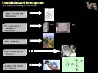
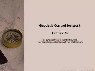
Geodetic Control Network Lecture 3. The positioning and orientation of the horizontal control network on the ellipsoid. Outline. The positioning and orientation of the network on the ellipsoid astronomical observations ; Laplace stations and „ deflection of vertical ” stations ;

E N D
Geodetic Control Network Lecture 3. The positioning and orientation of the horizontal control network on the ellipsoid.
Outline • The positioning and orientation of thenetworkontheellipsoid • astronomicalobservations; • Laplace stations and „deflection of vertical” stations; • Centringexcentricobservations; • Computationsontheellipsoid • Ellipsoidalcurves (normalsections, curve of alignment, thegeodesic); • The computation of ellisoidaltriangles; • The differentialequations of thegeodesic;
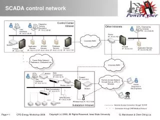
The positioning and orientation of the HCN The necessity of the application of surface coordinate systems. Geoid -> not a mathematical surface Ellipsoid fits the geoid well, and is a mathematical surface. At least the ellipsoidal position of one point of the network, and the orientation of at least one side of the network must be determined. Astronomical observations
Astronomical observations • Astronomical positioning: the determination of the coordinates of terrestrial points using observations to the stars. • Observations: horizontal and vertical angles; timing; <-> GPS • The „old-fashioned way”: • Since the standing axis of the instrument is vertical, therefore astronomical latitudes, longitudes and azimuths are measured and NOT ellipsoidal ones. • The types of astronomical observations: • As already discussed, every 120-150 km a pair of astronomical stations should be created. The astronomical observations are important for the positioning and orientation of the network, as well as: • the azimuth and latitude observations can be used to minimize the angular distortions in the network; • in case of large number of observations, the parameters of a best fitting ellipsoid can be determined; • the determination of the geoid – ellipsoid distances can be computed (geoid undulations) Geodesy
Types of astronomical points Laplace points: Points, where longitude and azimuth values are measured. Here the Laplace equation can be written: • where: • A,L are the astronomical azimuth and longitude values; • a,l are the ellipsoidal azimuth and longitude values; • j is the ellipsoidal latitude (which can be approximated by the astronomical latitude as well). • By reformatting the above equation, the ellipsoidal azimuth can be computed: Since the astronomical latitude is not necessary for the Laplace equation, therefore it is not mandatory to measure the latitude at the Laplace points.
Types of astronomical points „Deflection of the vertical” points: Only latitude and longitude, or latitude and azimuth is observed. What is the deflection of the vertical? The angle between the local vertical and the ellipsoidal normal (Q). The direction of the deflection has an angle e with the local meridian. Thus the deflection of the vertical in the meridian direction and in the orthogonal direction is: The astronomical observations can be used to compute these values: F, A or F, L should be measured
Choosing the loc. of astronomical points • Usually both ends of the extended baselines are used as the location of the astronomical points: • one of them is a „master station”: (F, L, A) • the other one is the „slave station”: (L, A for the Laplace eq.) • But! Due to the size of the instruments, the chosen point should have a good transportation connection. • And good visibility to the sky as well.
Reducing excentric observations In many cases the observations are taken at an excentric station. Reducing the latitude and longitude values: Reducing the azimuth observations: • – the convergence between • the two meridian
Outline • The positioning and orientation of thenetworkontheellipsoid • astronomicalobservations; • Laplace stations and „deflection of vertical” stations; • Centringexcentricobservations; • Computationsontheellipsoid • Ellipsoidalcurves (normalsections, curve of alignment, thegeodesic); • The computation of ellisoidaltriangles; • The differentialequations of thegeodesic;
Basic principles Ellipsoid of rotation: A 3D surface, which created by ellipse, rotated around its minor axis. Geometric parameters: a - semimajor axis b - semiminor axis - the square of the first excentricity - the square of the second excentricity - flattening - inverse flattening Two of these should be specified to identify the ellipsoid, one of them should be the size.
Definition of ellipsoidal coordinates j – ellipsoidal latitude l – ellipsoidal longitude a – ellipsoidal azimuth The reduced latitude: