Download
1 / 39
390 likes | 629 Views
Montgomery County’s MS4 Permit Implementation Strategy: Using the Watershed Treatment to meet local and Bay restoration goals. Ted Brown, PE, Biohabitats, Inc. and Meo Curtis, Montgomery County DEP. Presentation Outline. Background County’s MS4 Permit Implementation Strategy

E N D
Montgomery County’s MS4 Permit Implementation Strategy: Using the Watershed Treatment to meet local and Bay restoration goals Ted Brown, PE, Biohabitats, Inc. and Meo Curtis, Montgomery County DEP
Presentation Outline • Background • County’s MS4 Permit Implementation Strategy • Use of WTM as Assessment Tool • Lessons Learned and Challenges
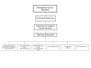
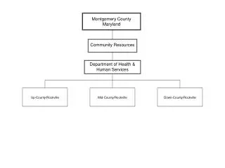
Montgomery County, MD • 500 sq. miles • 970,000 people • About 12% impervious overall • About 8,500 acres • Equal to Area of Washington, DC • Second only to Baltimore City within Maryland in average people per square mile • >95% of land zoned for development has already been developed • Two major basins:Potomac and PatuxentRivers • 8 major local watersheds
= No Implementation Plans Countywide Coordinated Implementation Strategy • Meet MS4 permit goals • Watershed Implementation Plans • Bay TMDL • Timeline • Began in June 2009 • Submitted to MDE in February 2011 • MDE approved plans in July 2012
Primary Driver: Restoration Goal • By February 2015, add stormwater management to an additional 20% of impervious area currently not treated to the maximum extent practicable (MEP) (1) Exclusions include: Certain zoning codes, parklands, forests, municipalities with own stormwater management programs, state and federal properties, and state and federal maintained roads
WTM Basis • Army Corps of Engineers used for Anacostia Study (2010) • Started with an updated version of the WTM which included volume reduction, received from Deb Caraco (Oct 2009)
Analytical Approach Watershed Treatment Model
Impervious Cover • IMPERVIOUS_RECRE • This information was updated by DEP staff on December 10, 2009
TMDL “Calibration” • TMDL Onion • Land use discrepancies with Waste Load Allocations • Watershed-specific EMCs or loading rates
Primary Sources • The Land Use Categories were adjusted in the Primary Source tab according to the categories given in the Guidance Document. AFTER BEFORE
Primary Sources • The Impervious Cover % and Turf Cover % were adjusted in the Primary Source tab according to the values given in the Guidance Document. BEFORE AFTER
Primary Sources • The EMCs, Impervious Cover %, and Turf Cover % were adjusted in the Primary Source tab according to the values given in the Guidance Document. AFTER BEFORE
Existing Management Practices • Edits performed to BMP pollutant removal efficiencies according to Guidance Document. BEFORE AFTER
Existing Management Practices • Edits performed to BMP pollutant removal efficiencies according to Guidance Document. BEFORE AFTER
Removal Efficiencies (from Schueler, 2010) 1 RR: percent annual reduction in post development runoff volume for storms • 2 Discount Factor: Fraction of contributing impervious acres effectively treated to the Water Quality Volume, used to rate BMP treatability • 3 TSS: Sediment Removal rate • 4 TN: Total Nitrogen Removal Rate • 5 TP: Total Phosphorus Removal Rate • 6 FC: Fecal Coliform Removal Rate
Future Management Practices • Post-TMDL BMPs from the Urban BMP database
Future Management Practices • Restoration Sites BMPs (WTM 2.0)
Future Management Practices • and Additional Retrofit opportunities (WTM 3.0) which include County lands (schools, buildings, roads, and parking lots) and targeted neighborhoods
Future Management Practices • Expanded number of Land Conversion rows to accommodate different land types.
Anacostia Nutrient TMDL: removal per unit cost Most reduction per unit cost
Anacostia Sediment TMDL: removal per unit cost Most reduction per unit cost
Countywide Strategy: Implementation and Pollutant Reductions NOTE: Subsequent to Strategy publication in February 2011, Maryland revised timelines for Bay TMDL targets to meet 60% implementation by 2017 and 100% implementation by 2025
What did WTM not include? • Secondary Sources • Channel Erosion • SSOs, CSOs, Septic (not applicable, WSSC) • Livestock (not applicable, NRCS) • Marinas (not applicable) • Road Sanding • Point Sources (not applicable)
Challenges and Lessons Learned • Sharpen your accounting pencils • Sequential analysis is useful • Target pollutants may require external analysis • Non-structural strategies rely on limited research findings
Challenges and Lessons Learned (MAST-related) • MS4 permit area (acres) • Land cover (impervious vs pervious) • Pollutant Loadings and Total Loads • BMP assumptions • Acres with some control • Type • Reduction Efficiency
Questions? Ted Brown Biohabitats, Inc. tbrown@biohabitats.com Meo Curtis Montgomery County, MD Waterhshed Management Division meo.curtis@montgomerycountymd.gov Acknowledgements Key County Co-collaborators: Steve Shofar, Craig Carson, and Dan Harper Project team members: Tom Schueler, Horsley Witten Group, Versar, Resolve, and Carrie Capuco