Download
1 / 55
560 likes | 864 Views
Southeast Asia, Oceania, & Antarctica. Chapter 30 Physical Geography. Southeast Asia: Mainland & Islands. Mainland SE Asia lies on two peninsulas Indochinese Peninsula – rectangular shape

E N D
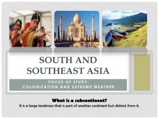
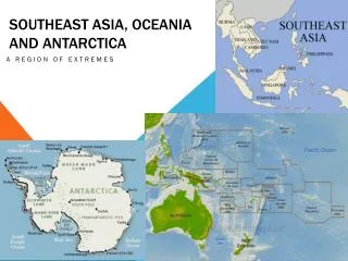
Southeast Asia, Oceania, & Antarctica Chapter 30 Physical Geography
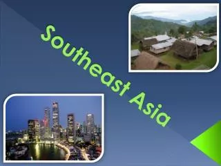
Southeast Asia: Mainland & Islands • Mainland SE Asia lies on two peninsulas • Indochinese Peninsula – rectangular shape • Malay Peninsula – narrow strip of land about 700 miles long, serves as a bridge from the Mainland and the islands
SE Asia • Most of the islands are found in archipelagoes • The Philippines and the islands of Indonesia are part of the Malay Archipelago
SE Asia - Mountains • Annamese Cordillera – run north to south on the Mainland • On the islands, most of the mountains are volcanic (Ring of Fire)
SE Asia - Rivers • Mekong River – starts in China and runs through several SE nations, forms a wide delta on Vietnam’s coast • Millions rely on the Mekong for fishing and farming
Mekong River in Cambodia – known for endangered giant catfish (can grow up to 10 feet long)
SE Asia – Natural Resources • Fertile soil due to volcanic activity and flooding • Fishing in the rivers and nearby seas • Petroleum • Tin • Gems
Australia: Continent & Country • Mountains • Great Dividing Range • Run along the eastern coast • Central Lowlands • Pastureland • Underground water called the Artesian waters are pressurized and rise to the surface into ranchers’ wells without any pumping
Australia • Western Plateau • Covers nearly 2/3rds of Australia • Called “The Outback” • 3 deserts cover much of the region • Great Sandy, Great Victoria, Gibson • Mammoth rock formations
Uluru, also known as Ayers Rock, is a large sandstone rock formation in the Outback
Australia • Great Barrier Reef • Off of the northeastern coast • Made of coral formed by the limestone skeletons of tiny sea animals • Long strip of coral-covered land that is home to an array of brilliantly colored fish & underwater creatures
Australia • Natural Resources • 10% of the land is arable • One of the world’s leading producers of wheat, cattle, & sheep • One of the world’s leading exporters of beef, mutton, lamb, & wool • Uranium, bauxite, iron ore, copper, lead, manganese, nickel, zinc, gold, silver, diamonds, & opals
Oceania: Island Lands • Divided into 3 major island groups based on location, how the islands were formed, & the culture of its inhabitants • Melanesia – north & east of Australia • Micronesia – north of Melanesia & south of Japan • Polynesia – from Midway island in the north to New Zealand in the south
Oceania • High Islands • Formed as a result of colliding tectonic plates • Part of the Ring of Fire known for its earthquake & volcanic activity
Oceania • Low Islands • Began as the result of volcanic eruptions • Coral has grown along the rim of an underwater volcano, creating a ring-shaped island called an atoll • At the center is a shallow lagoon • Low-lying so waves wash them in & out of view • Little soil & few natural resources
Oceania • Continental Islands • Made of rock that has risen from continental shelves on the ocean floor • Not formed by volcanoes, but many have active volcanoes • Mineral found on the islands include oil, gold, nickel, & copper
New Zealand • Located 1,200 miles southeast of Australia • A group of mountainous islands • North Island • Center of the island is a plateau of volcanic stone crossed by a chain of volcanic peaks (active) • Freshwater lakes • Hills – sheep & dairy cattle • South Island • Dominated by Southern Alps
New Zealand • Natural Resources • Fast-flowing rivers – hydroelectric power • Steam from volcanic hot water – geothermal energy • Coal • Natural gas • Exporter of sheep & wool products • Pine forests • Pacific Ocean fish
Antarctica: A White Plateau • Twice the size of Australia • Ice, as much as 2 miles thick in some places, covers about 95% of the continent • Transantarctic Mountains & Antarctic Peninsula divide the continent into two regions • East – high, flat plateau • West – land is mostly below sea level
Antarctica • Greatest resource – the scientists who conduct research there • Research weather patterns & observe the sun & stars without obstruction • Also look at the effect of human industrialization on the Earth’s ozone layer • Mineral resources • Wealth of sea resources – krill (may one day help feed the world’s hungry)
Climate & Vegetation • Australia • Desert – moisture is blocked by subtropical high-pressure air masses • Steppe – surrounds the desert, wet & dry season, acacia & eucalyptus trees dominate the landscape • Coasts – southern coasts have a Mediterranean climate, the northeast have a humid subtropical climate, & the southeast have a marine west coast climate